DOWNLOAD MY NEW FREE JOESTRADAMUS WEATHER APP FOR ALL DEVICES
THE APP IS ABSOLUTELY FREE TO ALL BUT CONSIDERING SUBSCRIBING TO PATREON FOR A WEATHER EXPERIENCE FREE OF ADS, EXCLUSIVE VIDEOS FOR MEMBERS ONLY AND MUCH MORE…STARTS AT $2 A MONTH..MESSAGE ME AT ANY TIME
April Fools Cold Midweek Coastal Well Offshore Late Week Rain
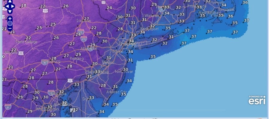
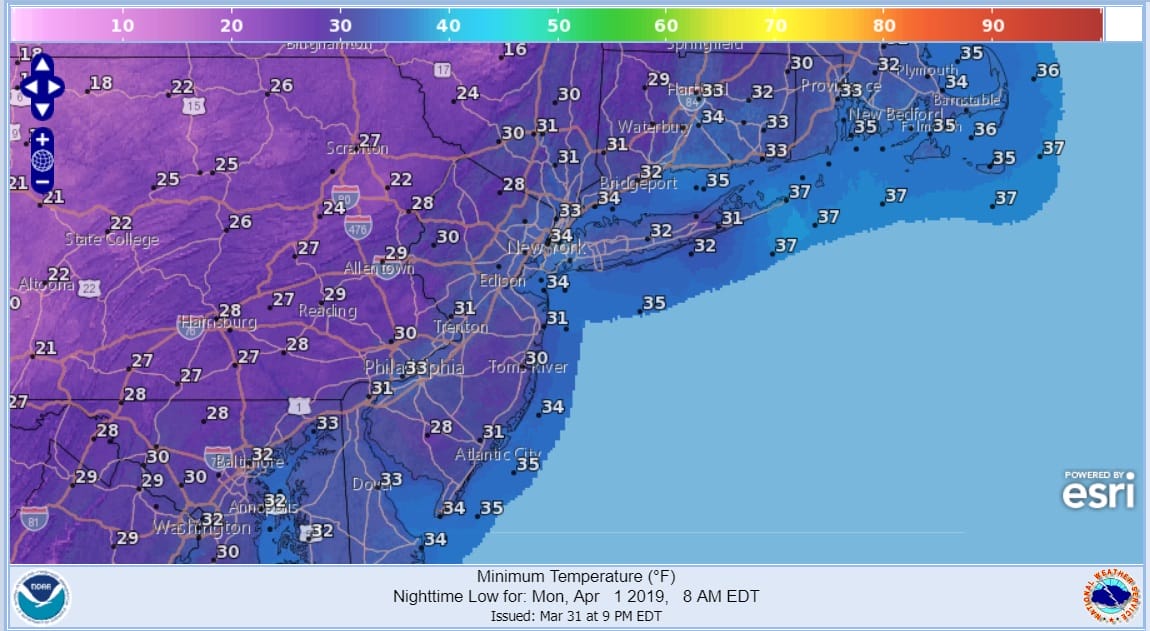
Sunday’s cold front is now well offshore and behind it colder air is coming in on gusty northwest winds Temperatures for the first of April should be bottoming in the mid 30s and highs should be in the middle 50s. We will be several degrees or more below those numbers tonight and Monday morning lows will be in the upper 20s and lower 30s. Add a gusty wind to the equation and we are talking wind chills Monday morning in the teens and lower 20s.
As far as the satellite loop and the regional radar loop show the rain from today is all over with now and well offshore. Lots of clouds extend across the Southeast US back into the Gulf States and the Gulf of Mexico where a low is taking shape. There will be no issues from this tonight or Monday. The high clouds will likely get close later Monday or Monday night.
SATELLITE

REGIONAL RADAR

As for the daytime Monday we should see plenty of sunshine. The strong April sun will take some of the sting out of the air but it will be a chilly day with many areas not getting out of the 40s though some some places will likely touch the 50 degree mark. Then another chilly night lies ahead for Monday night and Tuesday morning.

On Tuesday low pressure comes out of the Gulf States and heads for the Southeast US coast and high clouds will be increasing as the day wears on. We didn’t see anything that suggests that this low will come close enough to produce anything other than overcast skies Tuesday with some sun breaking through the clouds at times. Temperatures will struggle but should make it into the 50s if the sun can cut through the cloud cover. Temperatures will be higher as you head west where there will be a bit more sun and a bit less of an ocean wind.
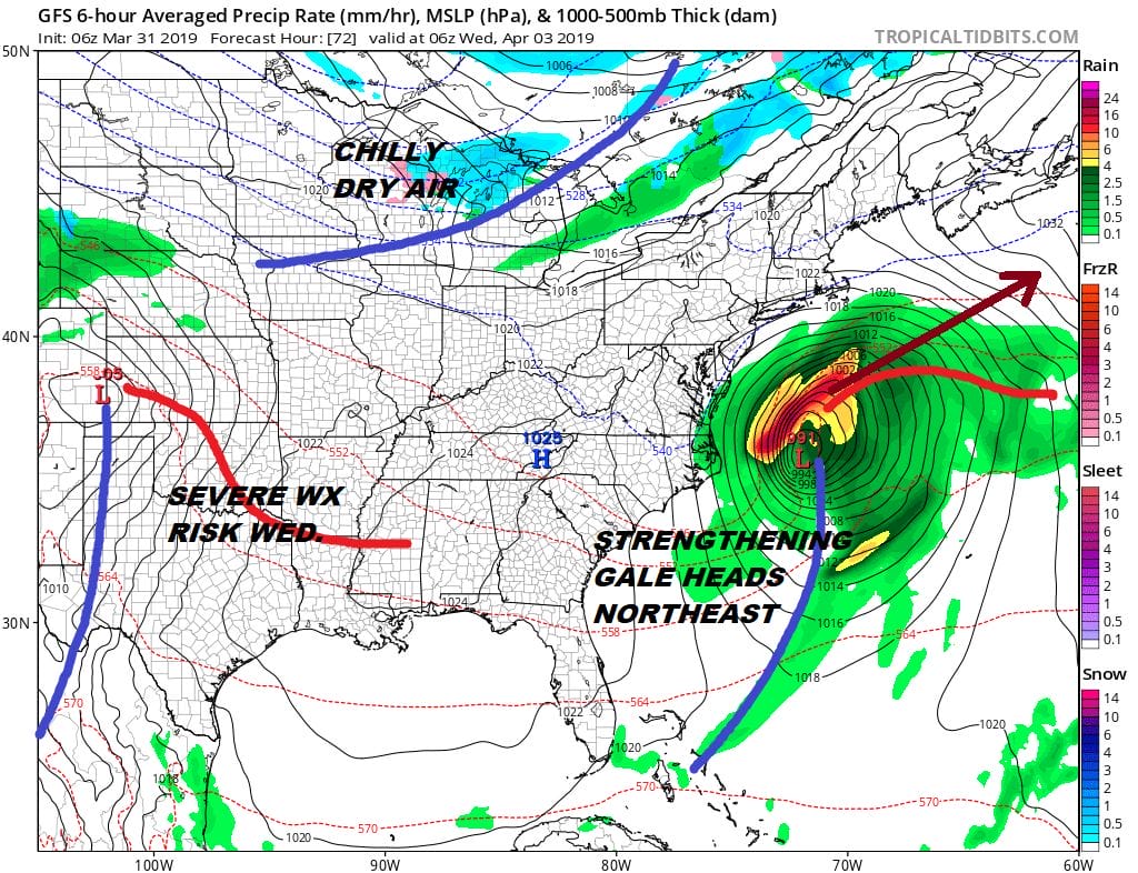
Other than the western edge of the rain shield perhaps reaching Southeastern New England for a brief time, the low moves out and Wednesday we should be back to sunshine. With enough sun highs should reach the 50s to near 60. Thursday brings a bit of an onshore flow with sunshine and some arriving clouds with highs mostly in the 50s.
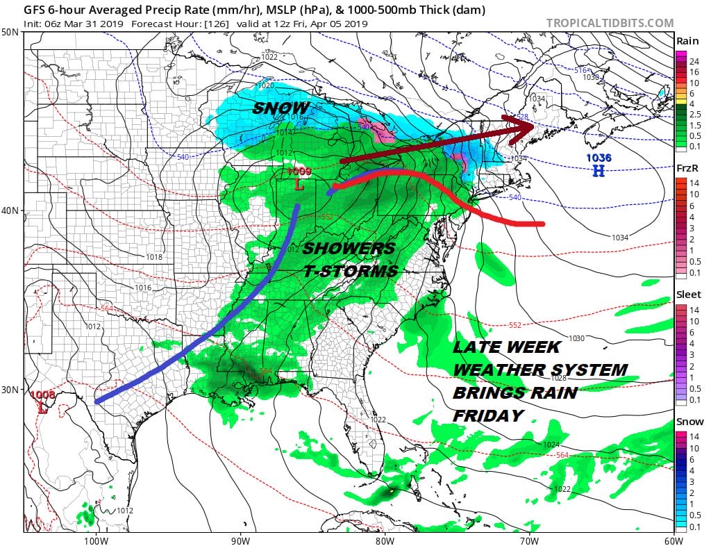
Friday is our next chance for clouds and some rain as low pressure comes out of the Southern Plains and heads for the lower Great Lakes. This system should move through and out by Saturday morning and then we are set up for a nice weekend of sunshine and temperatures in the 60s. There is no cold air to speak of behind this system so we should enjoy warmer temperatures next weekend and into the start of the week that follows. No major storms are on the horizon for us and no spring noreasters are on the table either in the long range.
MANY THANKS TO TROPICAL TIDBITS FOR THE USE OF MAPS
Please note that with regards to any tropical storms or hurricanes, should a storm be threatening, please consult your local National Weather Service office or your local government officials about what action you should be taking to protect life and property.


