Another Sticky Warm Day Changes Over The Weekend
WEATHER IN 5 THURSDAY OCTOBER 22, 2020
JOE & JOE WEATHER SHOW WEDNESDAY OCTOBER 21, 2020
Wash rinse repeat has been the theme all week along. We start the day with low clouds and fog with a dense fog advisory and then transition to a mix of sun and clouds or a mix of clouds and sun depending on where you are. To the northwest we have a stalled frontal bounday across the lower Great Lakes to Western NY with showers north and west of that boundary zone. That boundary isn’t going anywhere today. So look for highs today to reach the low to mid 70s just about everywhere with 60s along the immediate coast. Humidity is on the high side. Showrrs on the regional radar to the west won’t be coming eastward today nor will they come anywhere close to us in the foreseeable future.
SATELLITE
REGIONAL RADAR
Tonight sets up to be another night of warm and humid conditions with lows in the mid 50s to lower 60s with patchy dense fog developing again. Then we go back to clouds and sun for Friday with highs generally 70 to 75 with 60s along the coast.
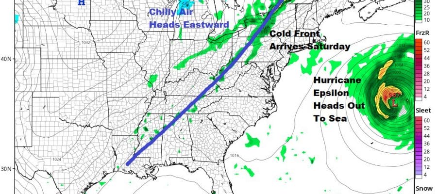
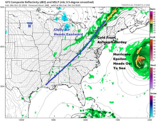
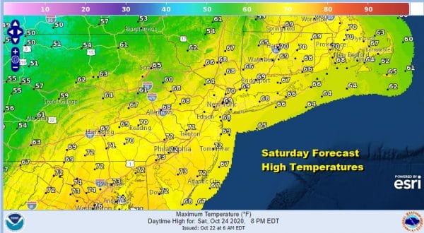
Finally on Saturday as Hurricane Epsilon heads out to sea and accelerates to the northeast, we will see the log jam along the East Coast break down and that allows a cold front to move through here Saturday morning. We get a wind shift to the northwest, humidity levels drop a bit, and we will have some sunshine. Highs will still be in the upper 60s and lower 70s but we will cool down considerably for Sunday.
High pressure builds to our north on Sunday and some of the chilly air from the Plains and lower Great Lakes will bleed southward into the Mid Atlantic states Sunday. Highs will be just in the 50s everywhere. We will have a mix of sun and clouds but with more clouds to the south from Southern New Jersey southward and more sun to the north in the Hudson Valley and Southern New England.
The Nam model supports the idea of a nice day on Sunday overall as the high builds rather far south into Virginia. Now eventually the high will give way and the frontal system to the west will begin to make its approach Sunday night at which point we will see clouds moving in from south to north as Sunday wears on and some showers could develop during Sunday night.
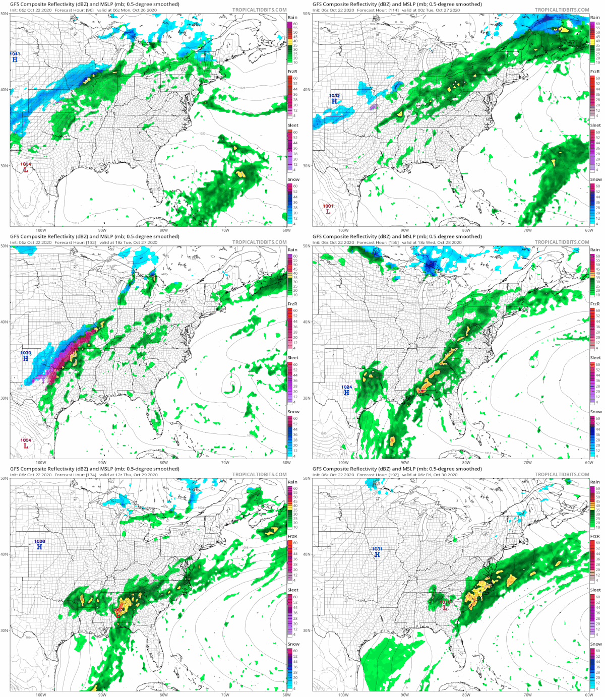
The ridge off the east coast remains intact though it will be a bit weaker and further east than where it has been for this week. This brings the frontal boundary a bit closer to us but the first two waves of rain will pass mostly to the north of us and it may not be until Wednesday before we see the frontal boundary close enough for some rain. Temperatures will warm back up into Wednesday before cooling down late next week.
BE SURE TO DOWNLOAD THE FREE METEOROLOGIST JOE CIOFFI WEATHER APP &
ANGRY BEN’S FREE WEATHER APP “THE ANGRY WEATHERMAN!
MANY THANKS TO TROPICAL TIDBITS FOR THE USE OF MAPS
Please note that with regards to any severe weather, tropical storms, or hurricanes, should a storm be threatening, please consult your local National Weather Service office or your local government officials about what action you should be taking to protect life and property.


