Wash Rinse Repeat Low Clouds Some Breaks Of Sun No Changes Into Saturday
JOE & JOE WEATHER SHOW WEDNESDAY OCTOBER 21, 2020
WEATHER IN 5 WEDNESDAY OCTOBER 21, 2020
The air mass is becoming stagnant and the result is that the longer autumn nights allow for low clouds and fog to develop and we will see that during the nights and early morning hours into Saturday. We have that around this morning and we should see the low clouds and fog burn off but it will take longer in coastal areas. Some breaks of sunshine are possible later today especially inland. Temperatures today will reach into the 70s. The satellite showers brighter white clouds back in Western NY and Western Pennsylvania where there are showers. A stalled frontal boundary remains just that..stalled. We won’t see a frontal passage here until Saturday.
SATELLITE

REGIONAL RADAR

With high pressure offshore and the frontal boundary so far to the west, no rain is forecast into Saturday. Tonight it will be back to low clouds and fog with lows in the 50s to lower 60s. Thursday we will see some sunshine break through the low clouds with highs in the low to mid 70s. One more time for Friday with highs in the low to mid 70s. Temperatures will be lower near the immediate coast.
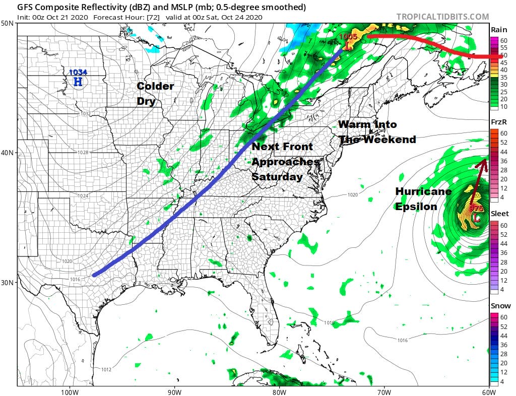
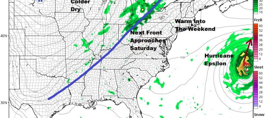
Saturday brings the next cold front and this one should make it through Saturday evening. The day looks like we will have more clouds around given that we start with morning low clouds and fog and that it never has a chance to burn off as that front reaches the coast. Highs will be just in the upper 60s and lower 70s. The front makes it through and then we get some changes for Sunday.

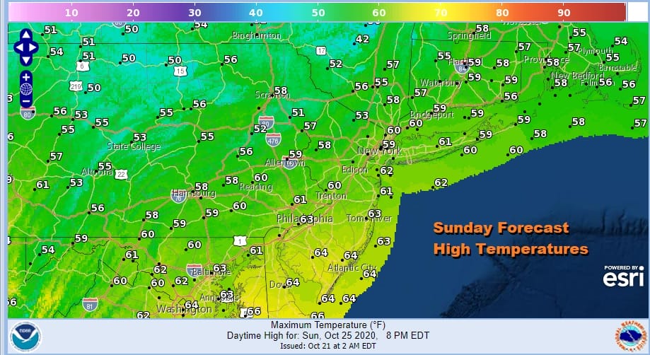
The flow becomes onshore Saturday night and Sunday as high pressure builds to our north. The cold front likely stalls out to the south of us but nearby which means we likely stay in clouds. It will be much cooler on Sunday also with temperatures in most areas Sunday not out of the 50s.
Sunday night into Monday another front will start its approach but it may not be until late Tuesday or Wednesday before that front passes. Other than maybe some passing showers Sunday night into Monday as a warm front tries to go by, we may have to wait until later Tuesday for a round of widespread showers here. Hurricane Epsilon will pass east of Bermuda Saturday and turn out to sea with no impact on our weather here.
BE SURE TO DOWNLOAD THE FREE METEOROLOGIST JOE CIOFFI WEATHER APP &
ANGRY BEN’S FREE WEATHER APP “THE ANGRY WEATHERMAN!
MANY THANKS TO TROPICAL TIDBITS FOR THE USE OF MAPS
Please note that with regards to any severe weather, tropical storms, or hurricanes, should a storm be threatening, please consult your local National Weather Service office or your local government officials about what action you should be taking to protect life and property.


