Another Line of Thunderstorms Before Skies Clear
Another Line of Thunderstorms Before Skies Clear
The first line of strong thunderstorms has worked its way through the area and it is now beginning to exit out to the east. We are still waiting for the cold front to push through. That will happen later tonight. Ahead of that cold front on the regional radar we can see another line of thunderstorms in Eastern Pennsylvania that is moving to the east. That will play through later this evening until about midnight or so in some areas before finally everyone clears from west to east.
EASTERN SATELLITE

REGIONAL RADAR

The western edge of the first line of thunderstorms is now moving east of NYC. That line overall has weakened considerably as it makes its way offshore. We are beginning to see that second narrow line of storms coming into view in the upper left of the local radars.
LOCAL RADAR NEW YORK CITY

LOCAL RADAR PHILADELPHIA


In the meantime we still have Flash Flood Watches in parts of Northern and Central New Jersey with a Flash Flood Warning posted for northeastern Ocean County where rainfall has been on the order of 2 to 3 inches in some places.
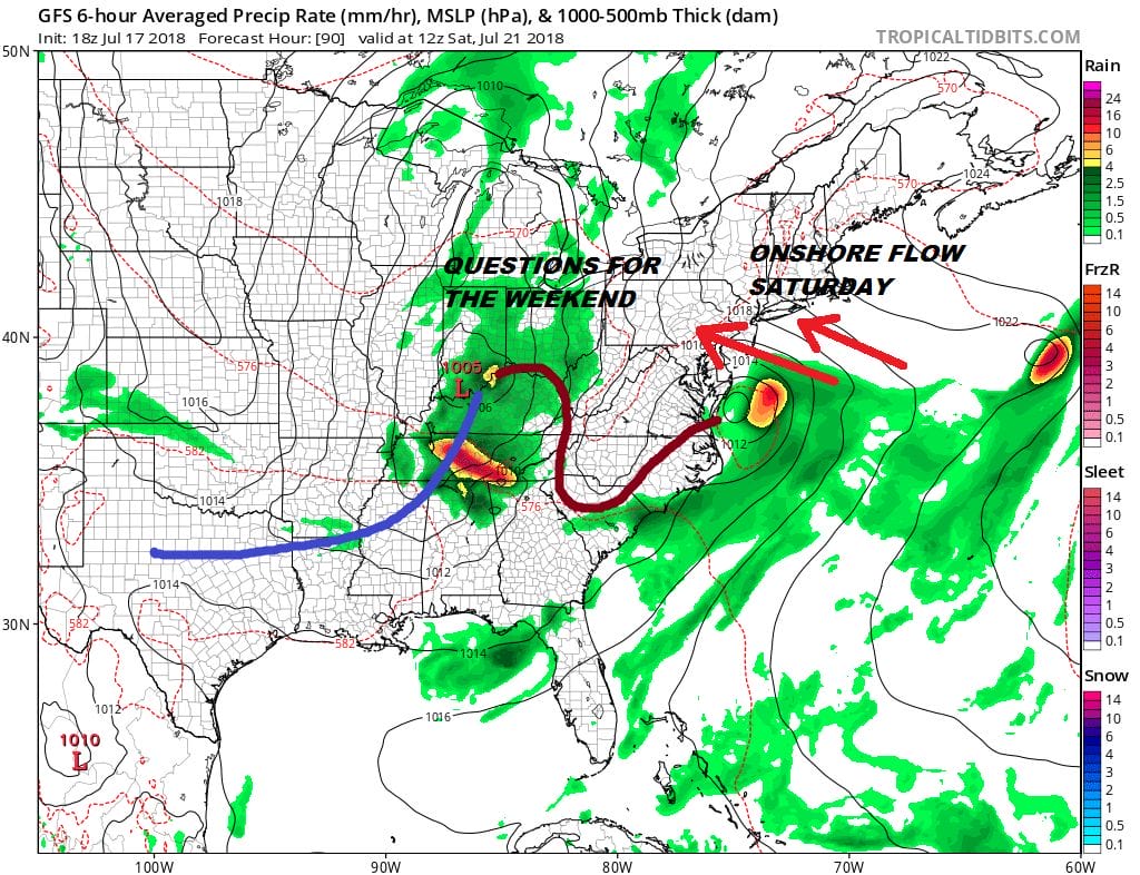
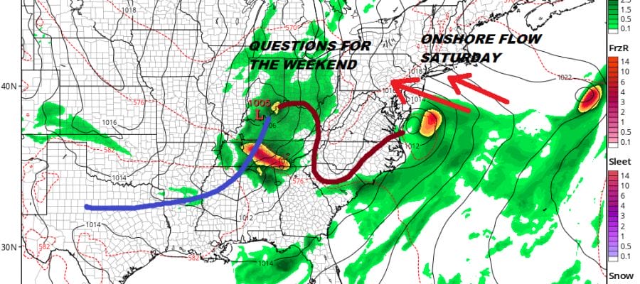
Wednesday through Friday brings sunshine and lower humidity to finish off the week. Then humidity comes back over the weekend with the chance for more rain though the details have yet to be worked out. Saturday during the day should be dry with an increasing threat for some rain Saturday night into Sunday morning and then the chance for some thunderstorms Sunday evening.
Please note that with regards to any tropical storms or hurricanes, should a storm be threatening, please consult your local National Weather Service office or your local government officials about what action you should be taking to protect life and property.
 GET JOE A CIGAR IF YOU LIKE

LATEST JOESTRADAMUS ON THE LONG RANGE


