
Another Frigid Night Snow Later Tuesday into Wednesday

Another Frigid Night Snow Later Tuesday into Wednesday
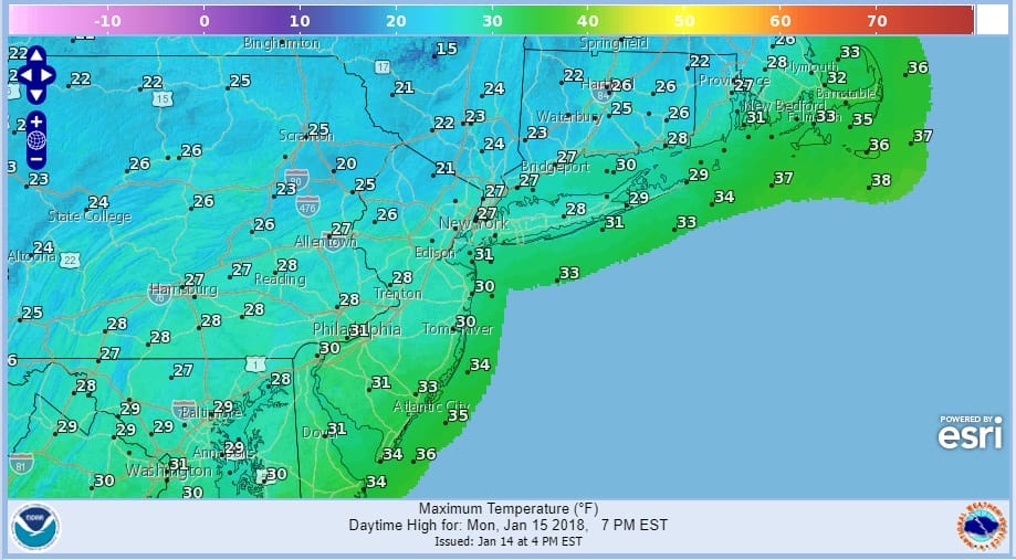
Single digits to low teens seems to be the theme around here lately (except for Friday & Saturday of course) and we have another frigid night ahead of us though at least the winds have dropped off. Temperatures managed the 20s today and we will do it all over again on Monday with some sunshine. Some highs near 30 could be reached in areas to the south in Southern New Jersey.
MONDAY FORECAST HIGH TEMPERATURES
The satellite picture below from the GOES16 shows clouds from the next disturbance dropping southeast into the Upper Midwest. Snow from this system will be spreading across the Great Lakes and Ohio Valley later tonight and Monday. This system looks to produce a 1 to 4 inch snowfall across that area.
US SATELLITE

REGIONAL RADAR

Clouds will begin to increase on Tuesday as low pressure swings out of the midwest. Along the east coast the old frontal boundary remains offshore and a weak low is likely to develop later Tuesday and Tuesday night with an inverted trough extending northward from the low to Southern New England. Some snow will be generated from this and we should see some snow developing later Tuesday afternoon and evening.
ANOTHER FRIGID NIGHT GFS FORECAST WEDNESDAY 1AM
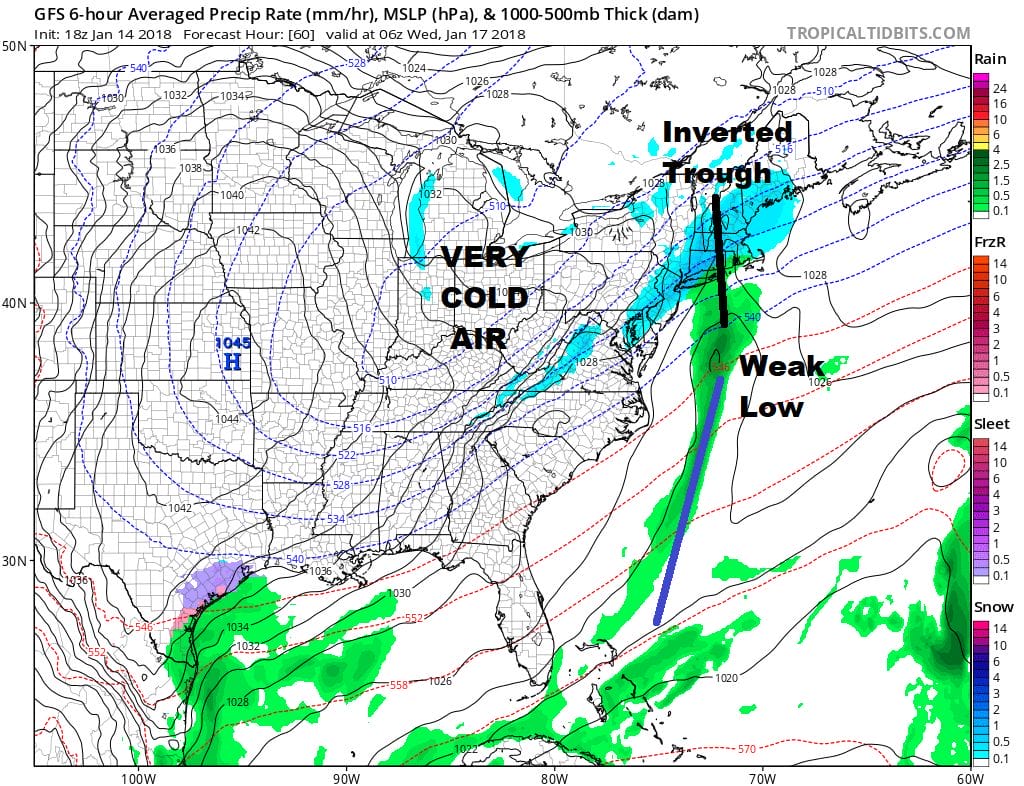
The surface profile on Wednesday morning 2am shows a weak coastal low with the inverted trough extending northward. The problem is the upper support which is getting suppressed and squashed to the south of us.

The system to the northeast swinging around in Southeastern Canada is preventing the southern stream trough from pivoting around as it approaches the coast. As long as this is the case, a significant snowfall would be unlikely. Once this system moves away offshore a cold high builds in for Thursday and Friday. However the long range shows that high moving out to the south and east and a warm up gets underway next weekend. It may be one we can enjoy with sunshine and temperatures at least back into the 40s by day.
NATIONAL WEATHER SERVICE SNOW FORECAST MAPS CAN BE FOUND HERE.
 GET JOE A CIGAR IF YOU LIKE

FiOS1 News Weather Forecast For Long Island
FiOS1 News Weather Forecast For New Jersey
FiOS1 News Weather Forecast For Hudson Valley


