
Another Cool Night Before Warm Up Begins Friday Warm Last Weekend of Summer
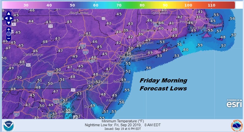
It was another beautiful day with highs that reached the upper 60s and lower 70s with wall to wall sunshine. It was hard to find even a few clouds from Maine to Virginia. High pressure is sitting right along the East Coast with Hurricane Humberto about 700 miles to the east and no cold front anywhere close by. The high overhead means clear skies and light winds tonight with morning lows in the 40s in many inland locations to the low and mid 50s in warmer urban centers and along the coast.
It is a windows open blanket nearby kind of night and the satellite picture this evening shows clear skies from Virginia to Maine and westward to the Great Lakes. It has been three days of nearly perfect weather conditions and we have three more days of sunshine ahead of us with warmer temperatures. No issues are on the regional radar with nothing for hundreds of miles.
SATELLITE

REGIONAL RADAR

There are no changes in the outlook for Friday and the weekend. Sunshine Friday will take temperatures to the upper 70s to near 80 degrees as winds turn to the west. Saturday and Sunday it will be warm but it won’t be humid with sunshine both days and highs back to the low and mid 80s. Humidity levels will be reasonable both days. It will be a great weekend for one last visit to area beaches. Just beware of rough surf conditions on Saturday that linger from Hurricane Humberto that is long gone by this point.
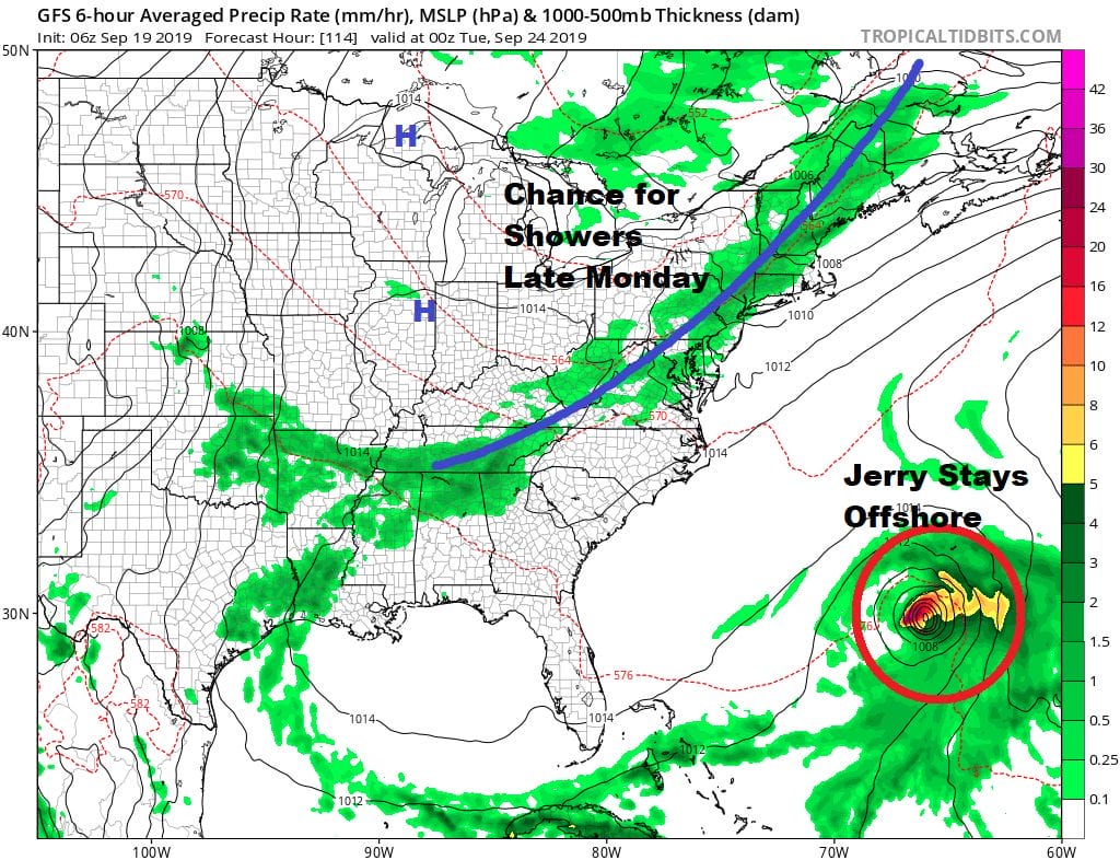
Monday brings the next cold front with the first chance for showers in well over a week. Those showers will come through late in the day though much of the day will be rain free. Highs will be into the 80s before the front passes. The front will move offshore and Hurricane Jerry will recurve ahead of that front and turn north and northeast, passing offshore but close to Bermuda on Tuesday. We will be turning cooler and drier again for the middle of next week.
MANY THANKS TO TROPICAL TIDBITS FOR THE USE OF MAPS
Please note that with regards to any tropical storms or hurricanes, should a storm be threatening, please consult your local National Weather Service office or your local government officials about what action you should be taking to protect life and property.


