Another Coastal Storm In A Colder Atmosphere

Another Coastal Storm In A Colder Atmosphere
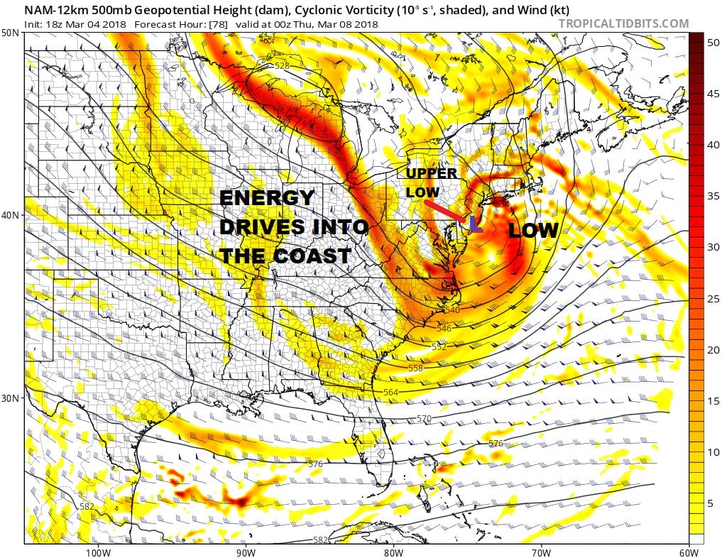
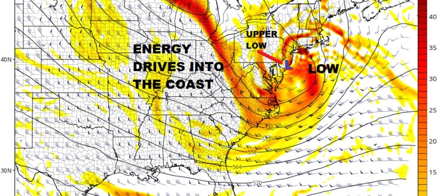
Noreasters have been few and far between for the last several years and as always happens in the world of weather it is either feast or famine. The strong Greenland Eastern Canada block has gained a foothold and it looks hold in position all this week. Friday’s noreaster came with the block just building in so cold air was limited. This time however we have the interaction of Friday’s storm which is still out to our southeast and stalled and the block to the north. The rotation of the old storm is actually creating a bit of a backdoor front that will be moving through tonight. A few snow showers are possible with this over Eastern Long Island and Eastern Connecticut. The end result will be a colder upper air profile over the Northeast and the Northern Middle Atlantic States.
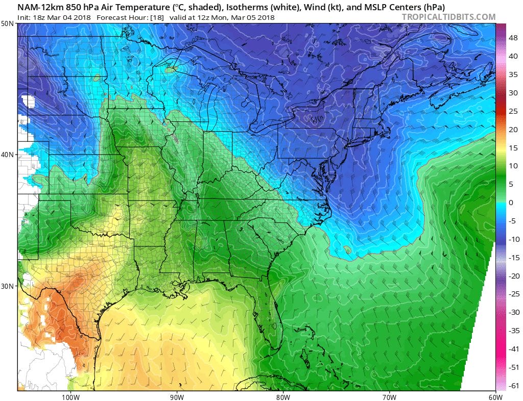
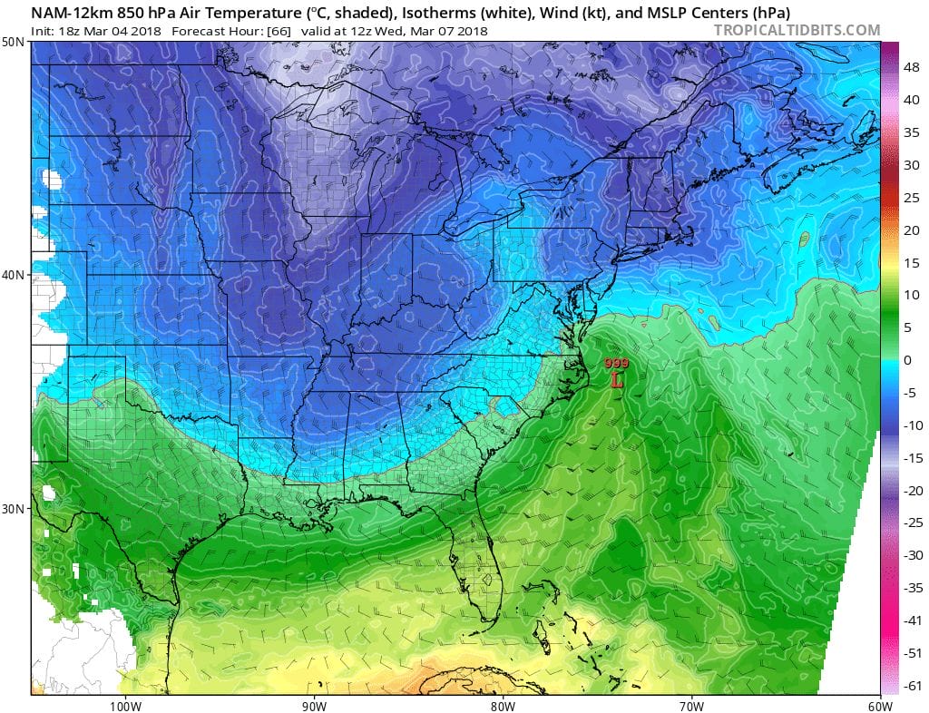
We are looking at temperatures at 5000 feet (roughly) Monday morning above and Wednesday morning below. Notice how far south the freezing line is here in both cases. By Wednesday morning the secondary low is revving up along the North Carolina coast and notice that the freezing line is still well to the south in the Southern Delmarva Peninsula so this is a much colder upper atmosphere profile than what we had on Friday.
Everything in the upper air suggests a coastal track for this storm which will pinch the cold air long the coast as well as inland areas. The usual model errors apply at this stage. I think the one direction this could shift is further to the east rather than west because of the strong block to the north.
NAM SNOW FORECAST POSITIVE CHANGE MAP
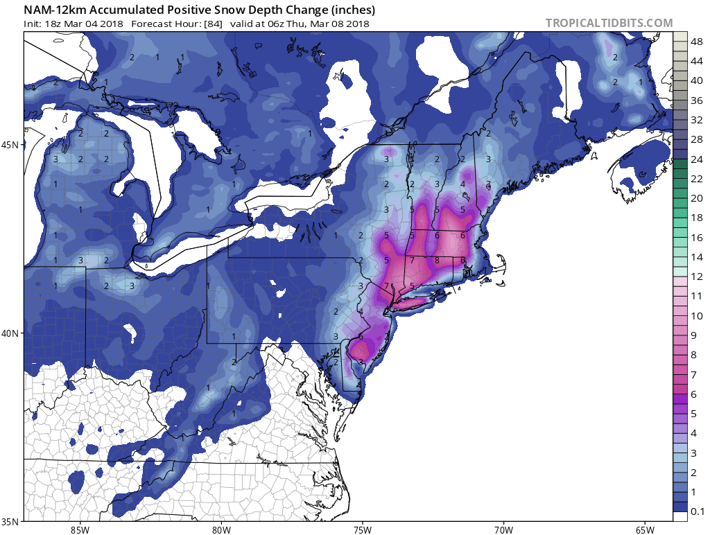
For those of you who live and die with the sun angle, warm ground, street light angle, moon beam power, etc etc this is the NAM snow forecast map positive growth. What this map does is account for all these factors and you can see from its forecast that it does have a rather bullish view for snow though it is about 1/3 less than the standard 10-1. Note that for the Northern New Jersey, NYC, Long Island area, the bulk of the snow comes later in the day Wednesday and Wednesday night.
NATIONAL WEATHER SERVICE SNOW FORECAST MAPS ARE UP WITH THE FIRST CALL FOR THIS STORM
SHOP THE JOESTRADAMUS STORE
MANY THANKS TO TROPICAL TIDBITS FOR THE WONDERFUL USE OF THE MAPS

GET JOE A CIGAR IF YOU LIKE!
FiOS1 News Weather Forecast For Long Island
FiOS1 News Weather Forecast For New Jersey
FiOS1 News Weather Forecast For Hudson Valley
NATIONAL WEATHER SERVICE SNOW FORECASTS
LATEST JOESTRADAMUS ON THE LONG RANGE


