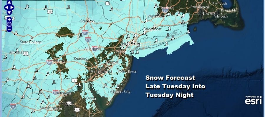
Another Chance for Snow Late Tuesday Tuesday Night Southeast Pa to Southern New England
Cold Weather Wednesday into Thursday Much Warmer Friday Into the Weekend
The small window ( and I do mean small) that has opened up for some snow remains open through Tuesday night. Last night’s upper trough produced a coating to an inch of snow in some places though some barely saw a few flakes. Skies did partially clear out this afternoon and we should be mostly clear for tonight with lows by morning in the mid 20s to lower 30s.
SATELLITE

REGIONAL RADAR

The satellite shows just a few clouds around along the coast though there are snow showers that continue across Upstate NY north of I-90 into Western New England. Those will diminish soon enough and the local radars will remain quiet into tomorrow.
LOCAL RADAR NEW YORK CITY

LOCAL RADAR PHILADELPHIA


Tuesday may actually start with some sunshine before clouds increase and thicken up. This should take temperatures into the 40s. While the surface temperatures are above freezing temperatures aloft remain rather cold. This actually favors snow IF we get a decent burst of precipitation with some intensity. That is where the issue lies with this system. Models continue to struggle over a track. This is a compact system and while there is upstream energy in the Great Lakes to juice this up, it doesnt’t happen until the low is long gone Early Wednesday morning.
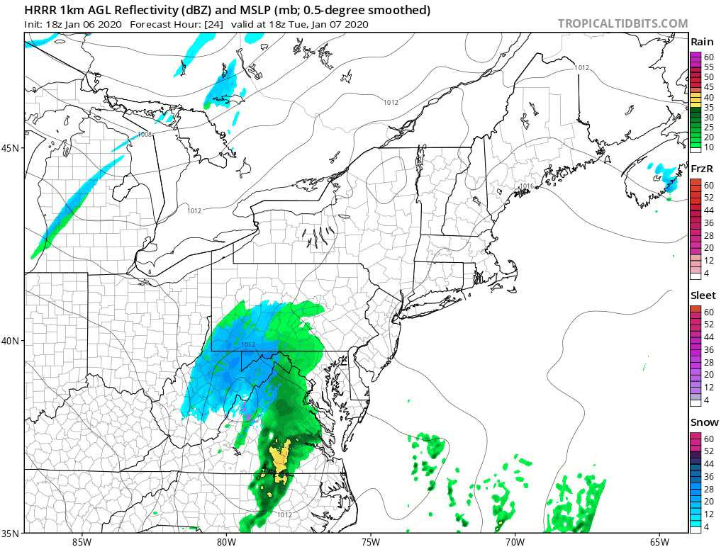
The HRRR model is further northwest than the NAM this afternoon and while it has precipitation further northwest that precipitation is very light and under a tenth of an inch total. The first frame is from 1pm Tuesday to 10pm Tuesday night. Notice that many areas start as rain before it changes to snow. This is at most a 6 hour event and there doesn’t seem to be much time for anything more than a coating to an inch or so in most places.
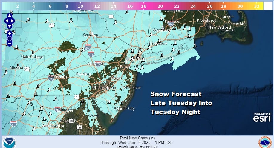
The National Weather Service idea of a coating to an inch or so of snow accumulation from Northeast Virginia to Delaware to Southern New England seems to make sense to me. There isn’t much room for upside here unless the models are wrong about the depth of the precipitation and I think the chances of that right now are rather low.
Weather conditions improve Wednesday though it will be cold with a gusty wind. We will have some sunshine with highs mostly in the 30s. The same should hold for Thursday before much warmer air arrives for Friday and the weekend. Some places will see 60 or better this weekend.
BE SURE TO DOWNLOAD THE FREE METEOROLOGIST JOE CIOFFI WEATHER APP &
ANGRY BEN’S FREE WEATHER APP “THE ANGRY WEATHERMAN!
MANY THANKS TO TROPICAL TIDBITS FOR THE USE OF MAPS
Please note that with regards to any severe weather, tropical storms, or hurricanes, should a storm be threatening, please consult your local National Weather Service office or your local government officials about what action you should be taking to protect life and property.


