Weak System Moves Through Today Chance Snow Late Tuesday Tuesday Night
We have the first of two rather weak systems moving through the area today and it produced some snow showers overnight. Some places in Northern New Jersey had a coating to an inch on car tops and grassy surfaces. Other areas saw little or nothing from this. We do have clouds around but we can look forward to seeing some sunshine developing later today. Highs will reach into the low and mid 40s in most places. Overall it won’t be a bad day as nice weather days have been few and far between lately.
SATELLITE

REGIONAL RADAR

Regional and local radars are still showing some snow shower activity. In some places it is reaching the ground. In other places it is mostly aloft. This all shifts to the northeast later today as dry air takes over and the radars go silent for awhile.
LOCAL RADAR NEW YORK CITY

LOCAL RADAR PHILADELPHIA


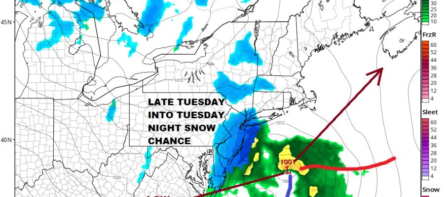
Tonight will be a cold clear night over most of the area. Lows by morning will be in the upper 20s and lower 30s. Then Tuesday brings the next weather system that will be moving across Tennessee and Virginia and then make the turn northeastward. Weather models have been trying to figure out how far north before it makes the turn. Also the air aloft will be cold enough for snow so it will be a matter of how much intensity and how much actual liquid precipitation this system is going to produce.
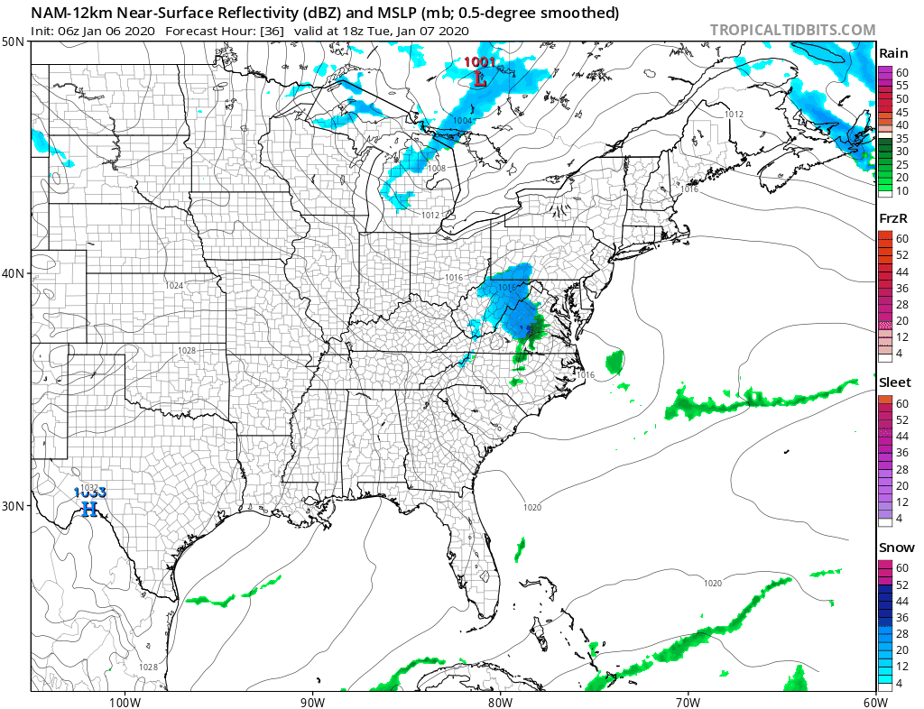
This system is on the smallish side and the potential here is very limited. We have energy moving across the Great Lakes that doesn’t look to get involved with this until the system is past us and east of Cape Cod. The potential for snow will be on the order of a coating to at most a few inches in some places. That was our early call from yesterday and we will just leave it alone for now and see how things go today. The Nam model overnight shows an area of snow advancing northeastward reaching Philadelphia around 4pm and NYC around 7pm. It is a 3 to 6 hour event at most before it moves away.
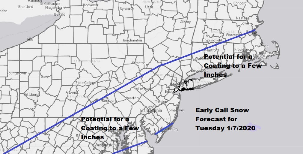
You know that the winter isn’t amounting to much when you have to draw maps for a coating to a few inches and that’s it. If anything I would lean closer to the coating than the idea of a few inches given the limited nature of the system from what we are seeing on satellites and radars today. Highs Tuesday will be in the upper 30s to some lower 40s and the drop close to 32 while it snows..if it snows hard enough. Weather conditions improve on Wednesday and Thursday with some sunshine both days and highs just in the 30s. Then prepare for a warm up at the end of the week with clouds returning and the next round of rain to deal with. Temperatures will likely reach the 50s by the end of the week.
BE SURE TO DOWNLOAD THE FREE METEOROLOGIST JOE CIOFFI WEATHER APP &
ANGRY BEN’S FREE WEATHER APP “THE ANGRY WEATHERMAN!
MANY THANKS TO TROPICAL TIDBITS FOR THE USE OF MAPS
Please note that with regards to any severe weather, tropical storms, or hurricanes, should a storm be threatening, please consult your local National Weather Service office or your local government officials about what action you should be taking to protect life and property.


