
90s Again Front Scattered Thunderstorms Approaching
90s Again Front Scattered Thunderstorms Approaching

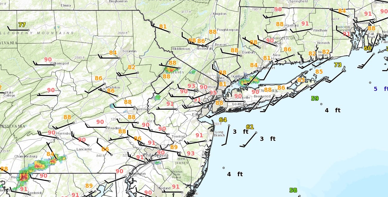
With all the sunshine we had into the afternoon no wonder temperatures made the upper 80s to lower 90s again. We are beginning to see some thunderstorms develop though scattered in nature as a cold front begins it approach from the northwest.
SATELLITE LOOP

REGIONAL RADAR

LOCAL RADAR NEW YORK CITY

LOCAL RADAR PHILADELPHIA


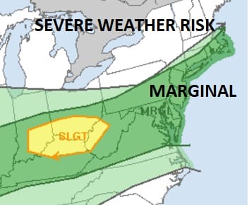
You have to look hard at the moment to see these thunderstorm cells. They are very small. I do not expect widespread activity to develop. We may see a greater number of cells pop up this evening from Central and South Jersey southward. A marginal risk for severe thunderstorms exists throughout the entire area into tonight.
The weekend still looks dry with some sunshine for Saturday and Sunday with highs in the 60s to near 70. Then with the next cold front it looks like Monday into Monday night we could see some showers and thunderstorms.
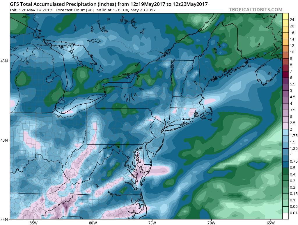
The GFS model and others suggest a good tropical moisture feed will be available so models are giving an inch to an inch and a half of rain for Monday. For now this seems reasonable especially in any heavier downpours. Dry weather returns on Tuesday but more rain is likely later next week.
 GET JOE A CIGAR IF YOU LIKE

LANDSCAPE COMPANIES FOR YOUR NEEDS
LONG ISLAND ROCKLAND COUNTY Connecticut

![]()

ROCKLAND COUNTY TRI STATE SNOW REMOVAL JOHNSTOWN PA


FiOS1 News Weather Forecast For Long Island
FiOS1 News Weather Forecast For New Jersey
FiOS1 News Weather Forecast For Hudson Valley
NATIONAL WEATHER SERVICE SNOW FORECASTS
LATEST JOESTRADAMUS ON THE LONG RANGE
Weather App

Don’t be without Meteorologist Joe Cioffi’s weather app. It is really a meteorologist app because you get my forecasts and my analysis and not some automated computer generated forecast based on the GFS model. This is why your app forecast changes every 6 hours. It is model driven with no human input at all. It gives you an icon, a temperature and no insight whatsoever.
It is a complete weather app to suit your forecast needs. All the weather information you need is right on your phone. Android or I-phone, use it to keep track of all the latest weather information and forecasts. This weather app is also free of advertising so you don’t have to worry about security issues with your device. An accurate forecast and no worries that your device is being compromised.
Use it in conjunction with my website and my facebook and twitter and you have complete weather coverage of all the latest weather and the long range outlook. The website has been redone and upgraded. Its easy to use and everything is archived so you can see how well Joe does or doesn’t do when it comes to forecasts and outlooks.
Just click on the google play button or the apple store button on the sidebar for my app which is on My Weather Concierge. Download the app for free. Subscribe to my forecasts on an ad free environment for just 99 cents a month.
Get my forecasts in the palm of your hand for less than the cost of a cup of Joe!


