Worst of Storm Is Over But Self Destructive Sunshine Clouds & Showers.
Solar Eclipse Outlook

Worst of Storm Is Over But Self Destructive Sunshine Clouds & Showers.
Solar Eclipse Outlook
The worst of the storm from yesterday is over with. Rainfall amounts of 2 to 3 inches plus 60 mph winds caused flooding and took trees down. The northeast wind has now turned to the northwest which normally would mean some improvement. However we have a problem as the satellite loops show. Note the rotation of clouds to the west back in the Ohio Valley and Great Lakes. That is the strong upper low that drove the development of the surface low which is now in Southeastern New Englands. What this means is that yes the heavy rain and the strong winds are over with, but we may need to wait until Sunday for day where we have sunshine for most of the day and no risk for additional showers.
SATELLITE WITH LIGHTNING STRIKES
WEATHER RADAR
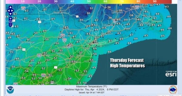
Snow is falling in Upstate NY and interior New England. Chilly air will be the dominant feature over the next 3 days. Some dry air is coming in from the southwest aloft however even if we see some sunshine breaking through the clouds today, it will immediately self destruct. The unstable nature of the atmosphere will lead to some patchy showers to develop. In colder elevated areas inland we could see some wet snow mixing in. Temperatures will go nowhere today with highs just in the 40s.
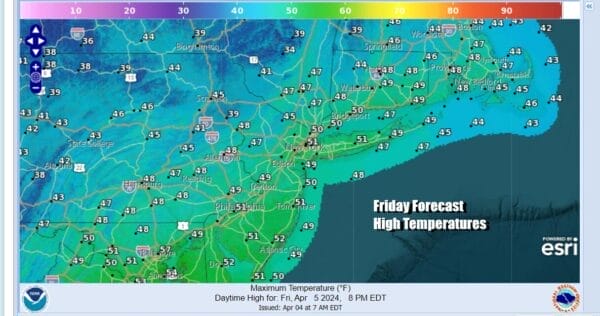
Look for clouds around tonight and there could be some scattered showers around with most lows in the 30s. Friday the upper low moves across Pennsylvania and heads into Southern New England so it will be another day of self destructive sunshine, clouds, and patchy showers. Not everyone will see the shower activity. Temperatures once again will be going no where and highs will be just in the 40s.
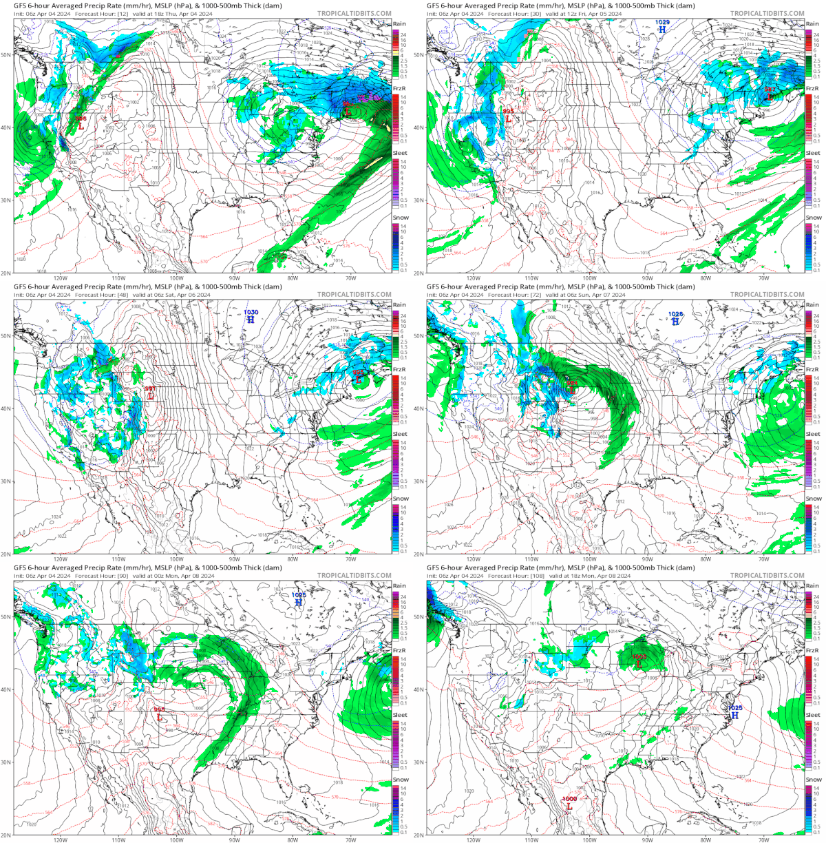
As we move into the weekend the storm system and the associated upper low will finally start to pull away to the east. This will allow high pressure to slowly build in from the west and north. That ridge is going to park itself in the Eastern US until Monday which sets for mostly nice weather for the solar eclipse Monday afternoon.
Saturday looks to be a day where we will have more sunshine and fewer clouds especially in areas inland an west of the coast. Just having the sun out will help to take temperatures back into the 50s in most places Saturday. Sunday we finally see sunshine and no weather issues. Highs Sunday will reach the middle and upper 50s which actually is a little bit below where we should be for this time of year.
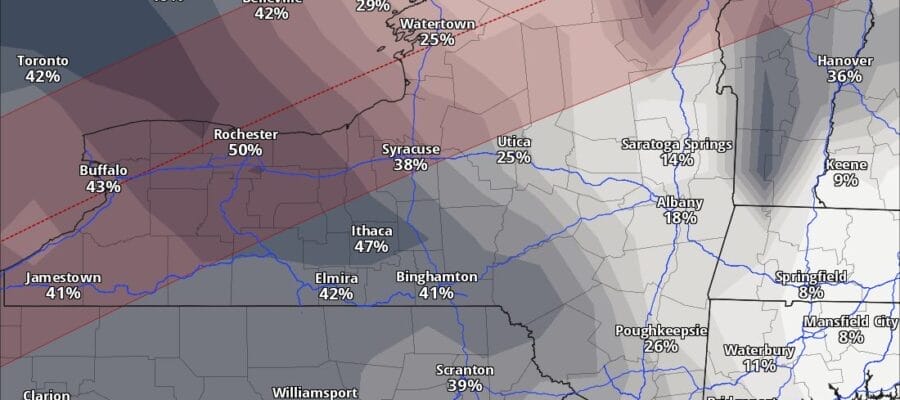
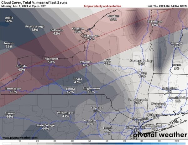
Monday we have the total solar eclipse with the path of totality in upstate NY. Low pressure in the Plains will be weakening but some high clouds will be moving east so we will be watching how that plays out. Right now based on the GFS weather model, the best place for almost cloud free viewing will be North Central and Northeastern NY into Northern New England. High clouds might be an issue in Southwestern NY. Cloud cover conditions for much of Eastern Pennsylvania to Southern New England looks to be 30 percent or less. Temperature wise Monday highs will be reaching into the 60s. We will be updating this outlook throughout the weekend.
BE SURE TO DOWNLOAD THE FREE METEOROLOGIST JOE CIOFFI WEATHER APP &
ANGRY BEN’S FREE WEATHER APP “THE ANGRY WEATHERMAN!
MANY THANKS TO TROPICAL TIDBITS FOR THE USE OF MAPS
Please note that with regards to any severe weather, tropical storms, or hurricanes, should a storm be threatening, please consult your local National Weather Service office or your local government officials about what action you should be taking to protect life and property.
(Amazon is an affilate of Meteorologist Joe Cioffi & earns commissions on sales.)

