Slow Improvement Into the Weekend, Solar Eclipse Monday

Slow Improvement Into the Weekend, Solar Eclipse Monday
The slow moving upper air stom continues to make very slow progress eastward. Until it gets out of the way, we won’t see wholesale improvement in sky and weather conditions. We will see some steps in that direction today but they will be limited. Lots of clouds will be around today. There might be a break or two of sun but that should self destruct rather quickly.
SATELLITE WITH LIGHTNING STRIKES

WEATHER RADAR

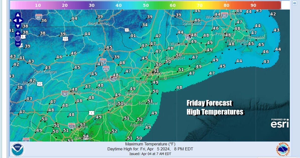
Cold upper air features like this create unstable conditions. Throw in a strengthening sun and you have the set up for some scattered showers. However most of those showers will be inland and they should be few and far between. Temperatures today will be in the 40s to around 50 for highs.
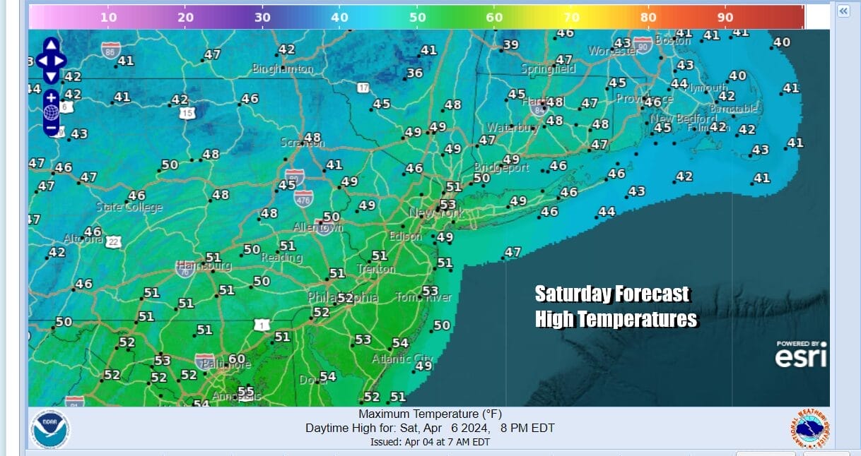
Once we pass sundown skies might partially clear overnight inland with most lows in the 30s. The upper low continues to move east Saturday and offshore the New England coast. There will still be lower pressures to the east and that will create another day of clouds though there should be some sunshine in the mix. Highs will be in the upper 40s and lower 50s.

A new storm is coming into the west but at least this time around, we will see the low reach its peak intensity in the Rockies and then gradually weaken as it moves eastward. Meanwhile high pressure builds down the East Coast and that sets us up for a better day Sunday. We will see more sunshine, fewer clouds, no showers, and highs in the mid to upper 50s.

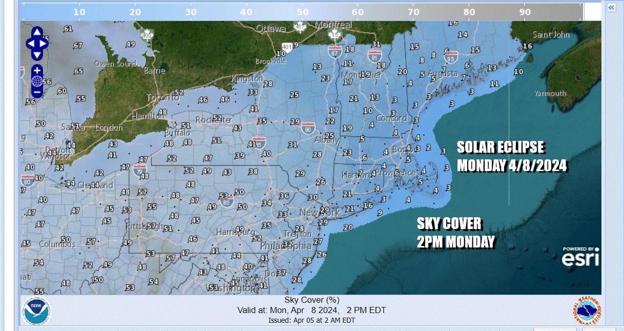
Monday we have the total eclipse of the sun and we are optimistic that sky conditions will be okay for viewing the eclipse. In the zone of totality which is over Northern & Western NY and through Northern New England, the clearest skies will likely be east of I-81.
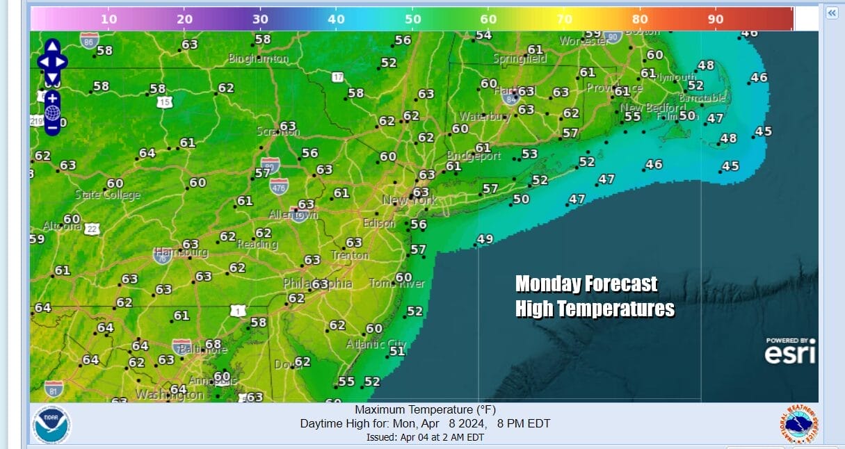
Monday will also be a nice day temperature wise as the chilly air over us now will be long gone. Temperatures will top out into the 60s Monday afternoon and it will likely be the best weather day we have seen in awhile.
Longer range next week we should be dry through Tuesday but the second half of the week likely brings the risk for clouds and rain, especially for late Thursday and Friday. We will likely have a strong cold front approaching and getting us into more rain and some thunderstorm risk.
BE SURE TO DOWNLOAD THE FREE METEOROLOGIST JOE CIOFFI WEATHER APP &
ANGRY BEN’S FREE WEATHER APP “THE ANGRY WEATHERMAN!
MANY THANKS TO TROPICAL TIDBITS FOR THE USE OF MAPS
Please note that with regards to any severe weather, tropical storms, or hurricanes, should a storm be threatening, please consult your local National Weather Service office or your local government officials about what action you should be taking to protect life and property.
(Amazon is an affilate of Meteorologist Joe Cioffi & earns commissions on sales.)


