Rain Wind Coastal Flooding Snow Well North Severe Weather Florida to Delaware

Rain Wind Coastal Flooding Snow Well North Severe Weather Florida to Delaware
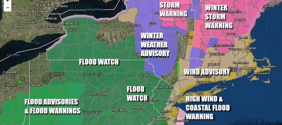
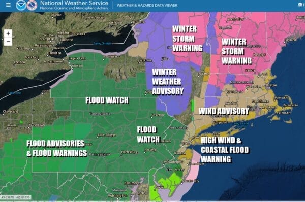
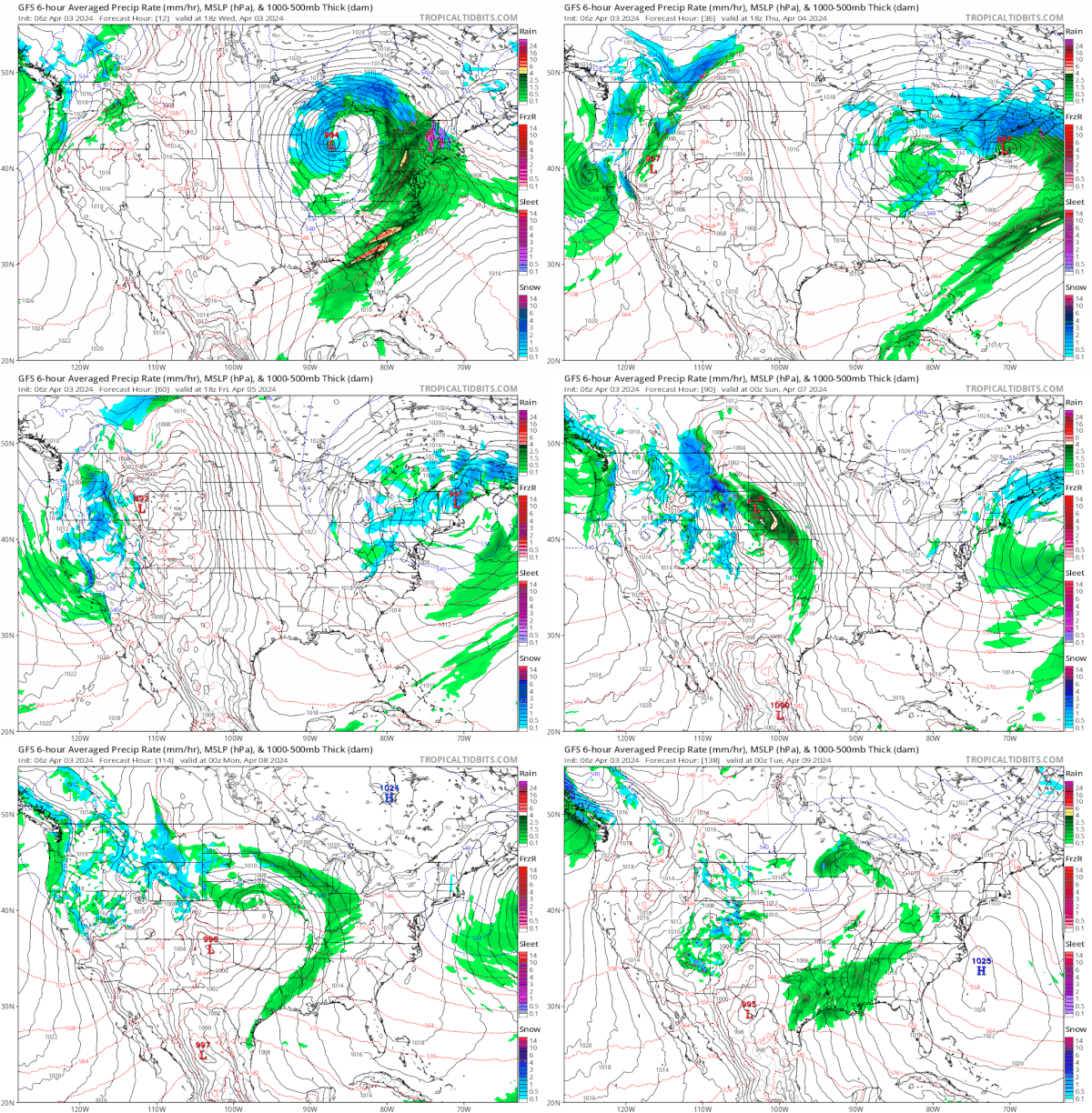
It is another day of weather in the northeast and another storm that is producing what I would describe as “over the top” conditions. We have everything from heavy rain and flood watches to strong winds and high wind warnings. Heavy snow to the north in Northern New York and Northern New England which means we have Winter Storm Warnings and Winter Weather advisories. To the south from Delaware to Florida we have severe weather risk and elevated tornado risk.
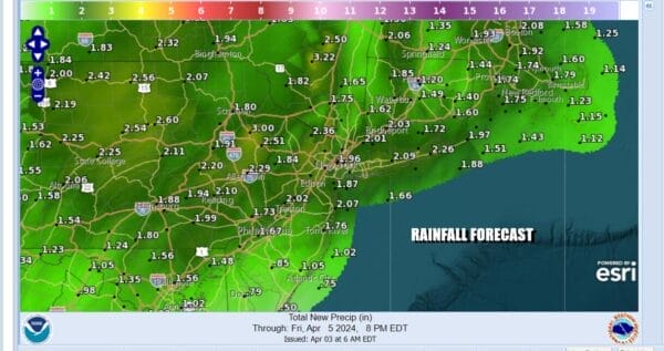
For today and tonight it is rain and wind. Rain will be heavy at times and we could even see a thunderstorm or two later today or this evening as low pressure develops over Delaware Bay and straddles its way northward up the coast. Rainfall amounts will total 2 inches or more and that is on top of what has already fallen over the last couple of days so Flood Watches are required. Make sure you have an ark ready!
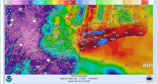
The pressure gradient tightens so ou can expect strong winds to develop from the New Jersey coast east to Southern New England and Long Island. Above is a snapshot of forecast wind gusts at 7pm this evening and we see a large area of 40 to 50 mph wind gusts or higher, mainly from Monmouth County in New Jersey to Long Island, Southern New England, The Hudson Valley, as well as NYC and surrounding counties.
SATELLITE WITH LIGHTNING STRIKES
WEATHER RADAR
Satellite and radar loops show clouds and rain blossoming across Pennsylvania to Southern New England. The northern edge of the precipitation shield in Upstate NY will be rain changing to heavy wet snow and that spreads into interior New England where we have Winter Weather Advisories and Winter Storm Warnings. Elevation driven snows will produce 1 foot plus amounts in many locations from Northern NY eastward to Vermont, New Hampshire, and Maine.
Rain continues into tonight for Eastern Pennsylvania to Southern New England with snow well to the north and northeast. Low pressure in Michigan weakens and a secondary low develops and intensifies off the coast of New Jersey and Long Island. Rain will come to an end Thursday morning. While all this is happening we have raw to the bone temperatures just in the 40s and in many cases only in the low to middle 40s.
The low pulls up into New England Thursday which means the steady rain is over but we still have the slow moving upper low to deal with Thursday and Friday. This means we will have lots of clouds around. Any breaks of sun will self destruct and there could be some scattered showers around. Temperatures both Thursday and Friday will be in the 40s to around 50. Saturday could see some improvement with the chance for scattered showers mainly from NYC east. Saturday highs will be in the mid 40s to lower 50s. Sunday looks nice (finally) with some sunshine and highs back into the 50s.
BE SURE TO DOWNLOAD THE FREE METEOROLOGIST JOE CIOFFI WEATHER APP &
ANGRY BEN’S FREE WEATHER APP “THE ANGRY WEATHERMAN!
MANY THANKS TO TROPICAL TIDBITS FOR THE USE OF MAPS
Please note that with regards to any severe weather, tropical storms, or hurricanes, should a storm be threatening, please consult your local National Weather Service office or your local government officials about what action you should be taking to protect life and property.
(Amazon is an affilate of Meteorologist Joe Cioffi & earns commissions on sales.)

