Major Spring Storm Gloom & Doom Heavy Rain
Northeast Winds Into Wednesday Night Severe Weather Heavy Snow

Major Spring Storm Gloom & Doom Heavy Rain
Northeast Winds Into Wednesday Night Severe Weather Heavy Snow

We are seeing the latest storm system get underway and it is a potent one with widespread impacts across the Eastern US. Rain and some thunderstorms are moving eastward on satellite and radar. There is more rain developing over the Northern Ohio Valley. In fact this storm is going to produce a potential widespread severe weather outbreak today across much of the Eastern US from the Ohio Valley south to the Tennessee Valley and the Deep South.
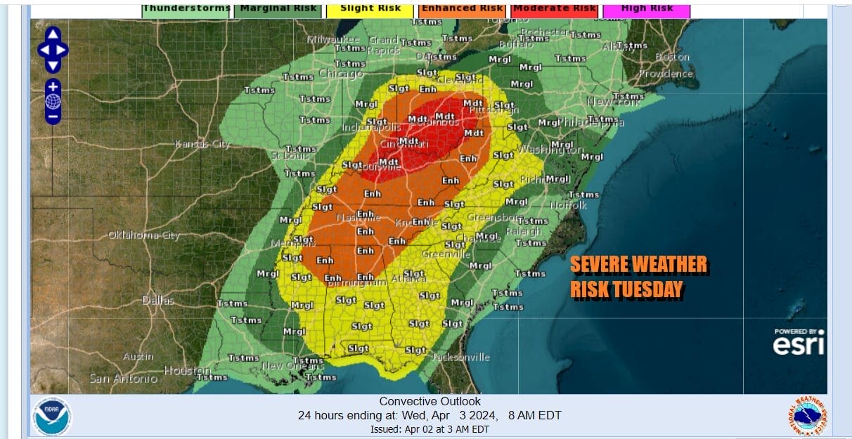
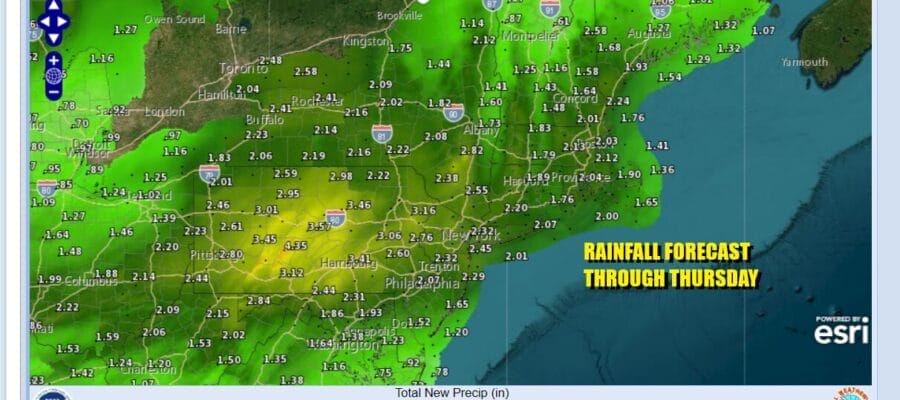
Marginal risk for severe weather touches Southern New Jersey down to Delaware and northwest into Southern & Central Pennsylvania. This is going to be a potentially stormy next two days for Eastern Pennsylvania to Southern New England with heavy rains of 2 to as much as 3 inches. Having that rain spread out over 48 hours probably lessens the risk for flooding but it is a situation that needs to be watched.
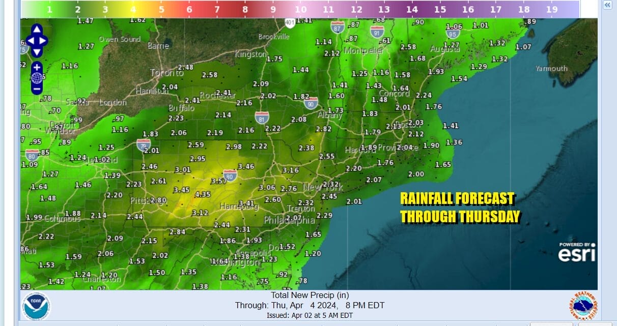
Rain, clouds and a developing raw northeast wind means that temperatures today will be in the 40s all day long for most areas. Raw wet conditions continue Wednesday and we will through in the chance for some thunderstorms and severe weather risk for Southern New Jersey, Southern Pennsylvania and points southward.
SATELLITE WITH LIGHTNING STRIKES

WEATHER RADAR

In Upstate NY we and interior New England we have Winter Storm Watches that will likely go to Winter Storm Warnings at some point. Snow will accumulate a foot or more across much of Upstate NY north of I-90 as well as for interior New England. The bulk of the snow will fall Wednesday into early Thursday. You will notice some areas with less snow are sandwiched in between areas of heavy snow. This is due to the time of year where elevation make a big difference in snow accumulations.

By Thursday, the storm system will be along the coast of Southern New England so we look for the rain to end Wednesday night from Eastern Pennsylvania to Southern New England. Thursday will be a day of mainly cloudy skies with some patchy showers. In the Hudson Valley north of Route 84 we could see some wet snow mix in from time to time. Otherwise it will a breezy raw day with temperatures in the 40s. Friday we could see some improvment with clouds and some sun along with just a slight chance for a passing shower. Highs Friday will be in the upper 40s to around 50. The same forecast holds for Saturday. Finally by Sunday we should see sunshine and temperatures in the 50s to near 60 degrees.
BE SURE TO DOWNLOAD THE FREE METEOROLOGIST JOE CIOFFI WEATHER APP &
ANGRY BEN’S FREE WEATHER APP “THE ANGRY WEATHERMAN!
MANY THANKS TO TROPICAL TIDBITS FOR THE USE OF MAPS
Please note that with regards to any severe weather, tropical storms, or hurricanes, should a storm be threatening, please consult your local National Weather Service office or your local government officials about what action you should be taking to protect life and property.


