
DOWNLOAD MY NEW FREE JOESTRADAMUS WEATHER APP FOR ALL DEVICES
THE APP IS ABSOLUTELY FREE TO ALL BUT CONSIDERING SUBSCRIBING TO PATREON FOR A WEATHER EXPERIENCE FREE OF ADS, EXCLUSIVE VIDEOS FOR MEMBERS ONLY AND MUCH MORE…STARTS AT $2 A MONTH..MESSAGE ME AT ANY TIME
Winter’s One Last Window of Opportunity
We are coming to an end to the window of opportunity we described two weeks ago. It did produce 2 snow events of size and 2 smaller snow events. Now we see the Pacific jet stream take control again beginning this weekend as our very cold weather pulls out and the action shifts back to the Western US. This will carry us through the weekend and next week. However one more window of opportunity will appear and it will start to take shape next weekend and last for about 10 days before the window likely closes.
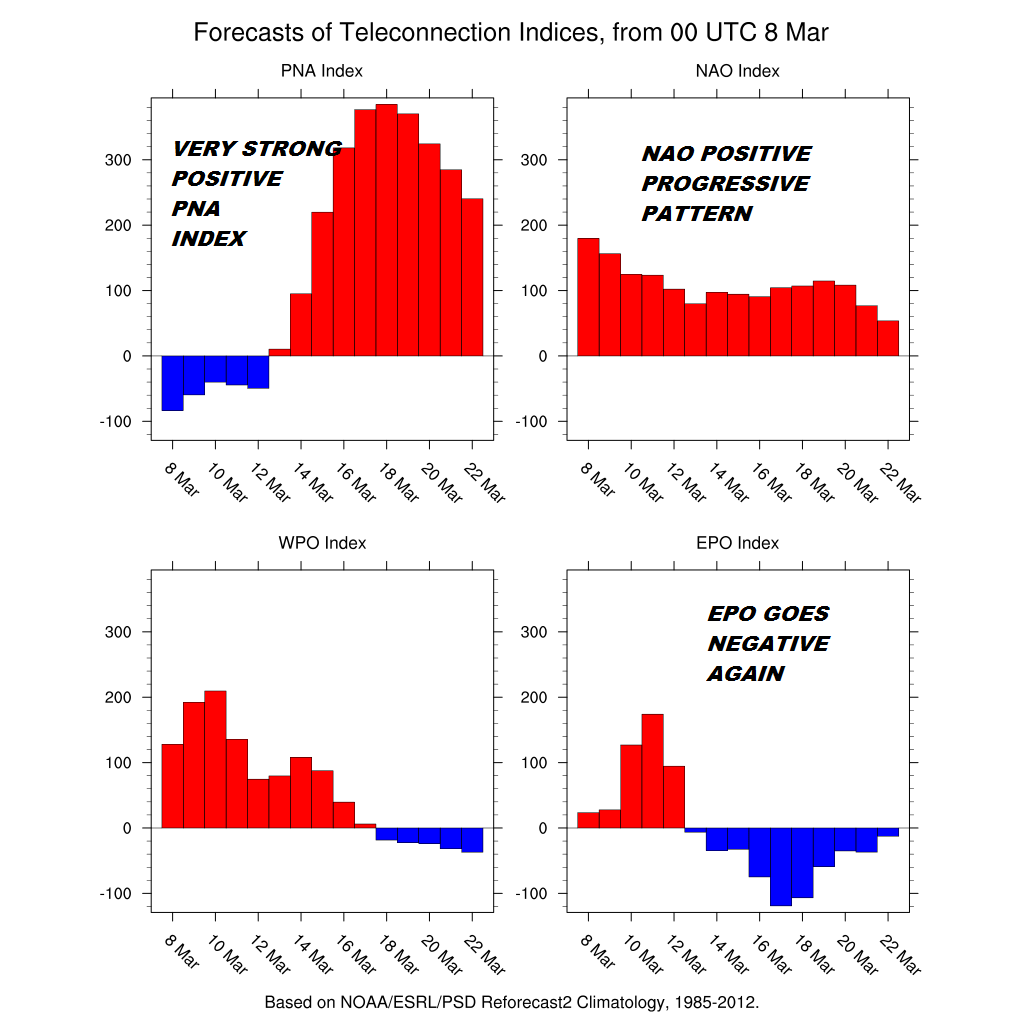
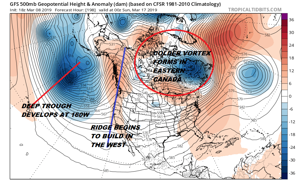
The tele-connections are signalling a change in the overall pattern with the Pacific North America index leading the way from its predominately negative reading to an off the wall strongly positive reading. This is due to the trough in the west lifting out and being replaced by a strong ridge. In addition a deep trough forms in the Pacific at 160 degrees west near Hawaii and this means lower pressures in Eastern Canada and a potential trough in the Eastern US.
We are speaking here in very broad terms. The drivers will be moving into place but whether that means anything specific is well beyond the scope and ability of these models. All this is saying is the upper air pattern will be in a more favorable position to produce something. It could produce a cold dry pattern. It could produce a storm of some sort but where the trough and ridge line up exactly if at all is along way off. Energy will be running around from the northern and southern streams during that time frame so it will be a matter if it all comes together perfectly. There is no blocking which is not an absolute requirement. We had no blocking in the last few weeks. It simply means that if something is going to happen you need to have all your ducks in a row. The pattern won’t last as it is likely to shift again late in the month so it will likely be the last chance for snow lovers to squeeze in one more snow event.
MANY THANKS TO TROPICAL TIDBITS FOR THE USE OF MAPS
Please note that with regards to any tropical storms or hurricanes, should a storm be threatening, please consult your local National Weather Service office or your local government officials about what action you should be taking to protect life and property.