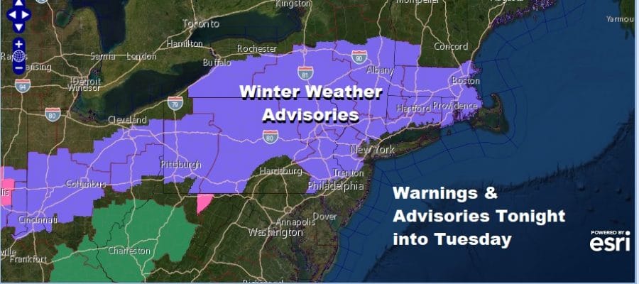
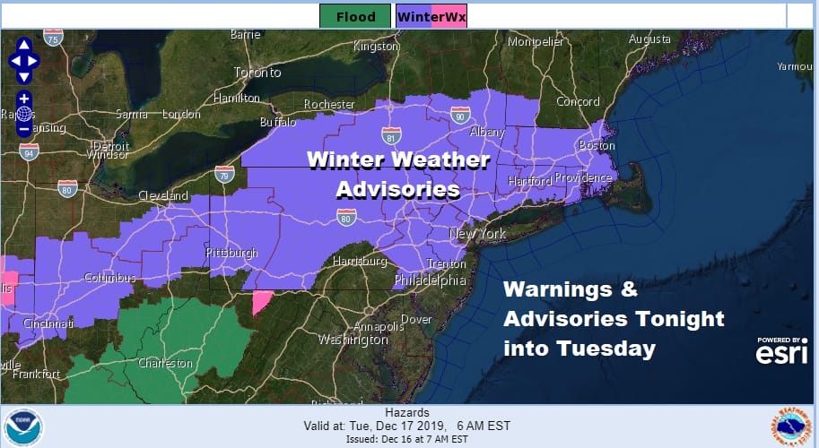
Winter Weather Advisory Snow Ice Tonight into Tuesday Morning
Winter Weather Advisories are posted for today and tonight across much of Pennsylvania to Upstate NY, Northern New Jersey NW of the NJ Turnpike, The Hudson Valley and Connecticut generally north of I-95.
The first round of snow played through in Southern New Jersey and Southern Pennsylvania this morning leaving a coating to an inch or so in some places. Now we sit back and wait for late today and tonight as low pressure comes out of the Tennessee Valley and heads for the Delaware/NJ coast Tuesday morning. The 32 degree line today and tonight will set up very close to or just north of NYC, down the NJ Turnpike to just north and west of Philadelphia. That is pretty much how the Winter Weather Advisories line up tonight
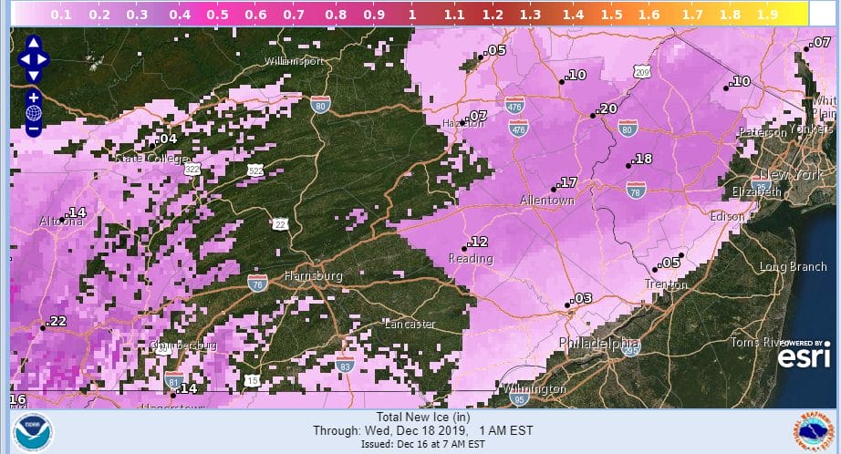
Icing is tough to figure sometimes. You have to watch the 32 degree line clearly but also topography lays a big role and it can create holes where not much happens. Cold air does not get trapped efficiently depending on wind direction or whether you are on a mountain or in a valley as these ice forecast maps clearly show.

In this situation it would appear that Northern New Jersey especially the northern and Western Counties, Eastern Pennsylvania north of Route 78, and the Hudson Valley look to be at the greatest risks. Also the areas either side of South Central Pennsylvania, east of Lancaster and West of Gettysburg south to the Maryland line appear to have the greatest risk for icing.
SATELLITE

REGIONAL RADAR

The satellite and radar confirm that most of the overnight and early morning precipitation has settled across Northern Virginia to Delaware and skimming Southern New Jersey. Not much is happening north of there nor will there be much happening today.
LOCAL RADAR NEW YORK CITY

LOCAL RADAR PHILADELPHIA


Lets get the evening and night underway with a burst of snow that develops over Northeastern Pennsylvania to Northern New Jersey to Long Island and Southern New England. The loop below is from 7pm tonight to 7am Monday. You can see just how tight the snow ice rain line is.

As far as snow is concerned I’m thinking a burst that leaves a coating to a couple of inches is possible and then we have the change to sleet , freezing rain, and then in some cases to rain along the coast (Long Island, NYC to the NJ counties south and east of the NJ Turnpike.

Tuesday the low goes by, whatever precipitation you start the day with is what you will likely finish with as the low moves away later Tuesday afternoon. Colder air follows. Wednesday a strong upper trough and cold front could set off a few snow showers with temperatures in the 30s. Then we will be down in the teens to near 20. Thursday morning and not much above the 20s to near 30 Thursday afternoon.
BE SURE TO DOWNLOAD THE FREE METEOROLOGIST JOE CIOFFI WEATHER APP &
ANGRY BEN’S FREE WEATHER APP “THE ANGRY WEATHERMAN!
MANY THANKS TO TROPICAL TIDBITS FOR THE USE OF MAPS
Please note that with regards to any severe weather, tropical storms, or hurricanes, should a storm be threatening, please consult your local National Weather Service office or your local government officials about what action you should be taking to protect life and property.


