
Winter Weather Advisory North RT 84

WINTER WEATHER ADVISORY NORTH RT 84
SNOW OF 2 TO 6 INCHES FORECAST
DUTCHESS & SULLIVAN COUNTIES NORTHWARD
With the next weather system approaching we have a WINTER WEATHER ADVISORY POSTED for the Hudson Valley and for Connecticut north of route 84. Snow will develop tonight probably after midnight so anything that falls overnight will stick to roadways. Temperatures will settle in the upper 20s to low 30s as wind diminish. The coastal storm is moving away on the satellite as one weather system after another makes its way to the east coast.
Winter Weather Advisory Satellite And Radar Loop


Regional radar shows snow moving into Western New York and heading southeastward and eventually we will see this spread across the interior Southern Tier of New York and eventually across the northern half of Connecticut late tonight into Monday morning.
Winter Weather Advisory Local Radar Loops


The systems are moving right along and unlike last night’s storm, this one is weaker and will have a limited amount of moisture to play with. South of route 84 precipitation will start as some wet snow but should go over to rain after daybreak. Amounts will be light toward the coast and will not produce any travel issues.
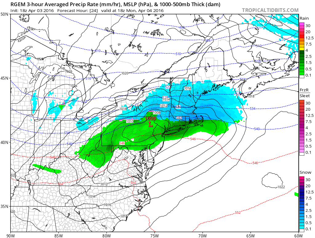
The low track on the RGEM model is similar to all the other models and will gradually sink southeastward to south of Long Island late in the day. A change back to snow along the coast could occur Monday evening but it won’t amount to anything.

For areas in upstate New York and for interior Southern New England, this will probably be the biggest snowfall of the year. Many areas in upstate and New England experienced their least snowiest winters on record. Also behind this wave record low temperatures are possible Tuesday morning in many areas including ours with readings in the teens and 20s.
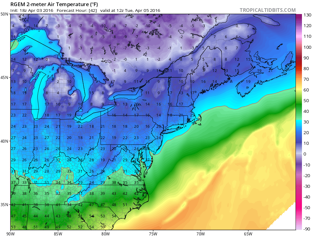
Tuesday’s highs will be just in the 30s to around 40. Wednesday will be dry and not as cold with some sunshine with some late day arriving clouds. Highs will be in the 40s to near 50. The next cold front approaches on Thursday with showers likely. Another shot of cold air follows for the end of the week and next weekend.
FiOS1 News Weather Forecast For Long Island
FiOS1 News Weather Forecast For New Jersey
FiOS1 News Weather Forecast For Hudson Valley
NATIONAL WEATHER SERVICE SNOW FORECASTS
LATEST JOESTRADAMUS ON THE LONG RANGE
Weather App

Don’t be without Meteorologist Joe Cioffi’s weather app. It is really a meteorologist app because you get my forecasts and my analysis and not some automated computer generated forecast based on the GFS model. This is why your app forecast changes every 6 hours. It is model driven with no human input at all. It gives you an icon, a temperature and no insight whatsoever.
It is a complete weather app to suit your forecast needs. All the weather information you need is right on your phone. Android or I-phone, use it to keep track of all the latest weather information and forecasts. This weather app is also free of advertising so you don’t have to worry about security issues with your device. An accurate forecast and no worries that your device is being compromised.
Use it in conjunction with my website and my facebook and twitter and you have complete weather coverage of all the latest weather and the long range outlook. The website has been redone and upgraded. Its easy to use and everything is archived so you can see how well Joe does or doesn’t do when it comes to forecasts and outlooks.
Just click on the google play button or the apple store button on the sidebar for my app which is on My Weather Concierge. Download the app for free. Subscribe to my forecasts on an ad free environment for just 99 cents a month.
Get my forecasts in the palm of your hand for less than the cost of a cup of Joe!
![]()
![]()

MENTION JOE CIOFFI AND GET A 5% DISCOUNT


