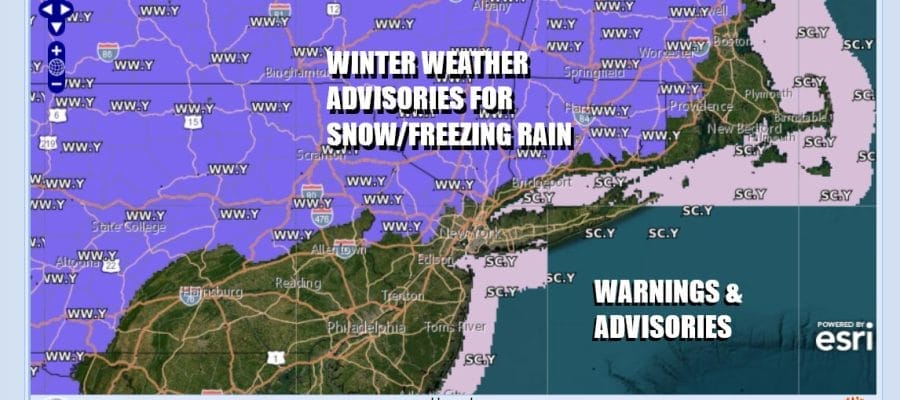
Winter Weather Advisory Inland Tonight
A Little Snow & Freezing Rain Followed By Rain

Winter Weather Advisory Inland Tonight
A Little Snow & Freezing Rain Followed By Rain
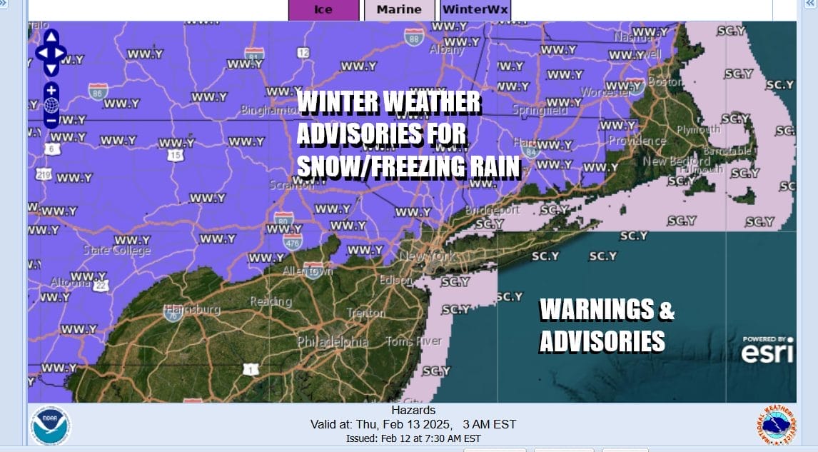
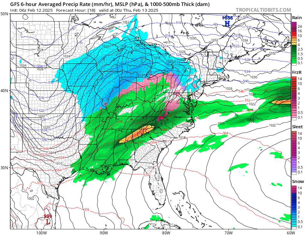
Last night’s storm system has now moved away to the east after leaving as little as a coating in areas from Northern Westchester and Northern Connecticut to 6 to 8 inches in the southeasternmost counties of New Jersey south into Delaware. Another storm is heading to the Great Lakes and that is setting inland areas up for a little snow and freezing rain this evening before a change to all rain occurs. Winter Weather Advisories are up for this possibility but this will not be a big deal.

Usually we clear out behind these systems but not this time. A new storm is heading for the Great Lakes so clouds are already arriving from that system This is going to keep things overcast today and temperatures likely won’t be going anywhere as most highs will be in the 30s. Late this afternoon and into the first part of tonight we will see some patchy light snow and freezing rain developing inland and patchy light rain developing for coastal areas as well as Central and South Jersey.
SATELLITE WITH LIGHTNING STRIKES

WEATHER RADAR

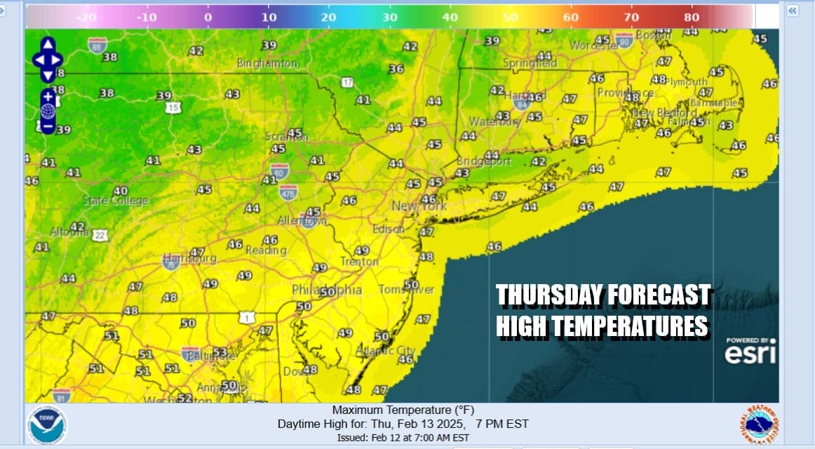
Overnight we will see inland areas go to all rain with minimal ice accretion. Temperatures will be slowly rising overnight. Rainfall will last into Thursday morning ending around daybreak or so. Rainfall amounts will be plus or minus a small amount either side of a half inch. This should not be too problematic. Weather conditions will improve Thursday with leftover clouds giving way to some sunshine and highs will be in the 40s.
Colder air is going to come in Thursday night on gusty northwest winds. Friday morning lows will be mostly in the 20s. Friday will be a cold day with a fair amount of sunshine but it will be on the windy side. Most highs Friday will be in the low to middle 30s. Then we head into the weekend where another storm system looms. This is going to be another storm that will track to our west however it looks to be loaded with moisture.
As precipitation arrives Saturday afternoon we will see some snow on the front end and there is the chance for a front end thump of a few inches especially inland before it all changes to rain Saturday night. That will be followed by a heavy soaking rain of of up to a couple of inches Saturday night into Sunday morning before a cold front passes and puts an end to it. Then behind the front we will have strong northwest winds and much colder air from Canada moves in for the start of next week.
BE SURE TO DOWNLOAD THE FREE METEOROLOGIST JOE CIOFFI WEATHER APP &
ANGRY BEN’S FREE WEATHER APP “THE ANGRY WEATHERMAN!
MANY THANKS TO TROPICAL TIDBITS FOR THE USE OF MAPS
Please note that with regards to any severe weather, tropical storms, or hurricanes, should a storm be threatening, please consult your local National Weather Service office or your local government officials about what action you should be taking to protect life and property.


