Winter Weather Advisories Winter Storm Warnings New Jersey,
Snow Late Today & Tonight

Winter Weather Advisories Winter Storm Warnings New Jersey,
Snow Late Today & Tonight
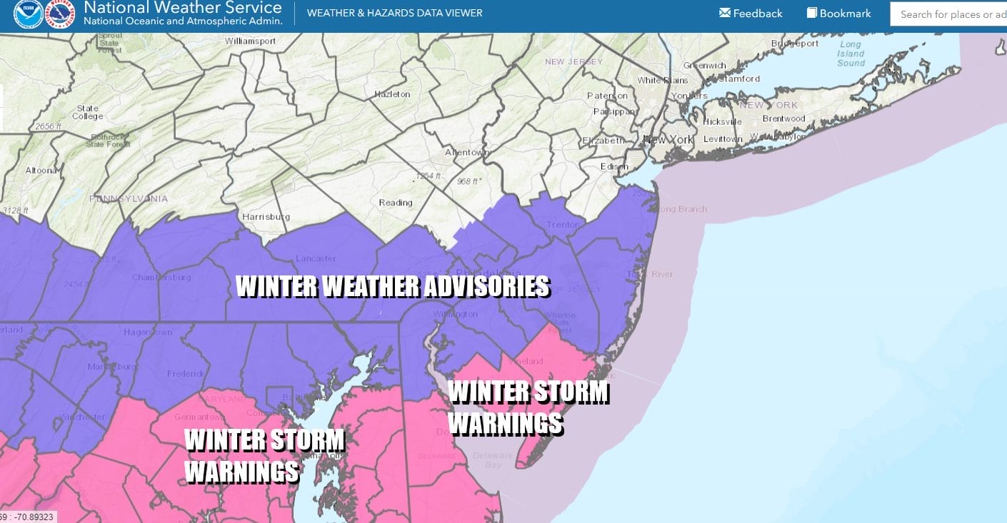
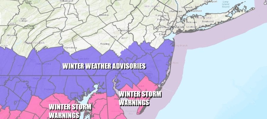
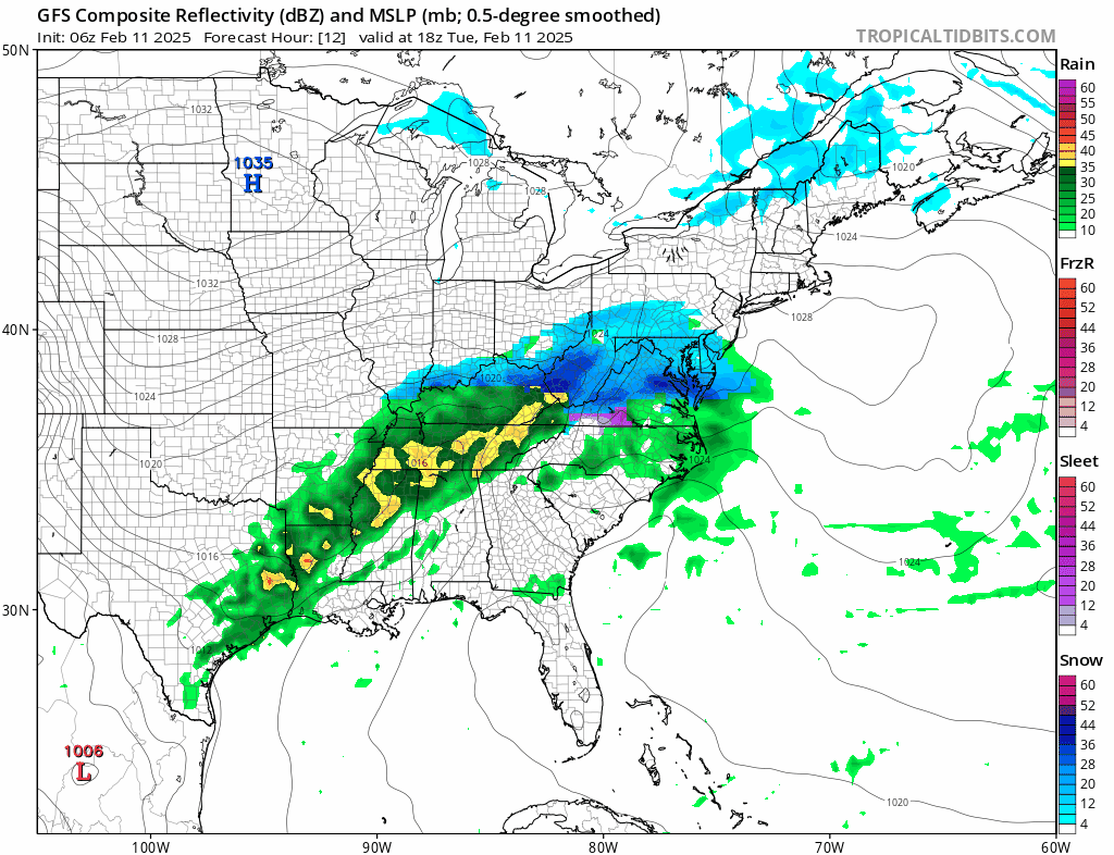
Across the southern half of New Jersey we have Winter Weather Advisories, mostly from Interstate 195 southward, and the southernmost counties including Atlantic and Cape May Counties are under Winter Storm Warnings. Areas to the north of the advisory zone will see snow however it falls under the 3 inch criteria for a Winter Weather Advisory.
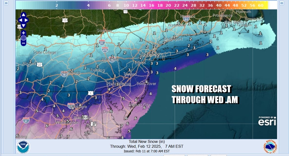
As far as snow amounts are concerned, the northern fringe of the accumulating snow reaches Interstate 84 in NY and Connecticut and a coating or perhaps a few tenths of an inch could fall there. Further south as you heady to Interstate 287 in New Jersey it could be about an inch or maybe 2. Areas from South of Route 80 in New Jersey including NYC, and Long Island will be in a zone of about 2 to perhaps near 3 inches when you get down to Interstate 195 in New Jersey and that is where the advisory kicks in with 3 inches or more. South Jersey in the warning area as well as Delaware, Maryland and Virginia will see at least 4 to 7 inches and this includes Washington DC, & Baltimore. Southern and Southeastern Pennsylvania should be in a zone of 2 to perhaps 4 near the Maryland state line.
SATELLITE WITH LIGHTNING STRIKES

WEATHER RADAR

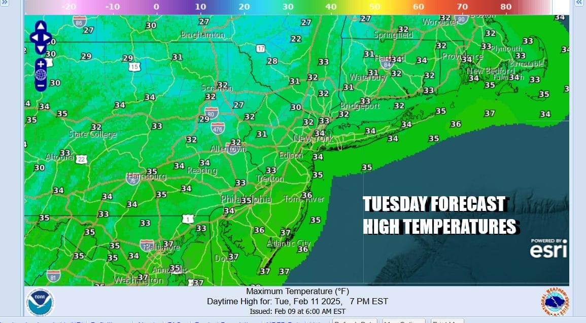
Satellite and radar loops show clouds and snow to the south that will gradually spread northward. We will likely see snow break out across Eastern Pennsylvania to Southern New England later in the afternoon to early evening and it should be mostly done by the early morning hours of Wednesday. Temperatures today will be in the cold upper 20s to mid 30s for highs and while it is snowing temperatures tonight will be in the 20s.
We are in a busy weather pattern and no sooner does this first system pull out but we have a second system right behind it. Low pressure is coming out of the Central Plains and it is taking a track northeastward to the Upper Ohio Valley/Lower Great Lakes. This time around with the track to the west, the heaviest snows will be from the Central Plains to the Lower Great Lakes.
For us we see a warm front approaching and there could be a brief burst of snow developing late Wednesday afternoon into Wednesday evening. It appeared that the burst of snow could have been enough to produce a coating to a few inches before a change to rain occurs however the low tracking further west seems to reduce the chances of a burst of snow.

Wednesday highs during the day will be in the 30s with cloudy skies. Temperatures will slowly rise Wednesday night as any snow changes to rain relatively quickly. Some pockets of freezing rain inland are possible. Rain ends Wednesday morning around daybreak or shortly afterwards and weather conditions will improve later in the with temperatures in the 40s. Colder drier air returns Friday but another storm system will approach for the weekend bringing snow ice and rain to the Northeast and Northern Mid Atlantic.
BE SURE TO DOWNLOAD THE FREE METEOROLOGIST JOE CIOFFI WEATHER APP &
ANGRY BEN’S FREE WEATHER APP “THE ANGRY WEATHERMAN!
MANY THANKS TO TROPICAL TIDBITS FOR THE USE OF MAPS
Please note that with regards to any severe weather, tropical storms, or hurricanes, should a storm be threatening, please consult your local National Weather Service office or your local government officials about what action you should be taking to protect life and property.


