Improving Weather Conditions Later Today Windy & Colder Friday
Snow to Heavy Rain Saturday into Sunday

Improving Weather Conditions Later Today Windy & Colder Friday
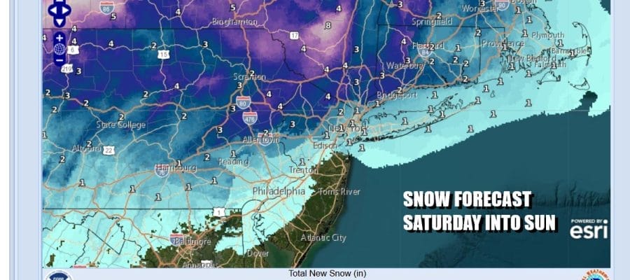
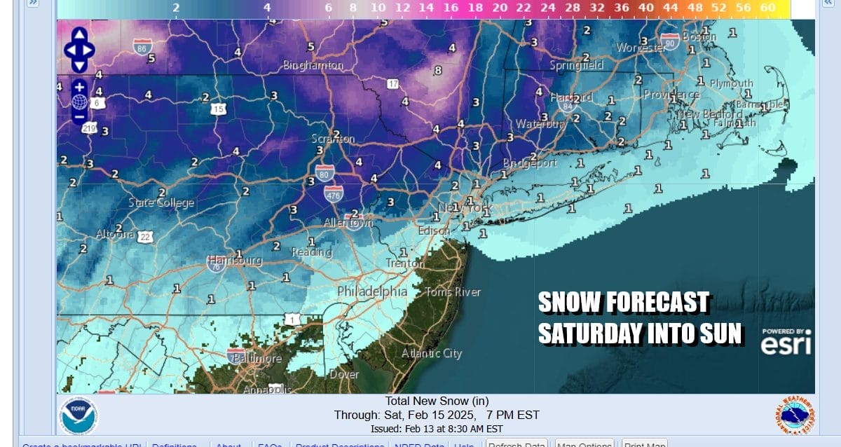
Snow to Heavy Rain Saturday into Sunday
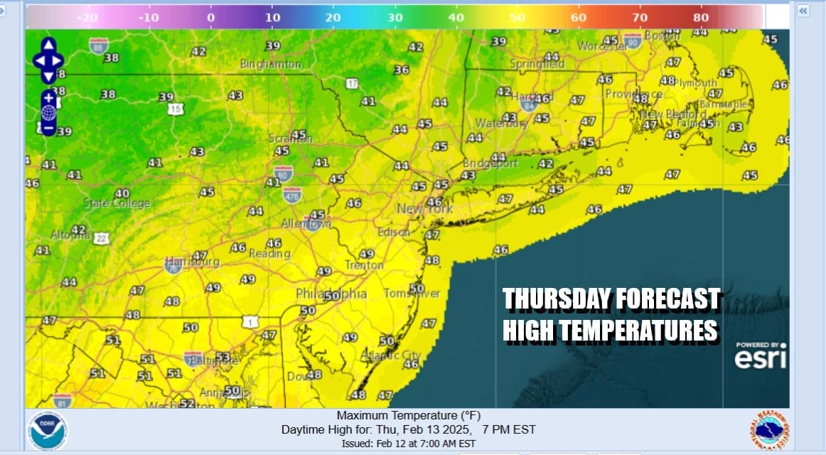
Low pressure is moving away to the northeast and the main rain area is offshore. Going forward today we will see slow improvement with leftover clouds. Some sunshine should break out from west to east late this morning and this afternoon as drier air pushes to the east. It will be a mild day with temperatures mostly in the 40s. Winds will pick up some later today and tonight which will help dry things out. Colder air will move in tonight and by Friday morning most lows across Eastern Pennsylvania to Southern New England will be in the low to middle 20s.
SATELLITE WITH LIGHTNING STRIKES

WEATHER RADAR

As this storm system departs we have high pressure that will build in for Friday bringing some colder air that will be setting us up for the next storm system that is coming in for the weekend. Low pressure is going to develop on an arctic boundary that will push into the Eastern US and stall. A wEave develops on the front and then heads northeast into New England Saturday night and Sunday.

Ahead of this we have a nice but windy and cold weather day for Friday with sunshine. Highs will be mostly in the 30s. Then we will see increasing clouds during Friday night and Saturday morning. It will be cold enough for snow at the start of precipitation Saturday afternoon. There could be a quick accumulation of a coating to a few inches across Eastern Pennsylvania to Southern New England with higher amounts as you go north into the Hudson Valley and Connecticut.
A gradual change to rain will occur from south to north late Saturday and Saturday and we will see a sokaing rain develop. Temperatures Saturday will be in the 30s and then rise during Saturday night into Sunday morning. We are expecting an inch to an inch and a half of rain over night into Sunday morning until the cold front passes. Rain will end from west to east Sunday morning and then it will turn windy later in the day. Temperatures Sunday will reach the 50s briefly and then drop into the upper teens to mid 20s Monday morning. Monday will be dry sunny and cold with most highs in the upper 20s and lower 30s.
BE SURE TO DOWNLOAD THE FREE METEOROLOGIST JOE CIOFFI WEATHER APP &
ANGRY BEN’S FREE WEATHER APP “THE ANGRY WEATHERMAN!
MANY THANKS TO TROPICAL TIDBITS FOR THE USE OF MAPS
Please note that with regards to any severe weather, tropical storms, or hurricanes, should a storm be threatening, please consult your local National Weather Service office or your local government officials about what action you should be taking to protect life and property.


