Winter Weather Advisory Inland Freezing Rain & Rain Friday
But Improving Weather Conditions Over the Weekend

Winter Weather Advisory Inland Freezing Rain & Rain Friday
But Improving Weather Conditions Over the Weekend
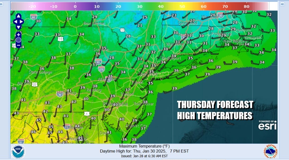
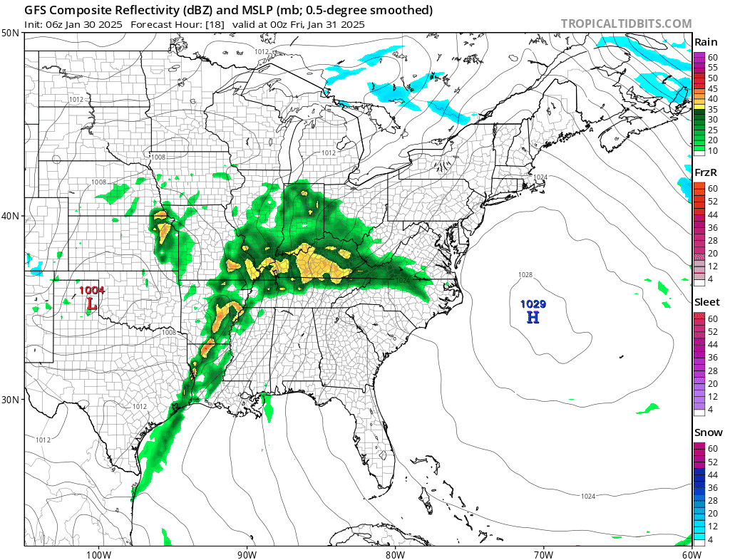
Colder air on northwest winds moved in overnight. This is a rather fast moving cold air mass that is going to be moving out later today and winds will turn more southerly as the day wears on. There are no weather issues for today as we will se mainly sunny skies. We will likely have some high clouds coming in later today ahead of the next storm system that is in the Lower Mississippi today but most of today will feature a good deal of sunshine. Radars are nice and quiet for today and the first part of tonight.
SATELLITE WITH LIGHTNING STRIKES

WEATHER RADAR

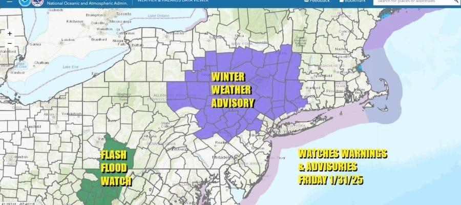
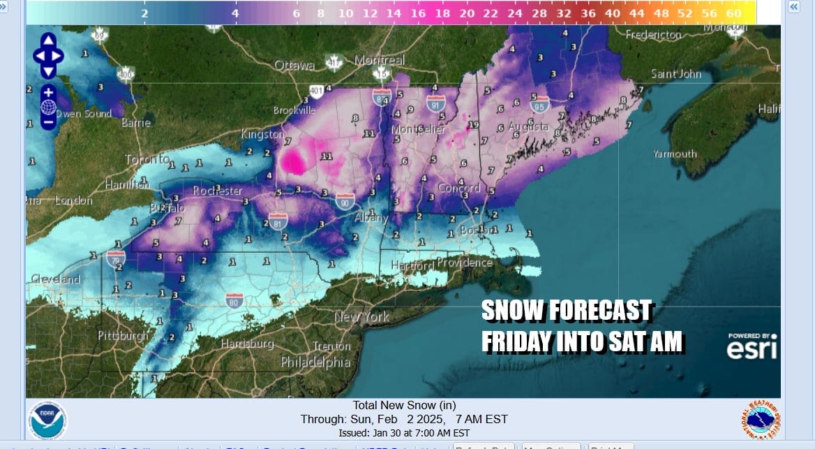
The first Winter Weather Advisories are posted for Friday morning over Northwest New Jersey, Northeast Pennsylvania, the Lower Hudson Valley, and Northwest Connecticut. This is for freezing rain that will come in during the early morning hours Friday. Temperatures inland will be close to freezing or a little below as precipitation gets underway. Valley areas may have cold air trapped through the Friday morning commute.
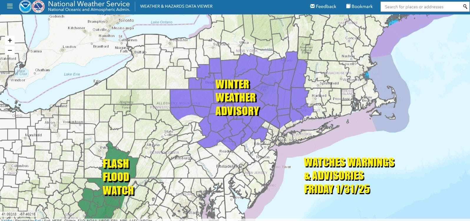
We do not expect any serious icing but slick spots will certainly develop in areas under Winter Weather Advisories. Temperatures will warm above freezing rather quickly Friday morning so we expect minimal ice accretion across Eastern Pennsylvania to Southern New England. In fact if the rain holds off until after daybreak, we could see little in the way of ice accretion.
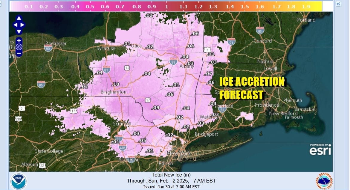
The bulk of the precipitation will be mainly rain. For a more significant ice and snow even you will have to go north to the Interstate 90 corridor in NY State and Central New England. That area stands the best chance for some accumulating snow from this system and we expect to see some areas pick up several to 6 inches from Northern New York to Northern New England.
Low pressure is going to take a track across the Northern Ohio Valley, across Northern Pennsylvania and then east across Southern New England Friday night. All of this should be long gone by Saturday morning as the low heads south of Nova Scotia. Improving weather conditions will develop and the weekend should be dry and seasonal as high pressure builds in behind this system,
As far as temperatures are concerned, we will see them rise into and in some cases through the 40s Friday. Saturday with returning sunshine, highs will be in the 30s. Sunday will be sunny with highs in the upper 30s and lower 40s. Rainfall amounts from this system will total a half to three quarters of an inch. Many areas in the Northeast and Northern Mid Atlantic have see very little precipitation for the month of January and for many areas this will be one of the top 5 driest Januarys on record.
BE SURE TO DOWNLOAD THE FREE METEOROLOGIST JOE CIOFFI WEATHER APP &
ANGRY BEN’S FREE WEATHER APP “THE ANGRY WEATHERMAN!
MANY THANKS TO TROPICAL TIDBITS FOR THE USE OF MAPS
Please note that with regards to any severe weather, tropical storms, or hurricanes, should a storm be threatening, please consult your local National Weather Service office or your local government officials about what action you should be taking to protect life and property.


