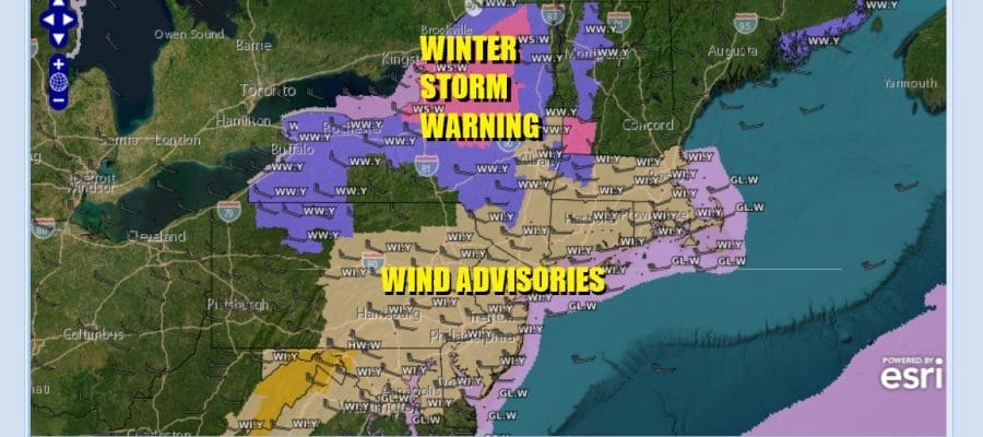
WIND ADVISORIES GUSTS 40 TO 50 MPH
Quick Cold Shot Rain Arrives Friday Freezing Rain Well Inland
Weekend Sees Improvement

WIND ADVISORIES GUSTS 40 TO 50 MPH
Quick Cold Shot Rain Arrives Friday Freezing Rain Well Inland
Weekend Sees Improvement

Prepare to be blown away by the wind today. Low pressure is moving across Upstate NY and a very tight pressure gradient will cover us today. That means strong gusty winds. Wind Advisories cover everyone in the Northern Mid Atlantic to Southern New England from West Virginia to Southeastern England. Winds will gust to 40 and even 50 mph at times throughout the day with the peak winds midday into mid afternoon. Upstate NY and Northwestern New England are seeing heavy snow as the low track eastward today.

Precipitation is not an issue today as we will see partly sunny skies with this howling wind. Temperatures this afternoon on the south side of the storm will reach the 40s but as you head north up the Hudson Valley and Connecticut it will be in the 30s. Snow could reach as far south Interstate 84 but the bulk of the accumulating snow will be well to the north and northeast,
SATELLITE WITH LIGHTNING STRIKES

WEATHER RADAR

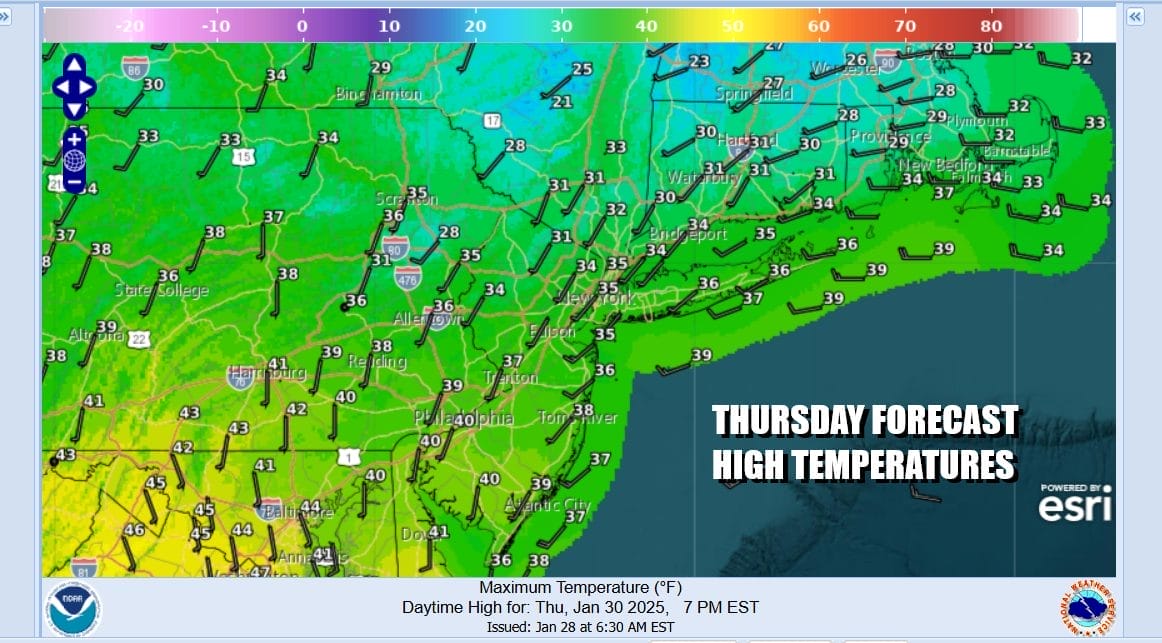
Winds will ease and skies will clear tonight with most lows in the upper teens to mid 20s. A quick shot of cold air is coming in behind this storm system. This leaves us with a nice weather day Thursday with much less in the way of wind, partly to mostly sunny skies, and high temperatures mostly in the 30s.
Another storm system is coming out of the southwest US and the low center is forecast to move across the Upper Ohio Valley to just off the coast of New Jersey/Long Island early Saturday. Rain will spread northward Thursday night and arrive across Eastern Pennsylvania to Southern New England before daybreak Friday. In areas inland in Northeast Pennsylvania, the Catskills east to Northwest Connecticut. Rain could start off as freezing rain for a few hours Friday morning. Elsewhere it will be all rain. Upstate NY and New England along the I-90 corridor it will be mostly snow.
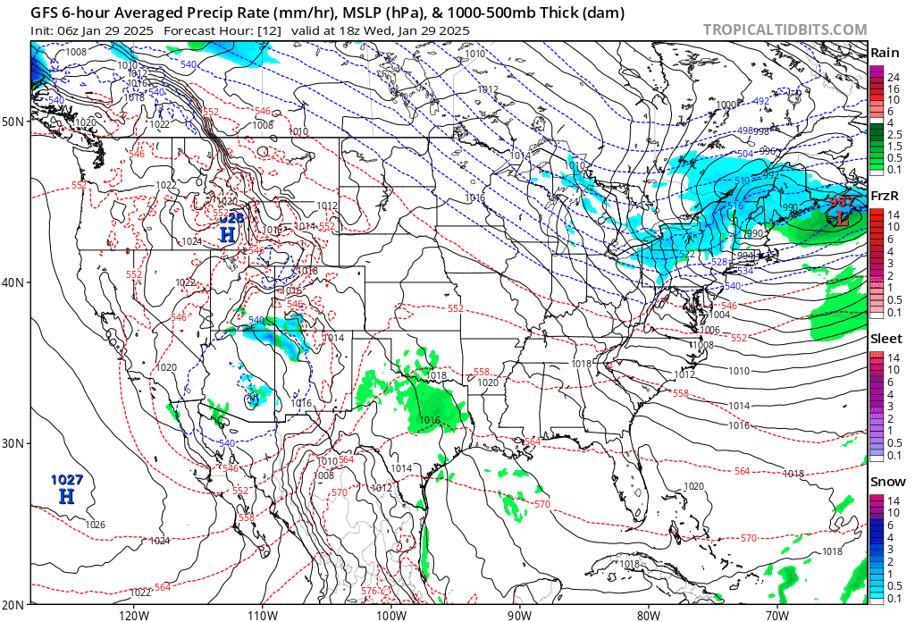
Temperatures Friday will rise into the 40s except for areas north of Interstate 84 where it will be in the 30s. Rain will move out Friday night and we will see improving weather conditions over the weekend. It will be back to near average temperatures for this time of year. Highs in the 30s and lows in the upper teens to mid 20s. Skies over the weekend should be no worse than partly sunny.
BE SURE TO DOWNLOAD THE FREE METEOROLOGIST JOE CIOFFI WEATHER APP &
ANGRY BEN’S FREE WEATHER APP “THE ANGRY WEATHERMAN!
MANY THANKS TO TROPICAL TIDBITS FOR THE USE OF MAPS
Please note that with regards to any severe weather, tropical storms, or hurricanes, should a storm be threatening, please consult your local National Weather Service office or your local government officials about what action you should be taking to protect life and property.


