Freezing Rain Well Inland Rainy Friday Improving Weather Over the Weekend

Freezing Rain Well Inland Rainy Friday Improving Weather Over the Weekend
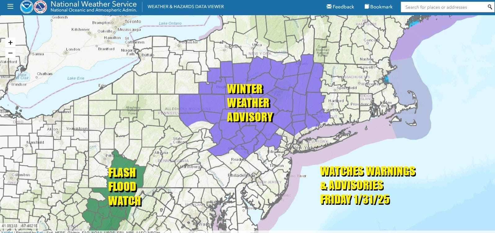
Freezing rain will be occurring this morning inland in Northwest New Jersey, Northeast Pennsylvania, the Hudson Valley into Western Connecticut especially in valleys where cold air may get trapped for awhile. Most temperatures are 32 or higher to start the day with the exception of areas north and west of the coast but by mid morning to noon everyone should be above 32.
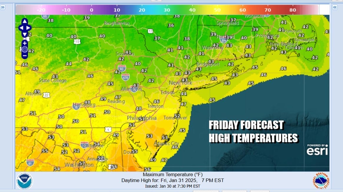
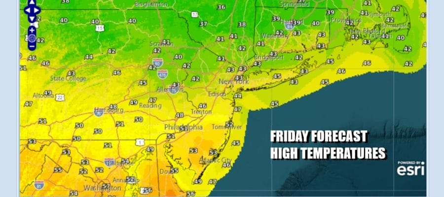
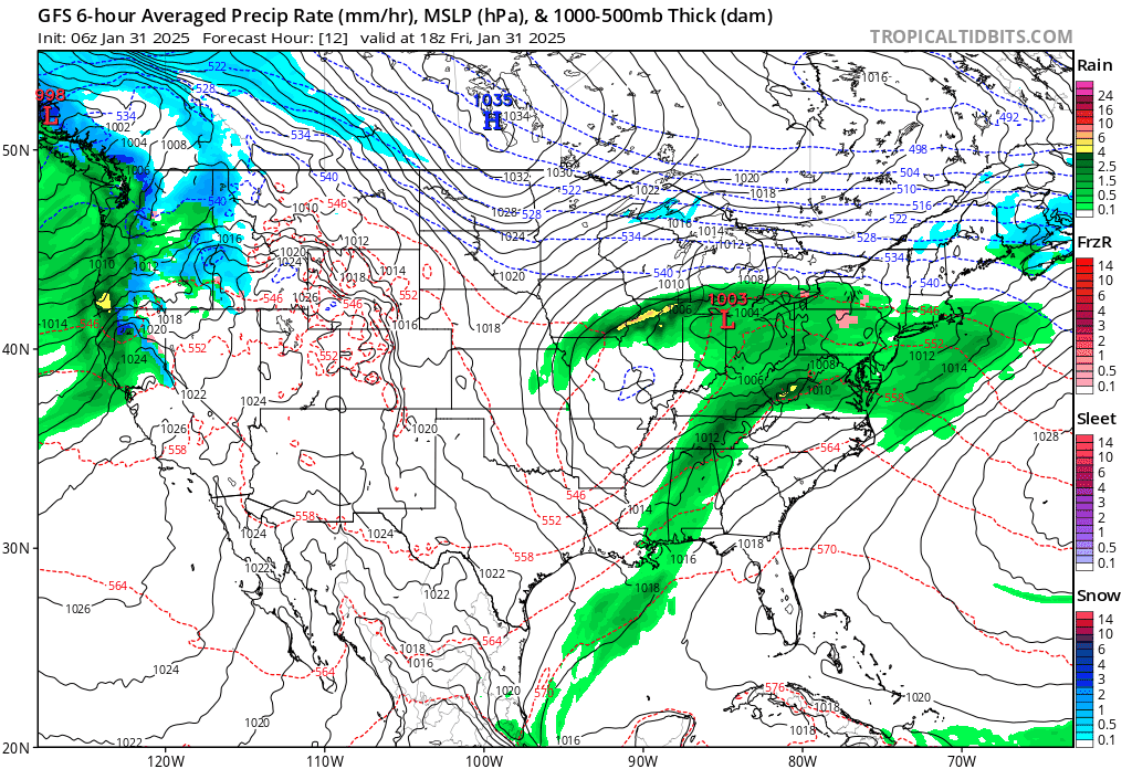
Today is going to be a wet day overall as low pressure moves across the Northern Ohio Valley and then exits virtually overhead and to the east across Southern New England tonight. This low pressure area is not going to strengthen much and most rainfall amounts will be around a quarter to a half inch. High temperatures later today will be in the 40s with some lower 50s in South Jersey and points south. Inland areas will struggle somewhat to get back to 40 degrees.
SATELLITE WITH LIGHTNING STRIKES

WEATHER RADAR

Once the low exits to the east tonight, rain will end from west to east. Snow will be in a narrow band to the north across the I-90 corridor into interior Northern New England and won’t amount to much, just a few inches to maybe 4 inch amounts in some places well north. Over the weekend high pressure builds in as weather conditions improve.
Sunday night sees a warm front going by with some snow across Upstate NY and New England. Any snow will be north of Route 84 and it won’t amount to much. As far as the weekend goes, temperatures will be close to average. We will see decreasing clouds and increasing sunshine for Saturday. Most highs will be in the upper 30s and lower 40s.

Sunday we will see a wider range in temperatures. North of NYC we could see highs in the upper 20s and lower 30s. Southern New Jersey and points south will be in the upper 30s and lower 40s. We expect to see sunshine to start the day before clouds arrive in the afternoon. The warm front should go by mostly unnoticed except for maybe those areas north of Route 84 where a brief period of snow is possible overnight.

Next week starts warm as we wait for a cold front to pass later Monday. There should be some sunshine Monday and the front will probably move through dry. Highs Monday will reach into the 50s. It will be a little colder Tuesday and Wednesday. Another warm front cold front combination arrives for Wednesday into Thursday. Thursday could see highs in the 50s to near 60 or so before another front passes.
BE SURE TO DOWNLOAD THE FREE METEOROLOGIST JOE CIOFFI WEATHER APP &
ANGRY BEN’S FREE WEATHER APP “THE ANGRY WEATHERMAN!
MANY THANKS TO TROPICAL TIDBITS FOR THE USE OF MAPS
Please note that with regards to any severe weather, tropical storms, or hurricanes, should a storm be threatening, please consult your local National Weather Service office or your local government officials about what action you should be taking to protect life and property.