Improving Weather Into Sunday
Chance for Some Snow Rain Showers Sunday Night

Improving Weather Into Sunday
Chance for Some Snow Rain Showers Sunday Night

Yesterday’s rain is now gone and we at least can see some improving weather conditions for the weekend, at least through Sunday afternoon. Today should be no worse than partly sunny with temperatures in the 30s. A cold high is building across Upstate NY and New England and this will be a quick shot of cold air. Radars are quiet today and will remain so through Sunday afternoon.
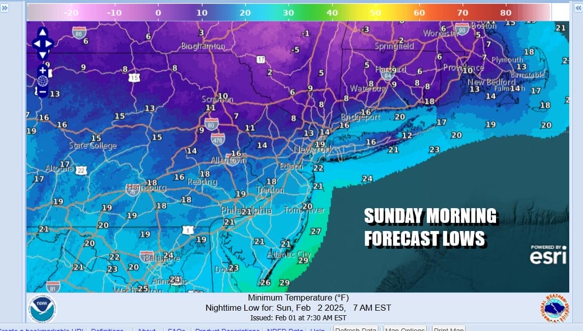
The core of this cold air mass will be felt tonight under a clear sky. Temperatures by morning will be in the teens. Warmer urban areas will be closer to 20 while colder inland spots could finish somewhere in the single digits by daybreak Sunday we will have sunshine to start the day but an approaching warm front from the west will bring arriving clouds. Most highs Sunday will be in the 30s to perhaps near 40 in areas to the south like South Jersey down into Delaware. Low 30s should do it north and northeast of NYC.
SATELLITE WITH LIGHTNING STRIKES

WEATHER RADAR

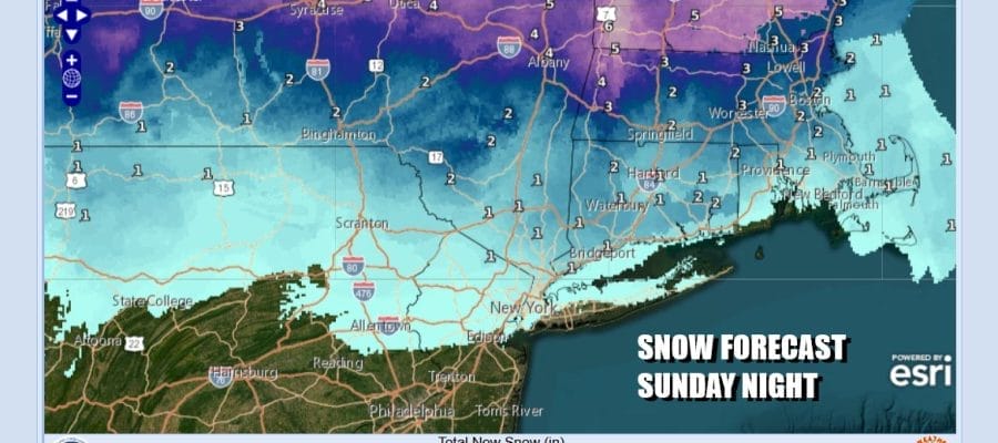
Low pressure is going to be moving across Southern Canada with a warm front that sweeps across the Great Lakes, New York and New England. An area of snow will break out ahead of the warm front and it will move through rather quickly Sunday evening and then be long gone by the early morning hours Monday.

Areas inland from Northeast Pennsylvania, Northern New Jersey north of Route 80, the Hudson Valley north of Route 287, and Connecticut north of I-95 could see anywhere from a coating to perhaps an inch or so of accumulation. This system is moving rather fast so there isn’t much room or time for any upside.

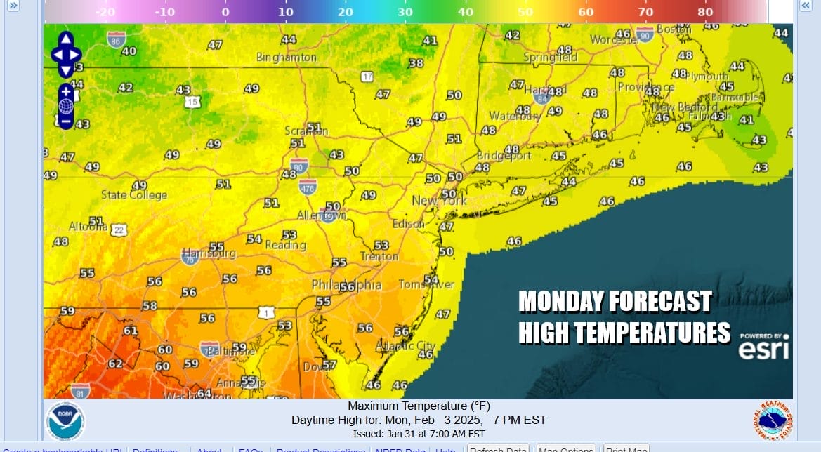
Once the warm front passes we will see warmer temperatures settling in for Monday. There is a cold front that will be approaching Monday afternoon and evening but there is no moisture with it. Much of Monday will be partly to mostly sunny and it will be on the mild side. Most highs will be in the upper 40s to some middle 50s.
Longer term the weather pattern seems to be in an evolutionary state. Colder air will be building across Southern Canada and we will probably lie on the southern edge of that colder air. There also appears to be a more active southern jet stream that will be shooting weather systems out every couple of days. Much of what happens will depend on how much colder is able to spread into the Northeast, Great Lakes and Ohio Valley in the coming weeks. We also see hints of a blockier pattern developing which could help to displace low level cold air southward. The first chance will be Wednesday night into Thursday for some form of wintry precipitation. We will get more specific in the coming days.
BE SURE TO DOWNLOAD THE FREE METEOROLOGIST JOE CIOFFI WEATHER APP &
ANGRY BEN’S FREE WEATHER APP “THE ANGRY WEATHERMAN!
MANY THANKS TO TROPICAL TIDBITS FOR THE USE OF MAPS
Please note that with regards to any severe weather, tropical storms, or hurricanes, should a storm be threatening, please consult your local National Weather Service office or your local government officials about what action you should be taking to protect life and property.


