
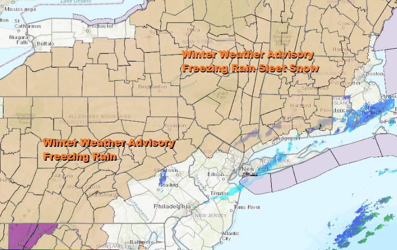
Winter Weather Advisory Eastern Pennsylvania Northwest NJ, Hudson Valley Connecticut Freezing Rain Wintry Mix

Weather in 5/Joe & Joe Weather Show Latest Podcast
Winter Weather Advisory Eastern Pennsylvania Northwest NJ, Hudson Valley Connecticut Freezing Rain Wintry Mix
Advisories are now posted for later Friday into early Saturday for a wintry mix of mostly freezing rain and sleet with some snow in the early mix. Before that we have leftover clouds on the satellite picture this evening as colder air has started to move in. We have a cold night ahead with skies partially clearing out especially north of NYC. Morning lows will be in the mid 20s to lower 30s. There is still some leftover precipitation aloft but that should disappear soon enough.
SATELLITE

Friday New Year’s Day we will see increasing clouds as we watch low pressure moving from Texas to the Ohio Valley. High pressure to the north and northeast of us will hold cold air in place for inland areas. Winter Weather Advisories are posted for most of Pennsylvania except the southeast, Northwest New Jersey (Sussex and Western Passaic Counties), the Hudson Valley except for Westchester County, and most of Connecticut except for the south coast south of I-95.
Precipitation will advance northward and reach Southern Pennsylvania and Southern New Jersey by early afternoon and to NYC by late afternoon or early evening and then quickly spread further north and east into upstate NY and New England. Temperatures will hold below freezing inland and mid to upper 30s along the coast where no advisories are posted. Ice accretion will range from .01 inch to a tenth of an inch. Up to .25 inch is likely further inland and north.
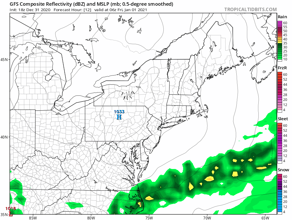
The system does move rather quickly and precipitation will be exiting early Saturday morning. We should dry out afterwards on northwest winds and developing sunshine. Highs could reach the upper 40s and lower 50s Saturday afternoon.
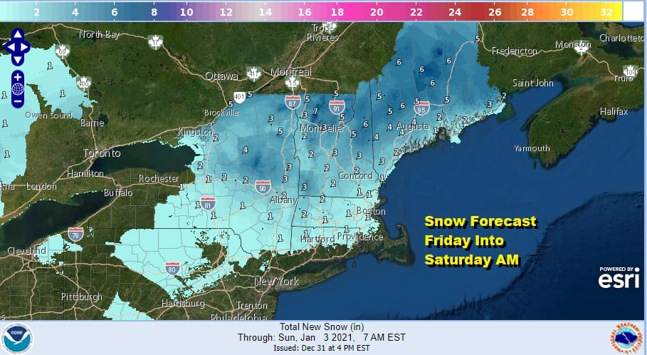
This system will not be a big snow producer with 4 inch or higher amounts in Northern and Northeast New England while other areas will see as little as a coating to as much as an inch or 2. Ice accretion will be on the order of a tenth to a quarter of an inch in most places with lesser amounts as you move southeast and closer to coastal areas.

Another storm system will develop along a stalled frontal boundary in the Southeast US and then the low moves northeastward. It is likely to spread rain up the coast and then snow will develop as the precipitation reaches Northern New Jersey into Southern New England later Sunday into Sunday night. We will address this issue in a post later tonight.
BE SURE TO DOWNLOAD THE FREE METEOROLOGIST JOE CIOFFI WEATHER APP &
ANGRY BEN’S FREE WEATHER APP “THE ANGRY WEATHERMAN!
MANY THANKS TO TROPICAL TIDBITS FOR THE USE OF MAPS
Please note that with regards to any severe weather, tropical storms, or hurricanes, should a storm be threatening, please consult your local National Weather Service office or your local government officials about what action you should be taking to protect life and property.


