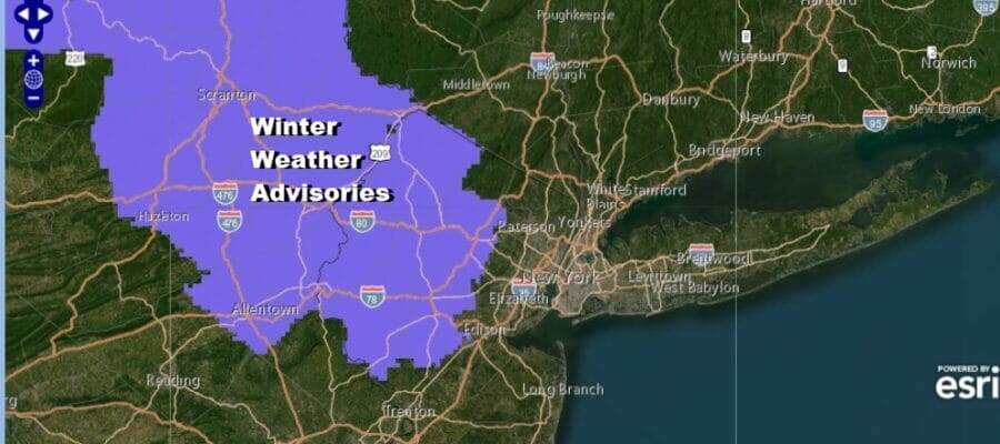
Winter Weather Advisories Posted Northwest New Jersey Northeast Pennsylvania
Late Friday Into Saturday More to Come
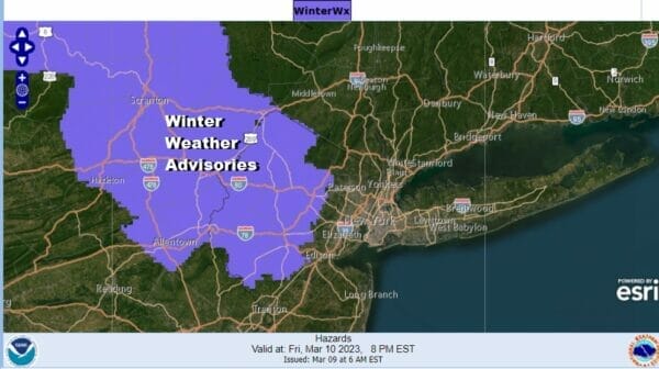
The first Winter Weather Advisories are up for Northwest New Jersey and Northeast Pennsylvania for late Friday into Saturday morning. Additional advisories will be required over portions of Eastern Pennsylvania to Southern New England as a storm comes out of the Plains and redevelops along the Mid Atlantic coast early Saturday morning.
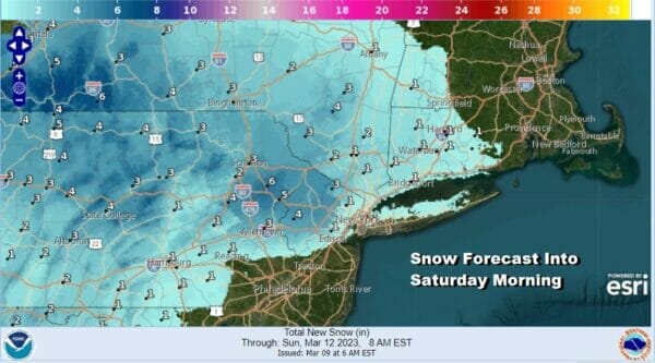
Early National Weather Service snow forecast amounts are in the range fomr a coating to an inch over Long Island and much of Connecticut to 2 to 4 inches in Northwest New Jersey and Northeast Pennsylvania. Some 6 inch amounts in the highest elevations to the northwest. 2 to 4 inches in the Hudson Valley west of the Hudson to the Catskills seems likely. Look for adjustments to these amounts as we get closer to event time which will begin later Friday afternoon and last into Saturday morning.
SATELLITE

WEATHER RADAR

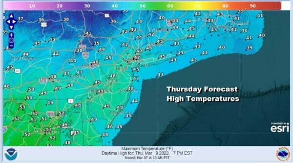
Before we get there we have a very nice Thursday ahead of us. The gradient between a storm well offshore and high pressure to the north is weakening so winds will continue to ease today. We should see a good deal of sunshine and nothing more than a few passing clouds. Highs this afternoon will be in the mid to upper 40s. A few spots cold touch 50 degrees.
We will have a chilly night ahead with clear skies for most of the night. Lows will be in the mid 20s in colder inland spots to lower 30s in warmer urban locations. Friday clouds will increase rather quickly and we will start to see moisture heading east from low pressure in the Ohio Valley and we will see snow and rain develop from west to east across Pennsylvania during the afternoon and reach Southern New England and Long Island by evening.

The low redevelops offshore and then sits there overnight, drops southeastward before moving east. Most of the precipitation should be overwith by daybreak Saturday, perhaps lasting a little longer over Central and Southern New Jersey. Coastal areas of New Jersey and parts of Long Island could see mostly rain with a little snow at the end. The storm system moving away to the southeast does tend to limit snowfall. Later Saturday we will see leftover clouds with highs in the 40s.
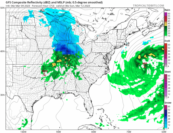
There will be a short break into early Sunday before we start to deal with the next storm system moving east across the Lower Ohio Valley and this could become a major storm for the Northeast, however it does seem that the track would be more favorable for heavy snow inland and not very much along the coast. That said there is still quite a bit of uncertainty with this system as its outcome is dependant on what the first system does. For now we will say Sunday we will see increasing clouds with snow or rain developing late in the day or Sunday night. Precipitation will continue into Monday in some form before the storm eventually pulls away to the northeast early Tuesday.
BE SURE TO DOWNLOAD THE FREE METEOROLOGIST JOE CIOFFI WEATHER APP &
ANGRY BEN’S FREE WEATHER APP “THE ANGRY WEATHERMAN!
MANY THANKS TO TROPICAL TIDBITS & F5 WEATHER FOR THE USE OF MAPS
Please note that with regards to any severe weather, tropical storms, or hurricanes, should a storm be threatening, please consult your local National Weather Service office or your local government officials about what action you should be taking to protect life and property.


