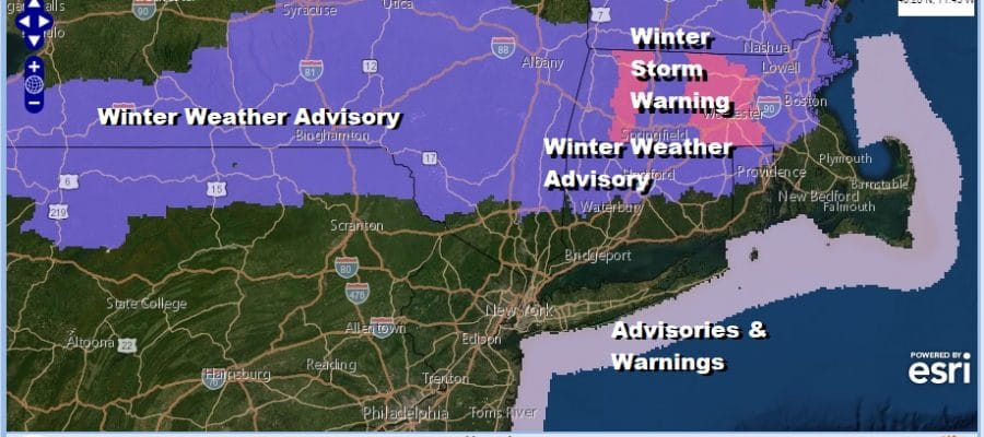
Winter Weather Advisories Northern PA to Central New England
Winter Storm Warning Berkshires
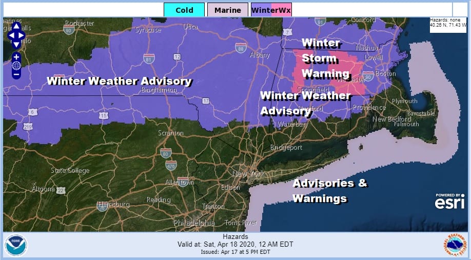
Winter Isn’t over for the interior Northeast it seems with Winter Weather Advisories now posted for a large area from Northern Pennsylvania and Western NY clear across interior Southern and Central New England (mainly north of Route 84). Snow amounts have been nudged up and i won’t argue the adjustments. Winter Storm Warnings are up for the Berkshires in Massachusetts which stand to get a solid 4 to 7 inches from this driven by elevation.
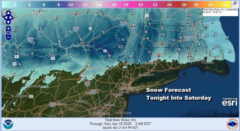
Clouds continue to roll in and thicken up this evening and we should start to see precipitation break out shortly as it comes in from the west. This is a time of year where the ground temperatures can warm up into the 40s and low 50s during the day (which they did) but the air aloft is rather cold. Some vertical motion and evaporational cooling inland should correct the bottom of the atmosphere making it ripe for wet snow to develop.
SATELLITE

REGIONAL RADAR

Regional radar is loading up over Pennsylvania and the northern fringe of the precipitation shield is in the form of wet snow (once the lower atmosphere corrects). It is possible that some wet snow could be in the mix at the start north and west of the coast.
LOCAL RADAR NEW YORK CITY

LOCAL RADAR PHILADELPHIA


Precipitation continues overnight into Saturday morning as the NAM model shows us. The southern end of the snow/rain line is a bit tricky. April can fool you some times and a degree or so colder could create a surprise for someone but it should be contained here as the system is not all that strong.

The low basically center jumps from Western PA to off the New Jersey coast by Saturday morning and then it moves away to the northeast. A cold rain will fall for coastal areas and for areas south of Route 84 down to Maryland and Southern New Jersey (and everyone in between). However it moves out and weather conditions should improve Saturday afternoon. North and east of NYC it probably won’t get out of the 40s while everywhere else it should recover into the 50s.

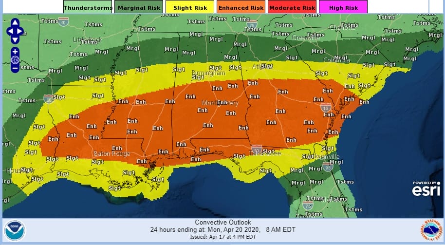
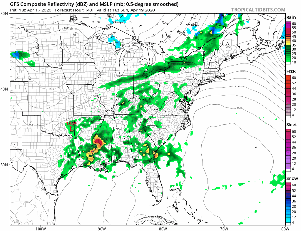
We should recover nicely on Sunday temperatures with sunshine to start followed by arriving clouds. Highs will reach the 60s just about everywhere. We have a cold front coming across the Great Lakes and Northeast Sunday night while across the south a strong short wave trough will move along and set the stage for another serious severe weather outbreak from East Texas to North Carolina.
Low pressure will be developing in the Southeast and head northeast off the North Carolina coast Sunday night and Monday. The low will pass south and east of New England Monday morning. It could come close enough to brush the immediate coast with a little rain but it shouldn’t be a huge deal. Clouds should give way to some sunshine on Monday. Highs Monday will be in the 50s.
The weather pattern next week remains active. The northern jet stream will send a short wave across the Great Lakes Tuesday with a cold front. The short wave trough is rather strong and models are responding by producing a line of thunderstorms Tuesday afternoon. Highs will be in the 50s to near 60.
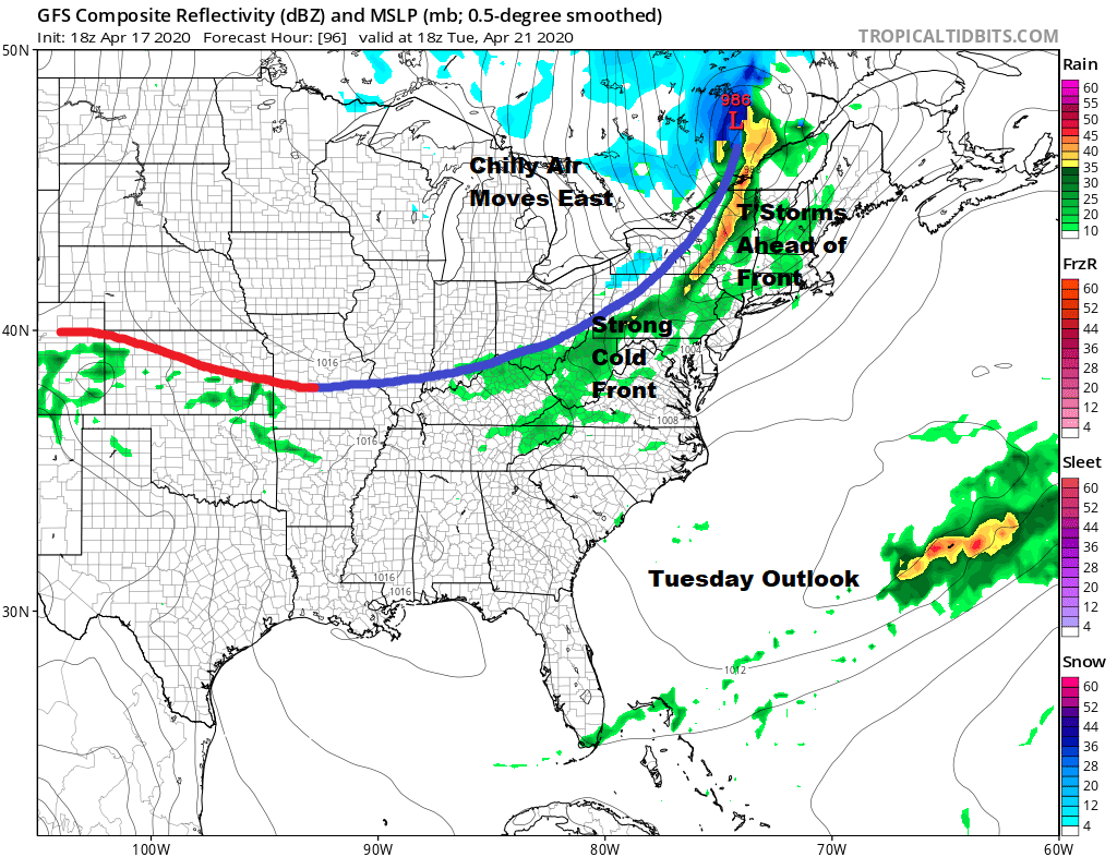
We aren’t done because after this system goes by we have a nice Wednesday but low pressure comes out of the Plains and heads to the East Coast with rain Thursday. This follows with a break on Friday and then another storm system arrives for next weekend. A very busy pattern indeed for an April which just doesn’t want to gives more than a day or so of nice weather in between each system.
BE SURE TO DOWNLOAD THE FREE METEOROLOGIST JOE CIOFFI WEATHER APP &
ANGRY BEN’S FREE WEATHER APP “THE ANGRY WEATHERMAN!
MANY THANKS TO TROPICAL TIDBITS FOR THE USE OF MAPS
Please note that with regards to any severe weather, tropical storms, or hurricanes, should a storm be threatening, please consult your local National Weather Service office or your local government officials about what action you should be taking to protect life and property.


