Winter Weather Advisories Inland Some Snow & Ice Possible
Overnight Into Monday

Winter Weather Advisories Inland Some Snow & Ice Possible
Overnight Into Monday

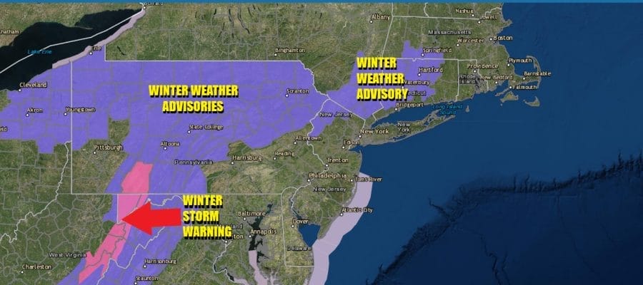
We have a weakening weather system moving through the Ohio Valley that is heading into the leftover cold air that is covering the Northeast. The result is Winter Weather Advisories. They are posted tonight into Monday morning for Northeast Pennsylvania, Northwest New Jersey, the Lower Hudson Valley, and the western half of Connecticut. The advisory is for a wintry mix of precipitation overnight which will glaze up roadways and sidewalks making getting around potentially difficult and potentially dangerous especially going into the Monday morning commute. Advisories are not up for the more urban centers of NYC or Philadelphia or are they up for Long Island.
SATELLITE WITH LIGHTNING STRIKES

WEATHER RADAR

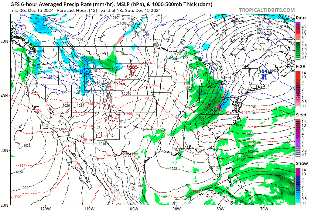
Temperatures this morning have bit bottom in the teens and low 20s away from urban centers and cold air is going to be difficult to dislodge. A warm front is pushing eastward through the Ohio Valley and we can already see precipitation heading east on regional and local radars. Clouds will be increasing today with high most high temperatures not much above the low and middle 30s in areas where advisories are posted.

Outside of the advisory zone highs will likely reach the upper 30s and lower 40s. Then tonight we see some rain coming in for coastal counties of New Jersey, Connecticut and Long Island. A little snow will fall inland that will gradually go to a mix of light snow and freezing rain, and the ultimately just freezing rain.
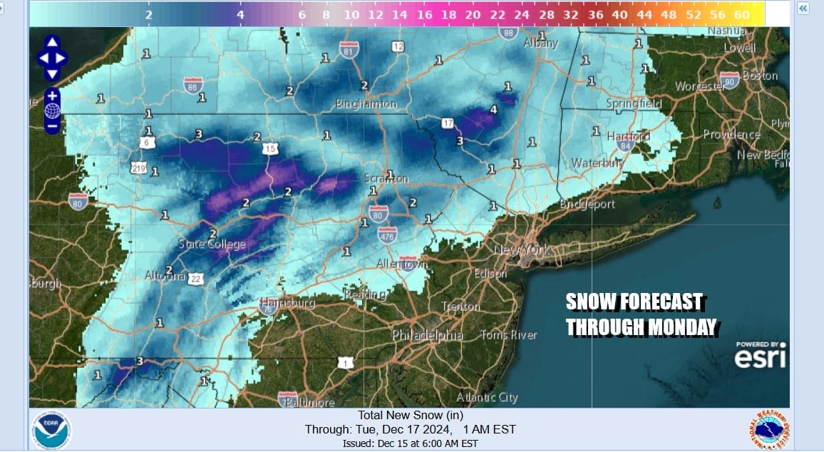
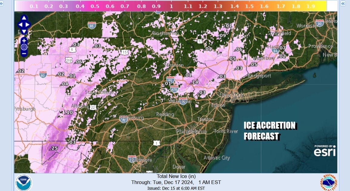
Snow accumulation will be well inland and we don’t expect it to be anymore than a coating to at most an inch. The we will transition to freezing rain which will glaze up colder surfaces especially in inland valleys where cold air may get trapped overnight. Thankfully this is a light precipitation event and not a major icing event but nonetheless we will see roads glazed and slickened up. Ice accretion estimates will be generally under a tenth of an inch and in most places under .05 inch.
The warm front will be struggling through the area Monday so once precipitation ends in the morning, we will see lots of clouds and then we get into a second round of rain or showers arriving ahead of a cold front during Monday evening. The rain will be mostly gone by Tuesday morning as a cold front passes offshore. Monday highs will range from low 40s north of NYC to low 50s south of Philadelphia.

The cold front is going to pass through and move offhore Tuesday morning leading to increasing amounts of sunshine, a northwest wind, and rather warm temperatures. There is not much in the way of cold air behind it so with a dry northwest wind, temperatures will likely reach the upper 50s and lower 60s everywhere.

The Tuesday cold front stalls just to the south and we see another wave of low pressure moving along that frontal boundary for Wednesday. Look for sunshine giving way to arriving clouds and temperatures Wednesday will be a little cooler but still above average. Wednesday highs will be in the low and middle 50s. We will see a bit of rain Wednesday night into Thursday followed by a slight downtrend in temperatures.
Late next week and going into next week we see low pressure moving southeast from Canada along with a trailing arctic cold front. That is likely to create some sort of storm developing to the east and northeast Friday and over the weekend. it is also going to bring down of shot of cold air for next weekend that may hold on going into Christmas week.
BE SURE TO DOWNLOAD THE FREE METEOROLOGIST JOE CIOFFI WEATHER APP &
ANGRY BEN’S FREE WEATHER APP “THE ANGRY WEATHERMAN!
MANY THANKS TO TROPICAL TIDBITS FOR THE USE OF MAPS
Please note that with regards to any severe weather, tropical storms, or hurricanes, should a storm be threatening, please consult your local National Weather Service office or your local government officials about what action you should be taking to protect life and property.


