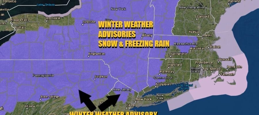
Winter Weather Advisories Inland Northeast Pennsylvania,
Northern New Jersey, Hudson Valley & Western Connecticut

Winter Weather Advisories Inland Northeast Pennsylvania,
Northern New Jersey, Hudson Valley & Western Connecticut
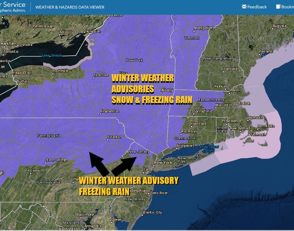
Winter Weather Advisories are posted for a mix of snow and freezing rain for areas from Northern Pennsylvania, the Catskills, much of the Hudson Valley, Northern New Jersey and Western Connecticut. For areas on the southern flank of the Winter Weather Advisory (parts of Northeast Pennsylvania and Northern NJ), the advisory is more for freezing rain.
We have temperatures that are borderline, light precipitation, and stubborn arctic air that is having a tough time getting out of the way. Sometimes less is worse as it creates the deception that things aren’t that bad out there. However freezing rain or freezing drizzle is not fun and icing in general can be dangerous so please be cautious if travelling around today.
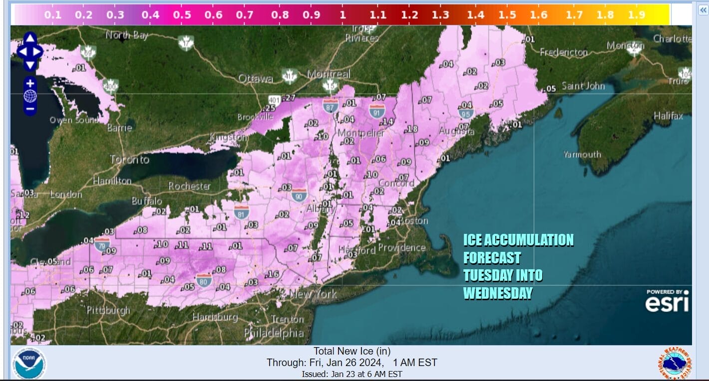
Snow amounts will be on the order of a coating to at most an inch or 2 in areas inland. Ice accretion forecasts I believe are more important and we will see ice accretion up to a tenth of an inch. The late arrival of Winter Weather Advisories likely means that roads have not been brined for this.
SATELLITE WITH LIGHTNING STRIKES

WEATHER RADAR

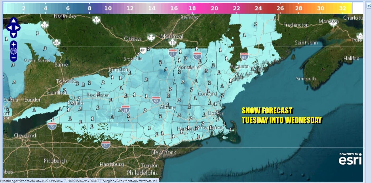
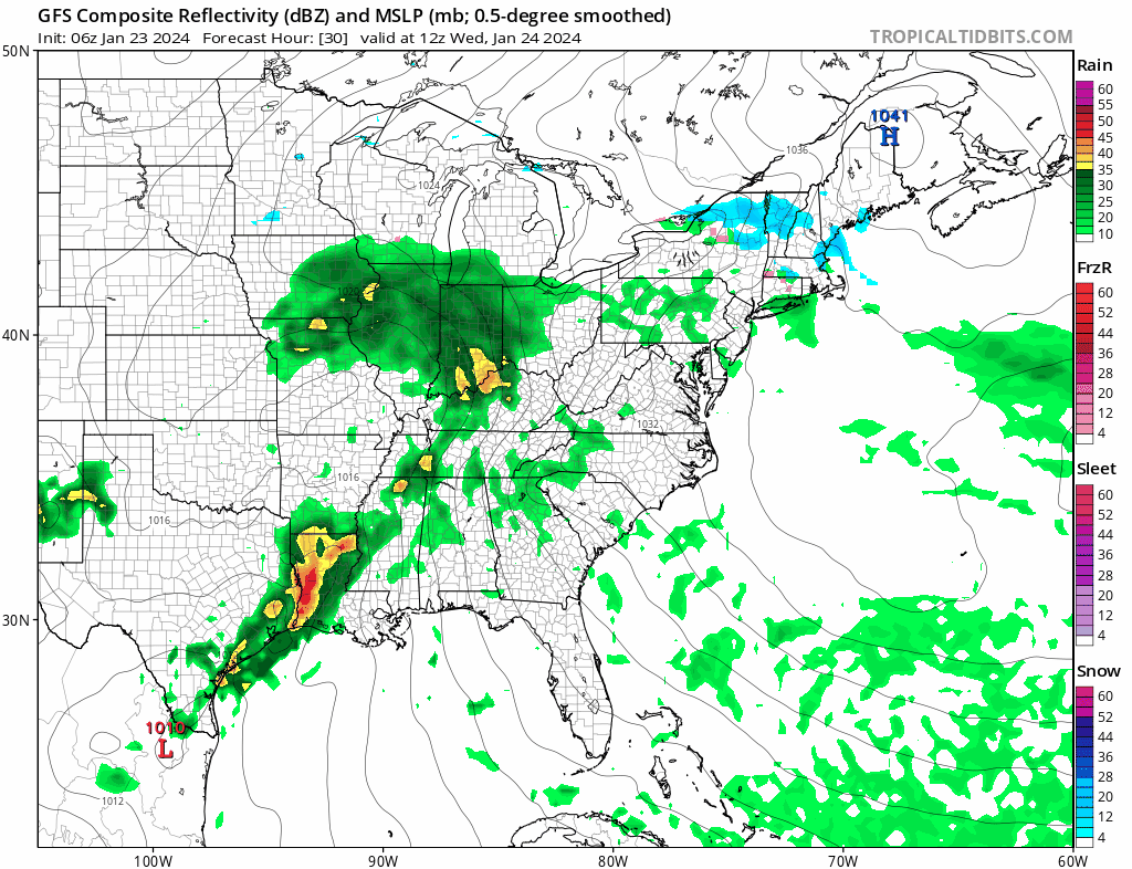
This is the first system of 4 that we are going to be dealing with over the next 7 days or so. This one is the weakens of the bunch. Look for precipitation to develop during the day and continue overnight into Wednesday morning. Near the coast it is going to be mostly light rain and actually from Central New Jersey southward there isn’t going to be much in the way of precipitation.

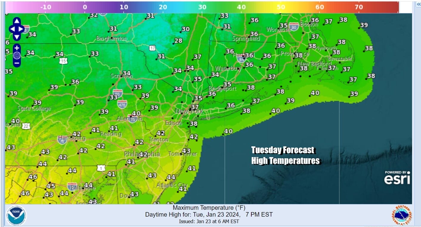
As far as temperatures go, we will be in the low 30s inland especially when precipitaion is falling. For Long Island NYC and New Jersey south of Route 78, it seems we will be above freezing and therefore freezing precipitation should not be an issue. Most highs will be in the low 30s inland and upper 30s to some lower 40s coast and south.
Precipitation will continue into Wednesday morning and then come to an end. The next wave will be heading our way with just rain and that will be for Wednesday afternoon into early Thursday morning and then another surge of rain with a third wave late Thursday into early Friday. Weather conditions may start to improve during the day Friday. The good news is that this at least gets out of the way so we have a nice Saturday.
Wednesday temperatures will be in the upper 30s to mid 40s from north to south. Thursday we will see highs in the 40s north and low to mid 50s across Central and South Jersey and points southward. Friday with some improvement in weather conditions, highs could be in the 50s to perhaps around 60. Right now we see dry cooler weather Saturday. Then we have another storm systemt to deal with Sunday into Monday. This system will hinge on track and the strength of cold high pressure building southeast into Eastern Canada. We will have more on this system in the coming days.
BE SURE TO DOWNLOAD THE FREE METEOROLOGIST JOE CIOFFI WEATHER APP &
ANGRY BEN’S FREE WEATHER APP “THE ANGRY WEATHERMAN!
MANY THANKS TO TROPICAL TIDBITS FOR THE USE OF MAPS
Please note that with regards to any severe weather, tropical storms, or hurricanes, should a storm be threatening, please consult your local National Weather Service office or your local government officials about what action you should be taking to protect life and property.
(Amazon is an affilate of Meteorologist Joe Cioffi & earns commissions on sales.)


