Slow Warming Trend Gloom & Doom Waves of Rain Late Tuesday Into Friday

Slow Warming Trend Gloom & Doom Waves of Rain Late Tuesday Into Friday

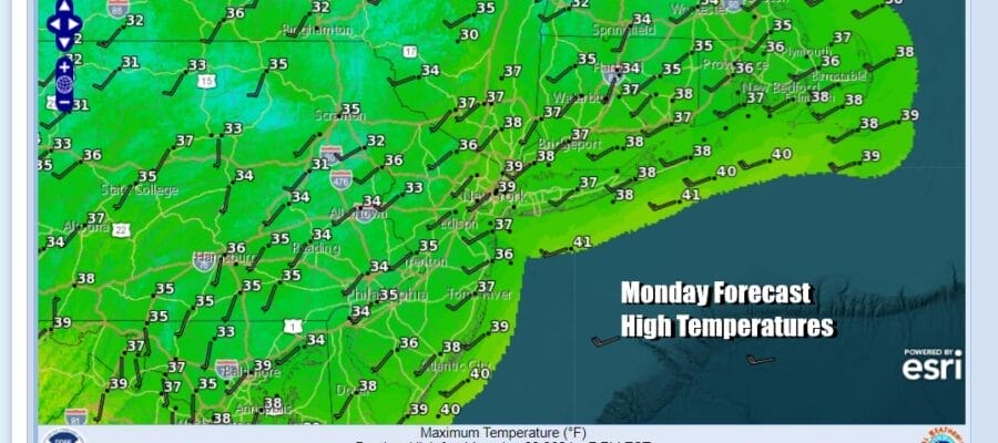
The new week begins with a warmnig trend that will be lasting all week but it will be a slow climb higher. Arctic air has made its exit but there is residual cold air left in the Eastern US, the Ohio and Tennessee Valley as well as the south and this cold air needs to be scoured out for temperatures to rise. Today will probably be the best weather day of the week with sunshine for much of the day. Temperatures this afternoon will go above the freezing mark just about everywhere and highs will reach the mid to upper 30s. Radars are nice and quiet with no precipitationt to worry about.
SATELLITE WITH LIGHTNING STRIKES

WEATHER RADAR

Most lows tonight across Eastern Pennsylvania to Southern New England will be in the 20s to around 30 as clouds increase. Tuesday begins a long parade of low pressure systems. None of these systems are major storms and are mainly flat waves that will be running along a frontal boundary. The result will be waves of rain that will move through much of the Deep South and the Eastern US.

The remaining Arctic air poses an issue from the Southern Plains to the Lower Great Lakes and Ohio Valley where we have Winter Weather Advisories in effect along with some local Winter Storm and Ice Storm Warnings in parts of Oklahoma and Arkansas. As the first system heads to the Northeast US, it will tend to weaken,. Light snow is likely to break out Tuesday across Upstate New York and New England, mainly north of Route 84.
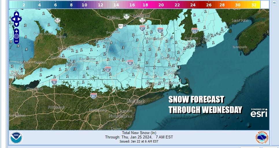
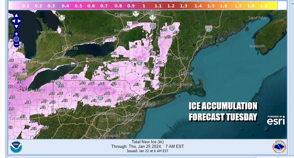
Snow accumulations will be on the light side with most areas seeing a coating to perhaps and inch to maybe at most 2. Ice could be an issue as well given the marginal cold air that will still be hanging around. Ice accretion forecasts of .01 to .05 inch seems possible as the map below indicates.
To the south of all this, Tuesday will see cloudy skies developing and temperatures that will be in topping out in the upper 30s to lower 40s and then hover close to the freezing mark inland Tuesday night. The bulk of any precipitation will be north and northeast of NYC with not much if any rain to the south.

The next wave will arrive with rain later Wednesday into Thursday and then another wave of rain Thursday night into Friday. There will be some short breaks in the rainfall and when it is not raining it is likely to be that cloudy gloom and doom type sky with little chance for breaks of sunshine. Temperatures Wednesday will inch higher as highs will be mostly in the 40s. Temperatures will rise into the 50s Thursday and we could see upper 50s and lower 60s Friday.
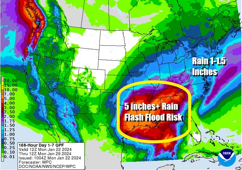
As far as rainfall is concerned we are forecast anwhere from an inch to an inch and a half of rain but the rain is spread out over the next seven days (there are two more waves over the weekend). We do not see any flooding issues developing even with the melting snow cover. On the other hand rainfall will be excessive across much of the South from East Texas to Georgia and several inches of rain common and areas of 5 inches or more of rain possible from East Texas to Louisiana, Mississippi, and Arkansas. This event could put a dent in the extreme to exceptional drought that conintues across this region of the US.
BE SURE TO DOWNLOAD THE FREE METEOROLOGIST JOE CIOFFI WEATHER APP &
ANGRY BEN’S FREE WEATHER APP “THE ANGRY WEATHERMAN!
MANY THANKS TO TROPICAL TIDBITS FOR THE USE OF MAPS
Please note that with regards to any severe weather, tropical storms, or hurricanes, should a storm be threatening, please consult your local National Weather Service office or your local government officials about what action you should be taking to protect life and property.
(Amazon is an affilate of Meteorologist Joe Cioffi & earns commissions on sales.)


