
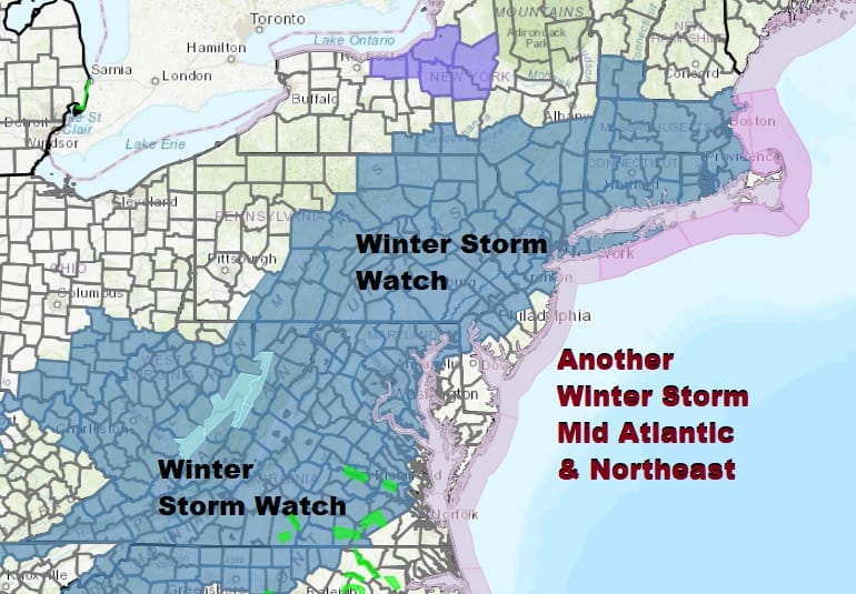
Winter Storm Watch Thursday Maryland to Southern New England
Snow Sleet Likely

Weather in 5/Joe & Joe Weather Show Latest Podcast
Winter Storm Watch Thursday Maryland to Southern New England
Snow Sleet Likely
Well folks they are back up again. Winter Storm Watches are posted and they cover a large area of geography from Western North Carolina clear up to New England. This includes most of Virginia, Maryland, Central and Eastern Pennsylvania, most of New Jersey, the Hudson Valley, Connecticut clear up to Southeastern New England.
In the meantime we cleared out and warmer up into the 50s in many areas today behind this storm but colder air is coming tonight. High pressure which represents the center of the bitter cold air mass to the west and south will be building in tonight through Wednesday night. Skies should partially clear out tonight and temperatures will bottom in the teens to lower 20s.
SATELLITE

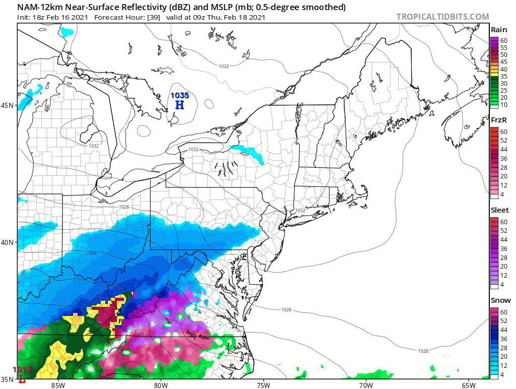
Some lake effect snow action is showing up on the regional radars to the west. Otherwise we will be quiet into Wednesday night before the radars start to crank up once again with the next storm. Wednesday itself should be sunny most of the day. Highs will only be in the upper 20s and lower 30s.
F5 WEATHER RADARS


Early Thursday morning snow will break out across Virginia and reach Southern and Southeastern Pennsylvania by 4am and NYC by 7am or shortly afterwards. From there it is on to Southern and Southeastern New England. The NAM model remains the model of choice overall as it handled yesterday’s system very well and has done so well this winter.
This time around the upper air profile will not warm nearly as much as the Monday event and will then turn colder Thursday night. A change to sleet along the coast is probable but only after a solid thumping of snow occurs. Rain could be confined to the immediate shore areas of New Jersey and perhaps briefly touching Long Island for a few hours Thursday night.
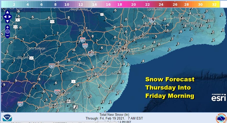
The low passes south and east and weather conditions should improve on Friday. We should have a nice dry cold weekend of sunshine and this very active weather pattern looks to take a breather for awhile, at least that is the plan at the moment.
BE SURE TO DOWNLOAD THE FREE METEOROLOGIST JOE CIOFFI WEATHER APP &
ANGRY BEN’S FREE WEATHER APP “THE ANGRY WEATHERMAN!

MANY THANKS TO TROPICAL TIDBITS & F5 WEATHER FOR THE USE OF MAPS
Please note that with regards to any severe weather, tropical storms, or hurricanes, should a storm be threatening, please consult your local National Weather Service office or your local government officials about what action you should be taking to protect life and property.


