Freezing Rain And Rain End Mild Day Colder Wednesday Snow Likely Thursday

Weather in 5/Joe & Joe Weather Show Latest Podcast
Freezing Rain And Rain End Mild Day Colder Wednesday Snow Likely Thursday
Warmer air flooded northward thankfully which reduced the extent of freezing rain overnight but it did not eliminate it entirely. We still have some icing issues in Northwest New Jersey, Northeast Pennsylvania and points north and east to the Catskills where temperatures continue to struggle. Near the coast temperatures have reached the 40s. Our weather system is moving along however and precipitation ends from west to east as the morning moves on.
SATELLITE

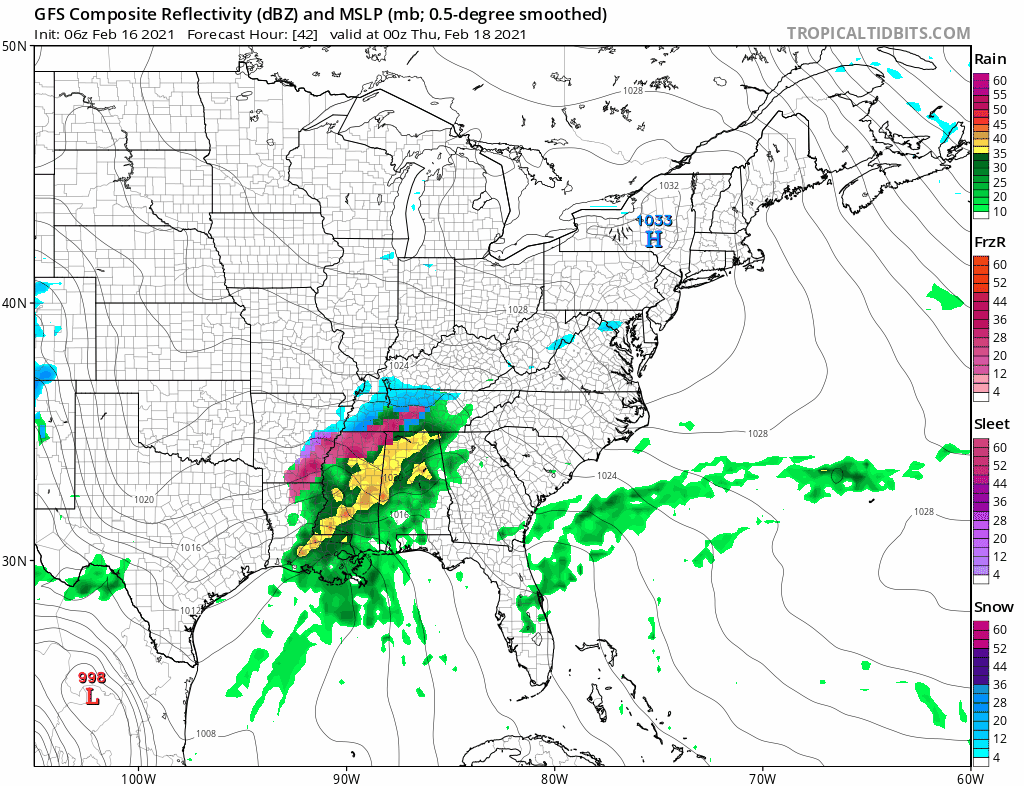
Regional radars show the rain to the south and the snow and ice to the north making west to east progress and this should be all long gone by afternoon. Get set for a warmish day with temperatures in the 40S and the snow melt continues.
F5 WEATHER RADARS


Behind this storm system we have what is left of the bitter cold air mass that covers the Plains and Midwest. The cold air is going to modify some but it still remains a very cold high that is headed east. Skies clear tonight with lows in the teens to lower 20s. Wednesday should be a sunny cold day with highs in the upper 20s to lower 30s. Then another cold night lies ahead with increasing clouds. Lows by Thursday morning will again be in the teens to lower 20s.
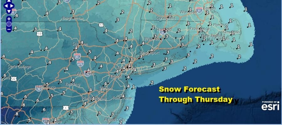
The last storm system of this series that began at the end of January lies ahead for Thursday. Unlike this one that went further north we think the risk here is that it goes further south. This argues for a front end thumping of snow possibility for Thursday and we already have snow forecast maps up from the National Weather Service.
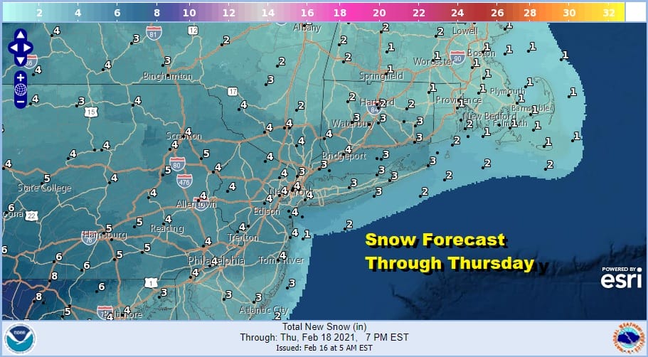
Please note that this forecast is only through 7pm Thursday. Snow will likely arrive during Thursday morning and there is a risk for a change to sleet or even rain. The track to the south and east of the low will limit how much warm air gets involved here and we will need to resolve that issue as it could impact snow amounts along the coast. This system exits Friday morning and weather conditions should improve as we remain cold through the weekend. At least we will be storm free for awhile.
BE SURE TO DOWNLOAD THE FREE METEOROLOGIST JOE CIOFFI WEATHER APP &
ANGRY BEN’S FREE WEATHER APP “THE ANGRY WEATHERMAN!

MANY THANKS TO TROPICAL TIDBITS & F5 WEATHER FOR THE USE OF MAPS
Please note that with regards to any severe weather, tropical storms, or hurricanes, should a storm be threatening, please consult your local National Weather Service office or your local government officials about what action you should be taking to protect life and property.


