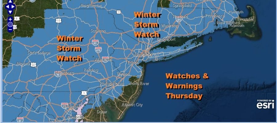
Winter Storm Watch Continues For Thursday Dry Cold Sunny Wednesday

Weather in 5/Joe & Joe Weather Show Latest Podcast
Winter Storm Watch Continues For Thursday Dry Cold Sunny Wednesday
This month has been very active and we get to catch our breath every now and then. Today is one of those days where we can catch our breath and just enjoy a quiet mid winter day. Skies are clear on the satellite and we should see sunshine for most of the day. However later today some high clouds will start to move in ahead of the next storm system. Temperatures today will go nowhere with highs mostly in the upper 20s to lower 30s.
SATELLITE

Both regional radars are quiet for now and they should remain quiet all day. Then they will start revving up tonight Clouds will increase and thicken up tonight. Snow will begin to advance northward during the early morning hours. Most lows will be in the upper teens and lower 20s.
F5 WEATHER RADARS


Areas in Southern Pennsylvania and points south will see snow overspread the area during the early morning hours while reaching Southern New Jersey probably before daybreak and NYC and Long Island around 7am.
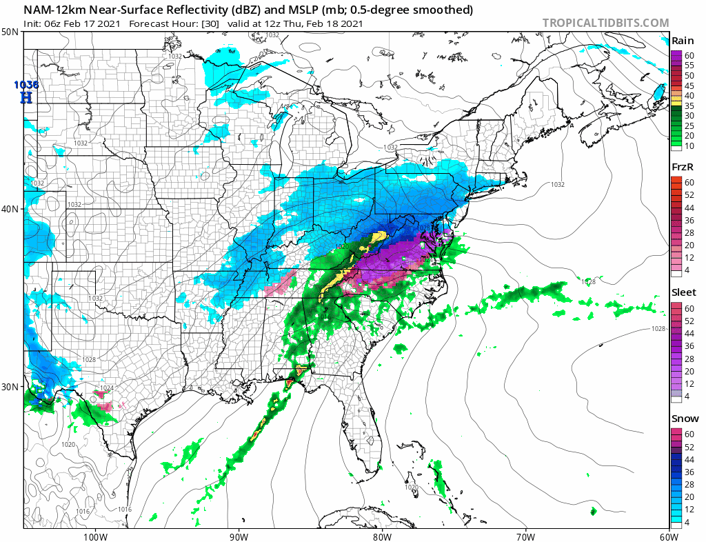
The NAM remains aggressive with this system behaving like some of the others we have seen this month with a large front end thumping of snow. Many of the other models however are much more fractured looking with weaker areas of snow moving through and taking longer to play out. Those models are also colder and have a longer duration event set up. For now we will leave our early ideas alone regarding a max area of 3 to 6 inches though if the NAM is correct, those amounts could be double. Temperatures Thursday will be mostly in the 20s though they cold rise to near 30 along the immediate coast.
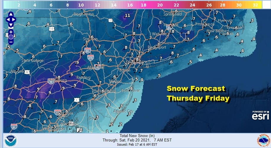
The National Weather Service has nudged up their numbers somewhat and they are at the high end of my range. I will wait and see if the dayside model cycle produces robust results from the model and I will do a little nipping and tucking of numbers this afternoon. After the initial burst of snow Thursday some areas near the coast and in Southern and Southeaster Pennsylvania could see a change to sleet and some freezing rain. Areas in South Jersey and the Jersey shore could go to rain for awhile. Long Island will see a period of sleet and a little rain mixing in during Thursday night. Despite hints on some models that this could stick around for Friday as colder air returns that seldom happens so we will go with the idea of slow improvement with leftover clouds Friday and continue to see a dry sunny weekend though it will be cold both weekend days.
BE SURE TO DOWNLOAD THE FREE METEOROLOGIST JOE CIOFFI WEATHER APP &
ANGRY BEN’S FREE WEATHER APP “THE ANGRY WEATHERMAN!

MANY THANKS TO TROPICAL TIDBITS & F5 WEATHER FOR THE USE OF MAPS
Please note that with regards to any severe weather, tropical storms, or hurricanes, should a storm be threatening, please consult your local National Weather Service office or your local government officials about what action you should be taking to protect life and property.


