Winter Storm Watch Sunday Night Into Tuesday Snow 6 to 12 Inches Forecast

Weather in 5/Joe & Joe Weather Show Latest Podcast
Winter Storm Watch Sunday Night Into Tuesday Snow 6 to 12 Inches Forecast
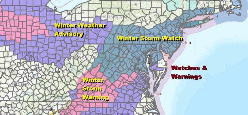
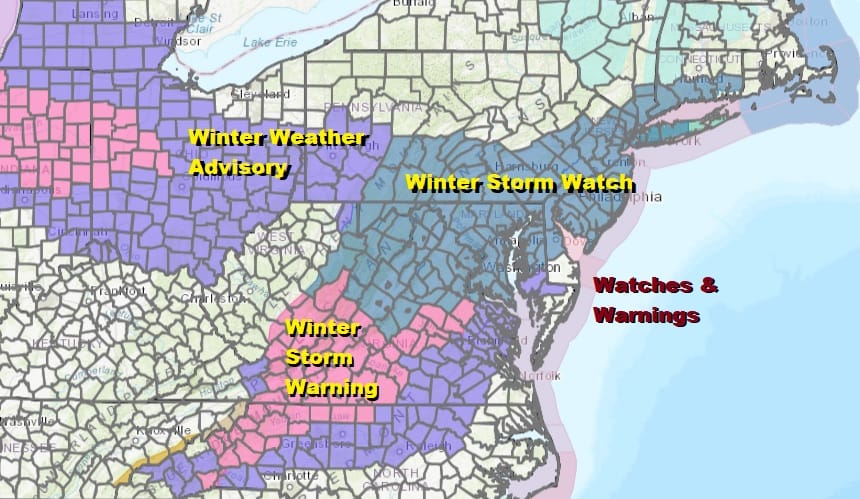
Winter Storm Watch is posted for much of the area from Eastern Pennsylvania to Southern New England including all the big cities up and down the I-95 corridor from Washington DC to NYC. Additional winter storm watches will probably go up for areas east of NYC later today or tonight. We will likely see warnings issued tonight for many areas in the watch zone.
In many ways this may play out in the same fashion as the December storm but with a change over to sleet or rain confined to a much shorter time frame this time around. In general I think this will be a 6 to 12 inch snow producer for most of the area from Eastern Pennsylvania to Southern New England with locally higher amounts possible.

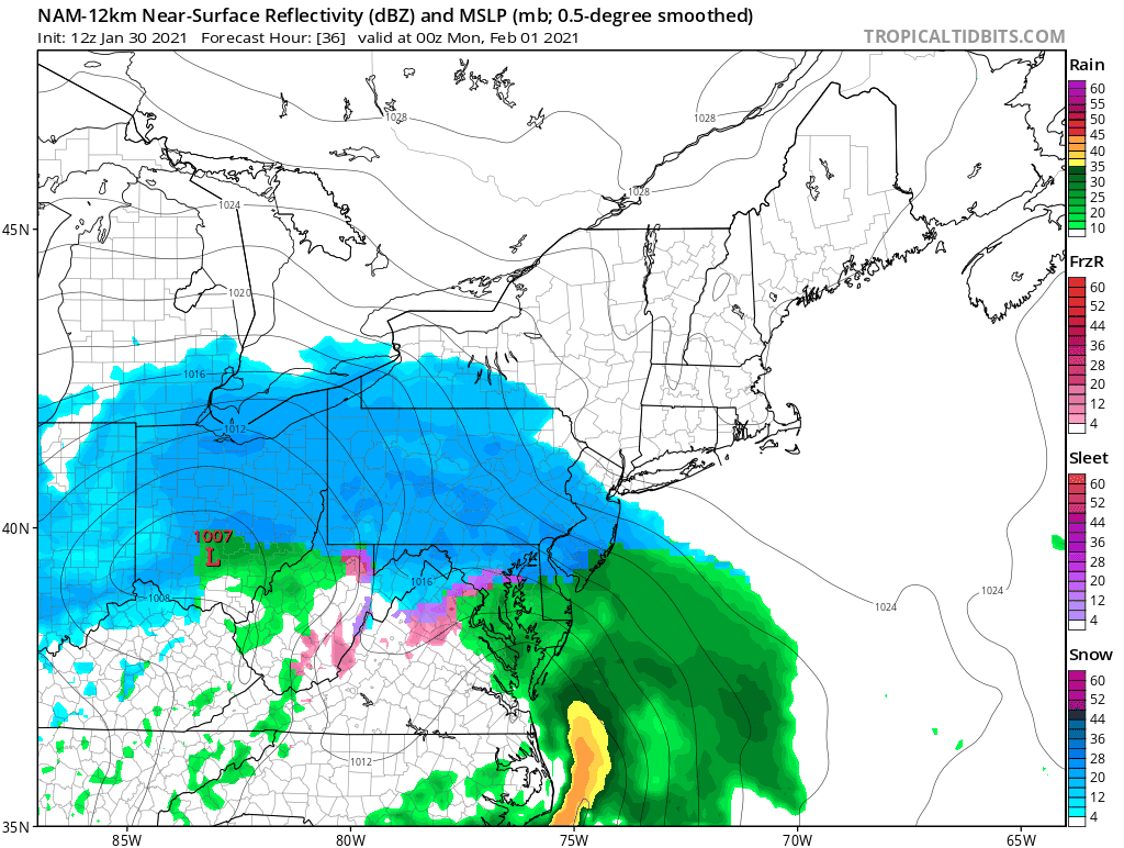
I think the NWS snow forecast map is very reasonable for expected snow totals. There might be room for a bit of upside here since we will get some snow on the back side of this system later Monday night into Tuesday morning.
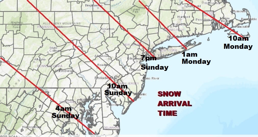
You can see the forecast arrival times. There is a lot of cold dry air that will be difficult to dislodge at first. Thi is why after an initial fast advancement of the snow developing across Virginia, Maryland South Central Pennsylvania, Delaware and Southern New Jersey into Sunday morning, the northward push slows down and it doesn’t reach NYC until after 7pm. It won’t reach the east end of Long Island until 7am Monday. In Connecticut the snow arrives Monday morning.

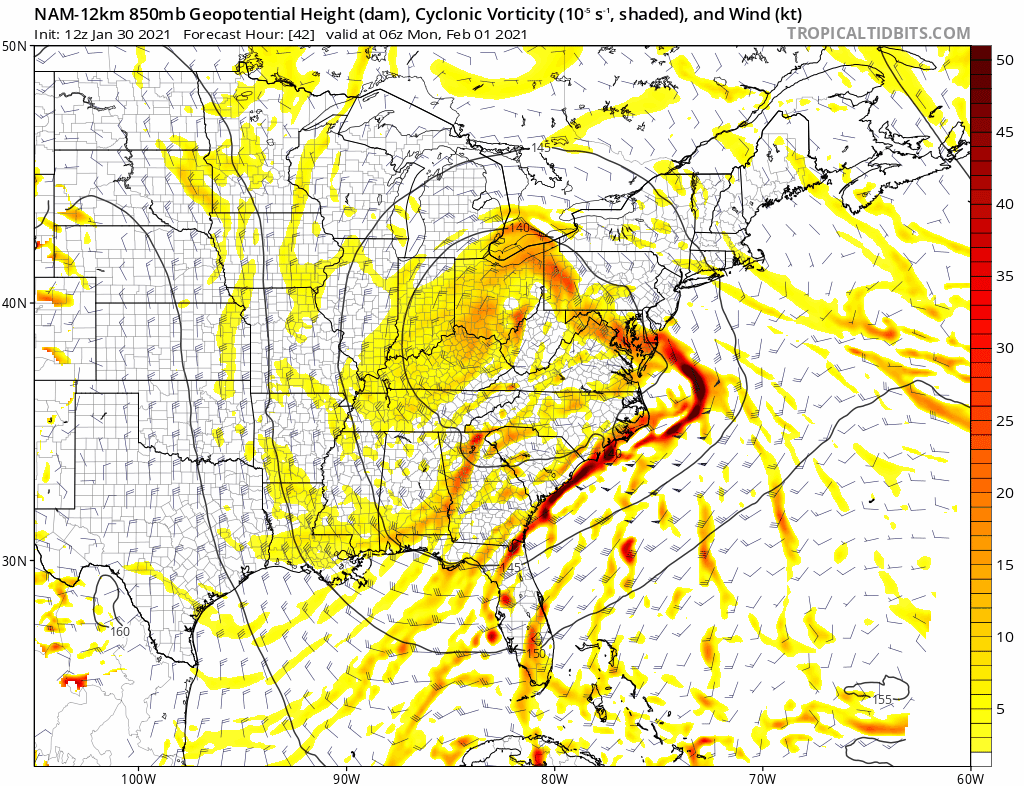
This is going to play out in two parts. The first burst followed by the back side as the low stalls offshore and then starts to edge northeastward. The weakening block allowed this system to move further north and also be more developed than the others. But there is still enough of a block there to keep cold air locked in for the most part.
Meanwhile for today we are in the ice box with ineffective sunshine. The satellite picture this morning shows some clouds inland and also offshore but there should be enough sun to take a little of the sting out of the air. The winds which have been gusty now for 2 days should slowly begin to ease later today and tonight. Highs will be in the upper 20s and lower 30s. All the radars in the Northeast and Middle Atlantic states are clear.
SATELLITE

Tonight will be clear and cold but clouds will start pushing up from the south and snow arrives Sunday morning as the arrival map shows above. Dry air will be an issue Sunday as we mentioned. Where there might be some upside here is later Monday night and Tuesday on the backside of this system. That is always hard to forecast and will depend on the track of the upper air storm.
Usually the heavies snow falls northwest of the track of the upper low with a hundred miles or so and this is one of those times where the upper low tracks to our east. That does create the potential here for an extra few inches for somebody in what I would call the upside surprise zone!
BE SURE TO DOWNLOAD THE FREE METEOROLOGIST JOE CIOFFI WEATHER APP &
ANGRY BEN’S FREE WEATHER APP “THE ANGRY WEATHERMAN!
MANY THANKS TO TROPICAL TIDBITS FOR THE USE OF MAPS
Please note that with regards to any severe weather, tropical storms, or hurricanes, should a storm be threatening, please consult your local National Weather Service office or your local government officials about what action you should be taking to protect life and property.


