
Winter Storm Watch NW NJ Winter Storm Warnings
Advisories Beginning to be Issued

Winter Storm Watch NW NJ Winter Storm Warnings
Advisories Beginning to be Issued
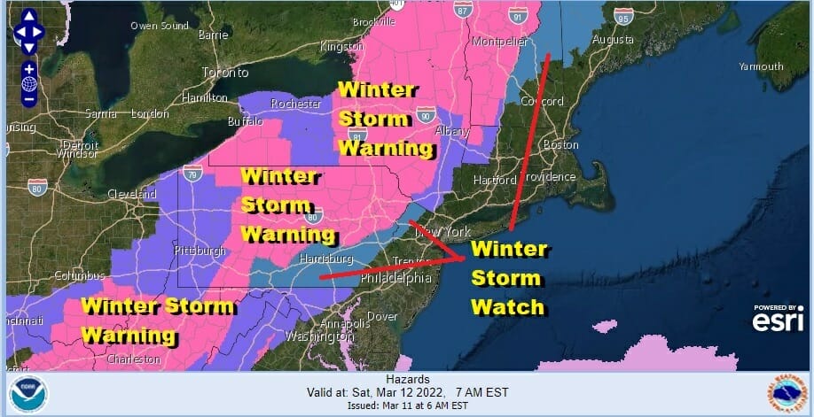
Winter Storm Warnings and Winter Weather Advisories have gone up for much of the interior Northeast and Mid Atlantic. We have Winter Storm Watches up for Northwest New Jersey extended southwest into South Central Pennsylvania. Winter Weather advisories are posted for the Hudson Valley from Orange County to Ulster and Dutchess Counties as well as Litchfield County in Connecticut. Additional advisories will likely be added to counties further south but they will probably wait until Saturday morning to put them up.
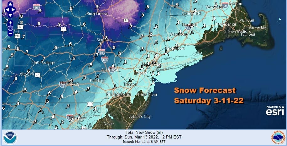
The National Weather Service snow forecast map is being slowly updated with new numbers that are slightly higher and cover a bigger area closer to the coast. We will post that updated map later this morning as soon as they post it. My own forecast is higher than NWS with generally a coating to 2 inches near the coast and 2 to 4 inches to the northwest with the highest amounts lining up where NWS has their winter storm warnings up.
SATELLITE

WEATHER RADAR

Nothing of consequence happens today or tonight as we see sunshine giving way to arriving clouds. Highs will be into the 50s in most places away from the ocean. Clouds thicken tonight and we will see rain develop from south to north during the early morning hours Saturday.
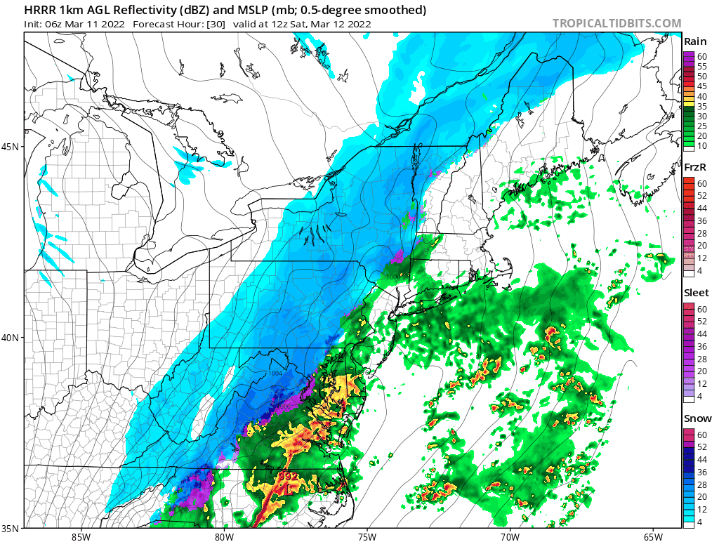
All the models have roughly the same idea so it becomes a matter of which model handles the arrival of cold air the fastest. I am leaning on the ones that bring it in a little faster and perhaps that also means that the back edge snow ends a little faster. The HRRR is among those models. We are seeing a change over occurring from northwest to southeast between 9am and 1pm and snow ending between 5pm and 7pm. There is a lead low that runs o0t ahead of the main low and that could be the reason why cold ai comes in a little faster. Even if the cold air comes in faster, the developing low is moving so fast that there really isn’t enough time for snow to accumulate. As temperatures fall into the 20s and winds increase we will see conditions deteriorate somewhat even near the coast as far as travelling is concerned. Saturday night will be windy and very cold with lows in the teens. Winds will be gusting to 40 mph or higher at times as the pressure gradient tightens later Saturday into Sunday. Winds will still be gusty Sunday morning though they should ease somewhat later in the day. Look for sunshine Sunday with highs in the 30s. Next week the cold air pulls out and temperatures moderate nicely into midweek.
BE SURE TO DOWNLOAD THE FREE METEOROLOGIST JOE CIOFFI WEATHER APP &
ANGRY BEN’S FREE WEATHER APP “THE ANGRY WEATHERMAN!
MANY THANKS TO TROPICAL TIDBITS & F5 WEATHER FOR THE USE OF MAPS
Please note that with regards to any severe weather, tropical storms, or hurricanes, should a storm be threatening, please consult your local National Weather Service office or your local government officials about what action you should be taking to protect life and property.


