
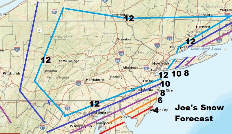
Winter Storm Warnings Virginia to New England
1 Foot Plus Snow Likely Many Areas

Weather in 5/Joe & Joe Weather Show Latest Podcast
Winter Storm Warnings Virginia to New England 1 Foot Plus Snow Likely Many Areas
Heading into this evening Winter Storm Warnings have been extended northward and are now in effect from Virginia to New England. Winter Storm Watches are posted for the middle and upper Hudson Valley and along I-90 in New York State and these will likely reach warning criteria tonight or Monday morning.
SATELLITE

Snow continues in Northeast Virginia and has now reached NYC on the radars at least. Movement is to the northeast. Dry air is trying to fight it off but it is not having much success in the holding the snow back. It seems to be moving northeastward faster than modeled. Darker blue echoes indicate bands of moderate snow.


As far as the forecast is concerned there are no major changes. We updated our snowfall forecast map to indicate a large are of 1 foot plus snow potential and this area remains unchanged.
With snow moving up faster than modeled, the heaviest snow will occur during Monday. The latest NAM model shows a band of moderate to heavy snow that develops in the ocean and moves northward Monday and then extends westward back into New Jersey and Pennsylvania.
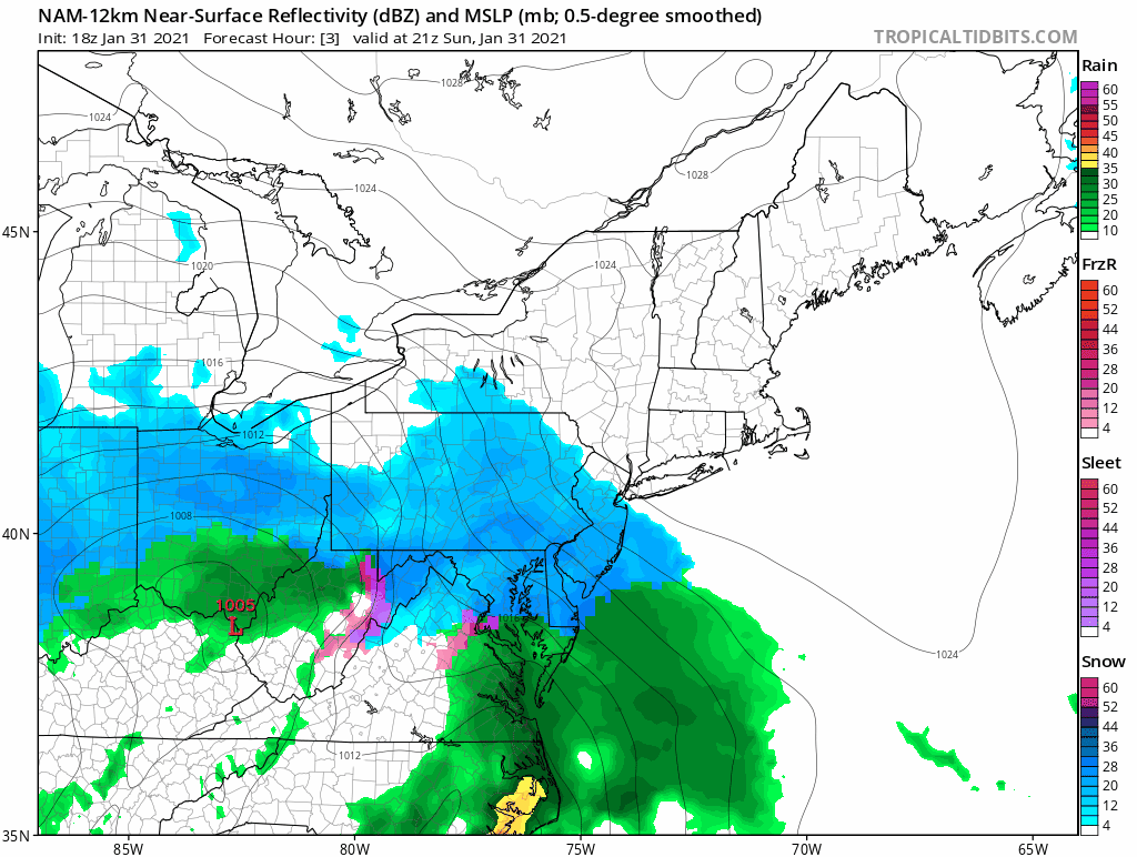
The model loop starts at 4pm today and runs until 7pm Monday. Two things worth noting is the band of heavy snow that develops south of Long Island and heads north which shows up as very dark blue. These could be 2 to 3 inch and hour snows with even a thunderstorm in the the mix. The other is the snow building back southwestward into Southern New Jersey and Southeastern Pennsylvania as the day wears on.
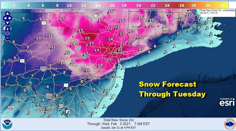
The National Weather Service has raised estimates for areas in and around NYC and into Northeast Pennsylvania. Snow numbers down in the south in Maryland and Virginia are final snow total forecasts and may include what has already fallen. Snow continues Monday night into most of Tuesday. A change to rain occurs along the Jersey coast Monday and on Long Island Monday evening for a short time. Both areas go back to snow and the changeover will make little difference in the snow totals.
BE SURE TO DOWNLOAD THE FREE METEOROLOGIST JOE CIOFFI WEATHER APP &
ANGRY BEN’S FREE WEATHER APP “THE ANGRY WEATHERMAN!
MANY THANKS TO TROPICAL TIDBITS FOR THE USE OF MAPS
Please note that with regards to any severe weather, tropical storms, or hurricanes, should a storm be threatening, please consult your local National Weather Service office or your local government officials about what action you should be taking to protect life and property.


