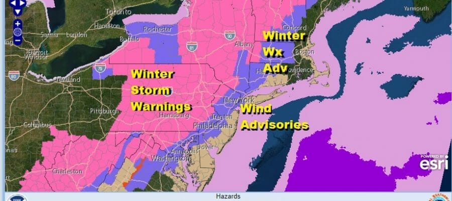
Winter Storm Warnings NW New Jersey Pa, Hudson Valley,
Wind & Winter Weather Advisories Elsewhere

Winter Storm Warnings NW New Jersey Pa, Hudson Valley,
Wind & Winter Weather Advisories Elsewhere
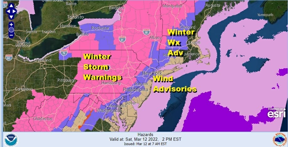
Winter Storm Warnings & Winter Weather Advisories continue today with only minor changes. Advisories have been added to the southwestern counties of New Jersey. In addition we have wind advisories from the Coastal Mid Atlantic through New Jersey, Eastern Pennsylvania northeast to Southern New England for winds gusting to 50 mph later today.
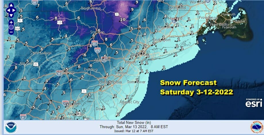
Snow forecasts were adjusted slightly to add coastal areas of New Jersey and parts of Long Island. Those areas won’t see much, generally under an inch. As you head west amounts go up reaching 4 inches or more in the Winter Storm Warning area. From here we watch the radar to see if there are any surprises. So far we see the radar performing in line with weather model forecasts.
SATELLITE

WEATHER RADAR

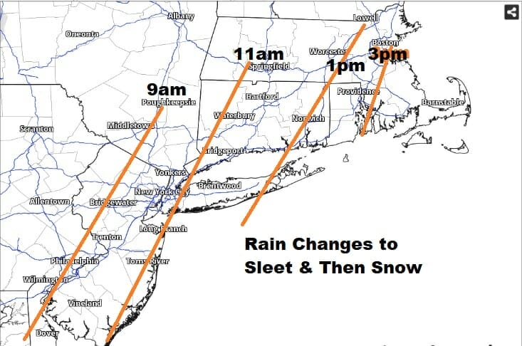
There isn’t much room for upside because the storm is moving very fast. Low pressure will rocket ship from North Carolina this morning to southeast of Long Island around midday and then in the Gulf of Maine late today. Rain is moving northeastward and snow is falling heavily in Pennslyania. It will change to snow from west to east this morning into this afternoon.
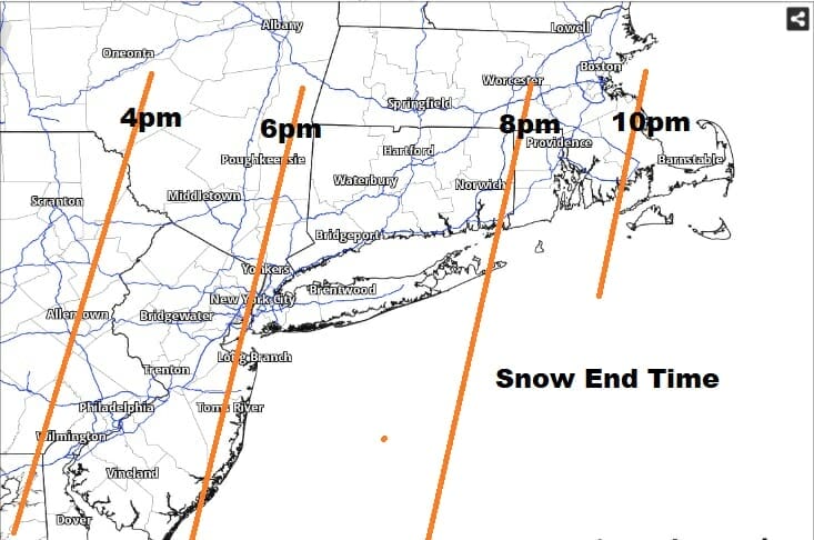
It all comes to an end later this afternoon and evening as the storm pulls away. Snow will end frmo west to east between 4pm in Eastern Pennsylvania and near 8pm in Southeastern New England to Eastern Long Island.
Winds will shift to the north and then northwest bringing in very cold air. Temperatures will fall into and through the 30s and into the 20s late today into tonight. Weather conditions improve tonight as skies clear but the winds will be cranking from the northwest at 20 to 35 with some gusts to 50 mph. Lows will be in the teens to low 20s. Sunday will see sunshine but a gusty wind continues with highs just back into the 30s. Temperatures will rebound nicely on Monday as cold air pulls out fast and winds go to the west. Sunshine will take temperatures up into the 50sl and we could be in the 60s Tuesday. The week ahead looks to be on the quiet side with no major storms and little if any rain.
BE SURE TO DOWNLOAD THE FREE METEOROLOGIST JOE CIOFFI WEATHER APP &
ANGRY BEN’S FREE WEATHER APP “THE ANGRY WEATHERMAN!
MANY THANKS TO TROPICAL TIDBITS & F5 WEATHER FOR THE USE OF MAPS
Please note that with regards to any severe weather, tropical storms, or hurricanes, should a storm be threatening, please consult your local National Weather Service office or your local government officials about what action you should be taking to protect life and property.


