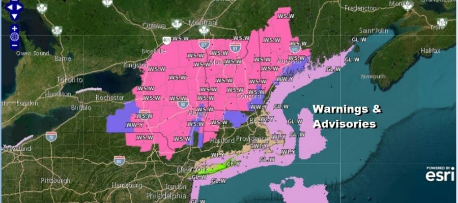
Winter Storm Warnings Continue Well Inland. Coastal Storm Moves Away Tonight
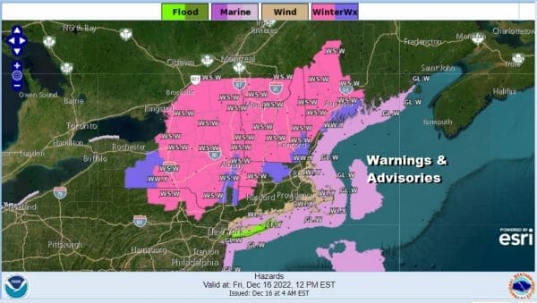
Winter Storm Warnings continue today well inland and north as the latest storm system continues to crawl northeasward just offshore. The bulk of the precipitation has moved northward to Upstate NY and New England but for much of Eastern Pennsylvania to Southern New England we have some areas of rain still to work through today. Most of the snow is north of the Catskills and well up to the north as the rain snow line has reached Albany. Most of the snow is elevation driven. We should also mention that there is some minor coastal flooding going on at high tides today thanks to the moderate nor’easter conditions.
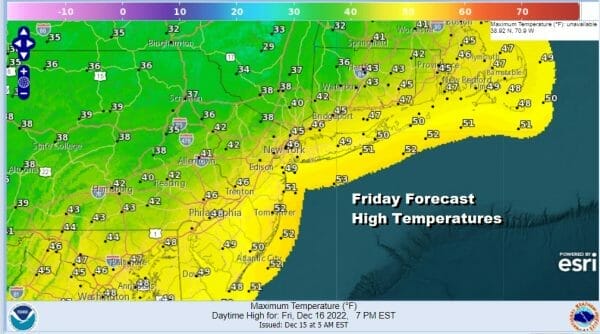
Temperatures today along the coast will be in the upper 40s and lower 50s while inland temperatures will be in the mid 30s to around 40 degrees. The low off shore makes its exit to the east late today and tonight so any precipitation will come to an end from west to east and skies might even partially clear out toward morning. Lows will be in the upper 20s inland and low to mid 30s along the coast.
SATELLITE

WEATHER RADAR

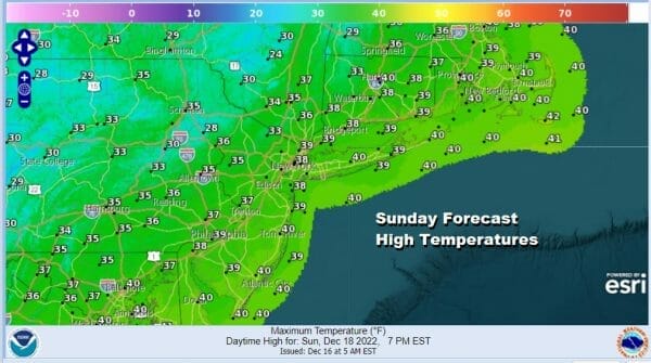
The weekend will be seasonal as far as temperatures are concerned with temperatures right around where they should be for this time of year. Saturday should be no worse than partly sunny and highs will be in the upper 30s and lower 40s. The same holds for Sunday with partly to mostly sunny skies and highs in the 30s to near 40. Saturday night and Sunday night will be partly to mostly clear with lows in the 20s.

Next week the focus will be on the second half of the week and as we near Christmas. Arctic air will be diving southeastward into the Plains and ahead of that low pressure out of the Plains will head for the Mississippi & Ohio Valley. The arctic front is likely to set off a major storm which will develop near or just offshore later Thursday into Friday.
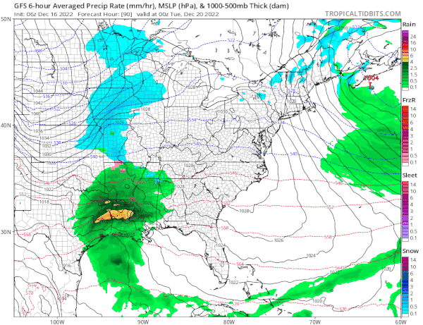
In the meantime Monday through Wednesday look relatively uneventful with dry weather conditions and seasonal temperatures for the most part. Monday and Tuesday highs will be in the upper 30s and lower 40s with some sunshine. Wednesday highs will be in the 30s as a cold front passes Tuesday night. Each day will be no worse than partly sunny. Then we get ready for this potential storm for late next week though how it plays out in terms of rain snow and wind is still uncertain. Very cold air will move in behind it for Christmas Eve and Christmas Day. There might even be a chance for a little snow Christmas Day as another weaker weather system approaches in this cold pattern that is developing.
BE SURE TO DOWNLOAD THE FREE METEOROLOGIST JOE CIOFFI WEATHER APP &
ANGRY BEN’S FREE WEATHER APP “THE ANGRY WEATHERMAN!
MANY THANKS TO TROPICAL TIDBITS & F5 WEATHER FOR THE USE OF MAPS
Please note that with regards to any severe weather, tropical storms, or hurricanes, should a storm be threatening, please consult your local National Weather Service office or your local government officials about what action you should be taking to protect life and property.


