
Windy & Colder Today Weekend Mostly Dry Rain Sunday Night Into Monday
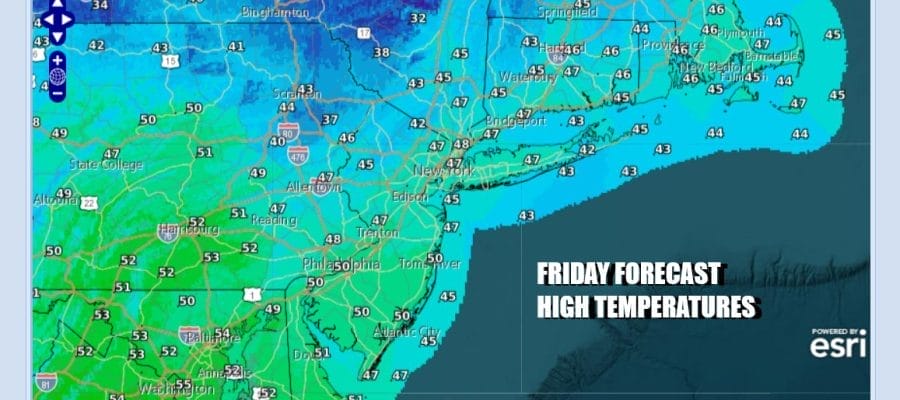
Overnight rain showers have now moved northeast into New England and we are seeing gusty winds and drier air behind low pressure and a cold front to the east. Today will be a day of general weather improvement from west to east across Eastern Pennsylvania to Southern New England. We should see a fair about of sunshine, gusty northwest winds to 40 mph at times, and highs reaching the upper 40s and lower 50s. This is about where we should be for this time of year. Radars have gone quiet locally and we have no precipitation issues to worry about for the rest of today and tonight.
SATELLITE WITH LIGHTNING STRIKES

WEATHER RADAR

Over the weekend we see the first of two weather systems Saturday. A cold front will be moving quickly southeast from Canada and then passing through the Northeast Saturday afternoon. The front won’t have much with it other than some passing scattered rain an snow showers. There is a shot of colder air behind the front that settles in to the Northeast and Mid Atlantic for Saturday night and Sunday.

A second weather system which is in the form of low pressure that moves across the Northern Plains and Great Lakes will bring a warm front cold front combo for Sunday night into Monday and this is when we will see a period of rain or showers moving through. In between all of this we can safely say that most of the time this weekend will be dry.

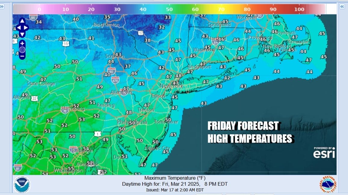
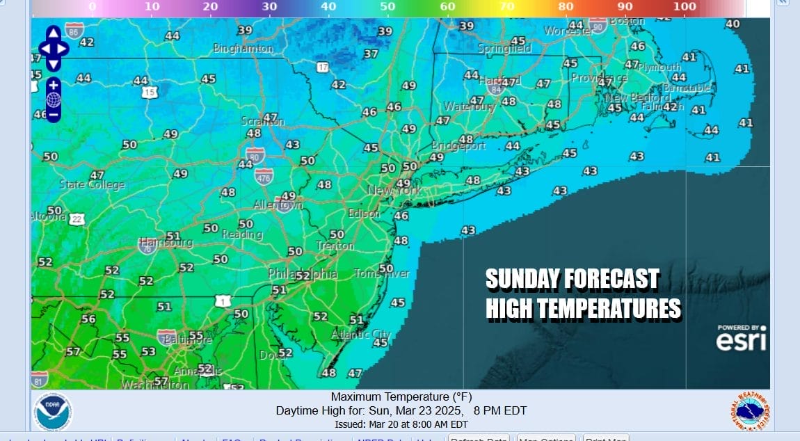
Other than a passing scattered shower Saturday we will see a mix of sun and clouds with highs in the 50s to near 60 degrees. Then it turns colder Saturday night under clear skies. Sunday morning lows will be in the 20s inland and mostly lower 30s along the coast. Sunday dayside should be sunny before clouds move in later in the day. It will be a chilly day with highs not getting out of the 40s in most places.
You can expect some rain Sunday night into Monday morning before low pressure and a cold front head to the east and offshore. Weather conditions next week after Monday will be mostly on the quiet side with weak weather systems along the way and temperatures close to average for this time of year. No major storms or noreasters are in sight anytime soon.
BE SURE TO DOWNLOAD THE FREE METEOROLOGIST JOE CIOFFI WEATHER APP &
ANGRY BEN’S FREE WEATHER APP “THE ANGRY WEATHERMAN!
MANY THANKS TO TROPICAL TIDBITS FOR THE USE OF MAPS
Please note that with regards to any severe weather, tropical storms, or hurricanes, should a storm be threatening, please consult your local National Weather Service office or your local government officials about what action you should be taking to protect life and property.


