
Strong Front Rain & Gusty Winds Tonight Into Friday Mostly Dry Weekend
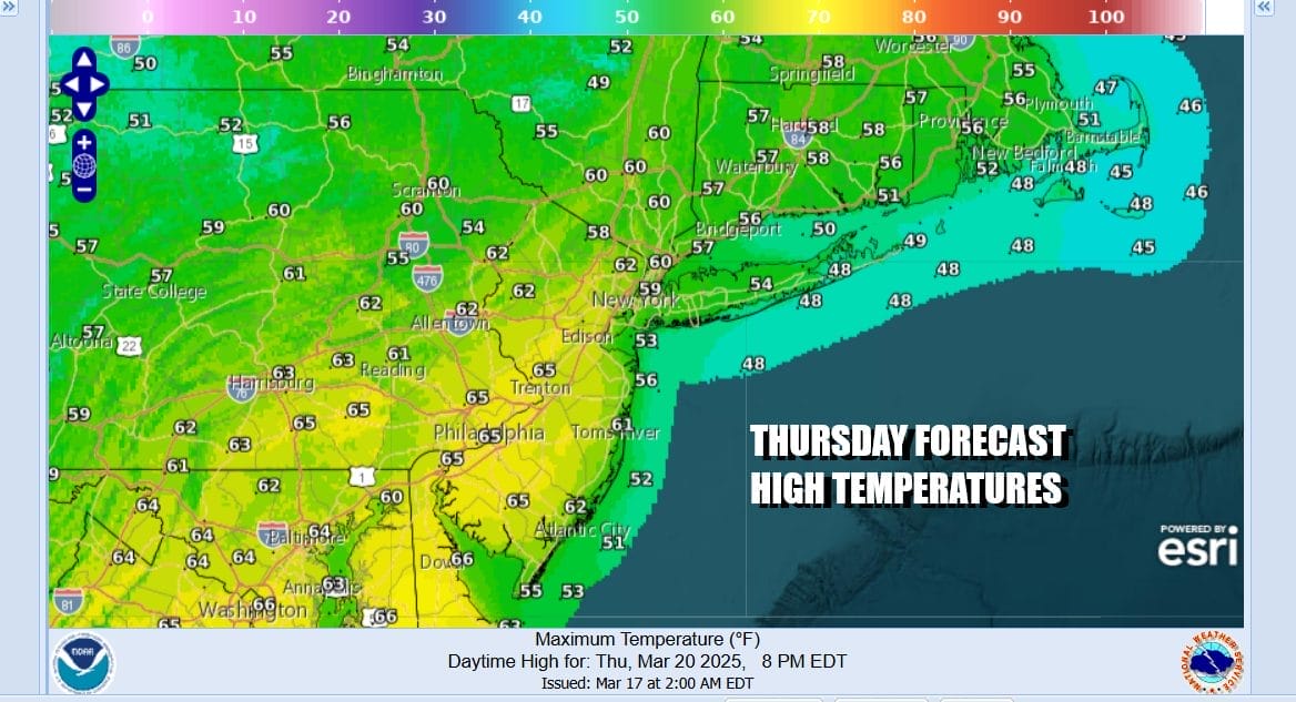
The Spring season officially begins today and we are seeing typical spring-like conditions in the Northeast. The cold ocean keeps the coast chilly while warmer inland areas tend to avoid that cooler air for the most part. We have a cold front approaching today from a storm that is now moving into Southeastern Canada. Clouds and some sun will be around this afternoon in varying amounts depending on where you are. areas from New York City north and east will be in the mid to upper 50s this afternoon while areas to the south and west will reach the low and middle 60s.
SATELLITE WITH LIGHTNING STRIKES

WEATHER RADAR

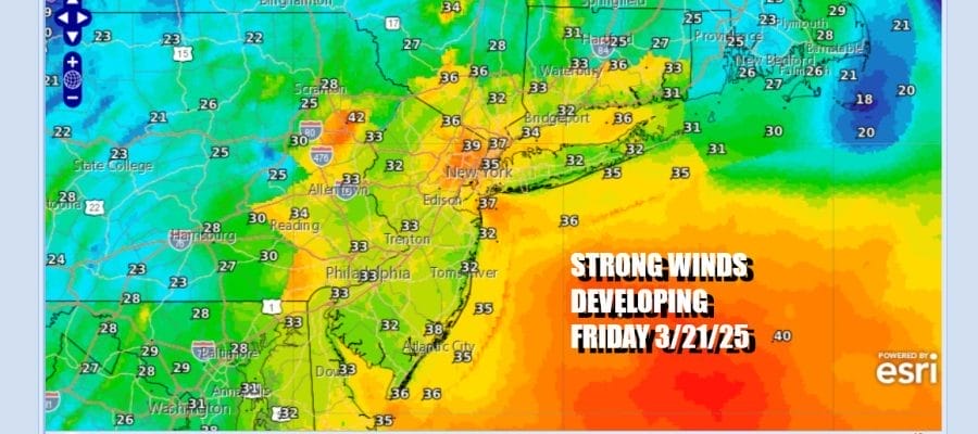
Radars are starting to pick up on showers to the west with an approaching cold front. We will avoid these showers this afternoon but as the front gets closer to the coast tonight look for showers to develop and there might even be a thunderstorm in the mix. The front will be slowing down and low pressure will develop on the front to our south in or near Delaware Bay and strengthen Friday morning. It will move northeast and straddle Southern New England late tonight and early Friday morning.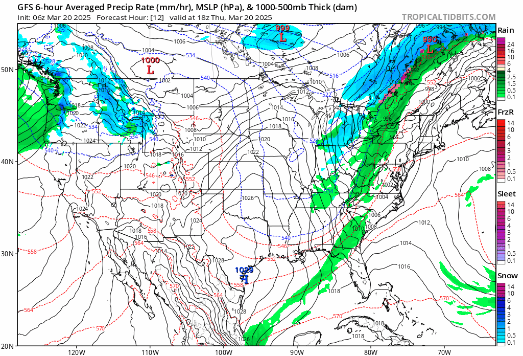
Rain will be gone Friday morning before daybreak and we will see leftover clouds and some developing sunshine Friday. Northwest winds will pick up overnight and through much of the dayside Friday. Wind speeds will be on the order of 15 to 25 mph with gusts of 30 mph or more. We should be just below wind advisory criteria. Winds will peak by midday and then slowly ease late in the afternoon.

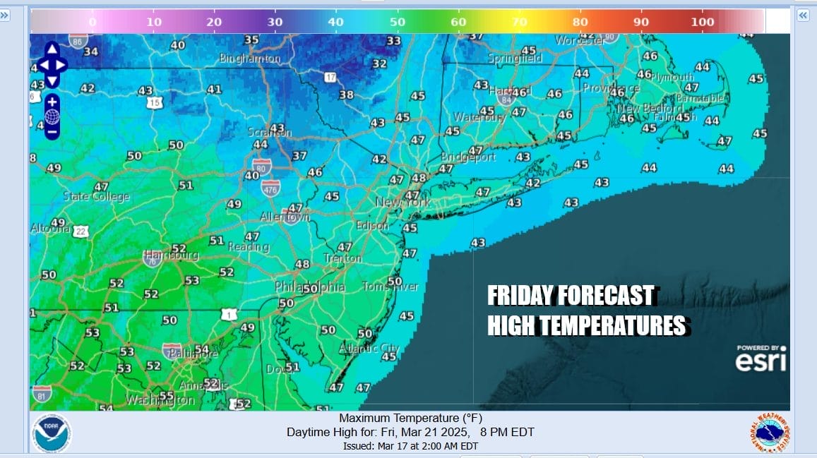
Colder air is on the menu on the backside of this storm system. Temperatures Friday will likely be mostly in the 40s all day and the gusty winds will make it feel colder. Saturday we see a cold front dropping southeast from Canada and ahead of that we will have a mix of sun and clouds. We do not see much in the way of rain with this front but we will throw in the chance for a scattered shower Saturday afternoon. Otherwise it will be of clouds mixed with sun. It will be breezy and highs will reach the mid 50s to around 60 degrees in most places.

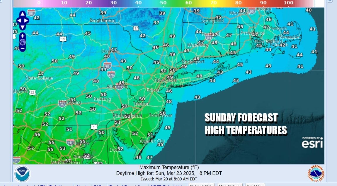
Colder air from Canada comes in for Saturday night and Sunday. We will see sunshine giving way to arriving clouds because the pattern is active and another weather system will be approaching for Sunday night and Monday. Temperatures Sunday will be in the 40s. Look for some rain or showers Sunday night into Monday morning until a cold front passes and weather conditions should improve Monday afternoon.
BE SURE TO DOWNLOAD THE FREE METEOROLOGIST JOE CIOFFI WEATHER APP &
ANGRY BEN’S FREE WEATHER APP “THE ANGRY WEATHERMAN!
MANY THANKS TO TROPICAL TIDBITS FOR THE USE OF MAPS
Please note that with regards to any severe weather, tropical storms, or hurricanes, should a storm be threatening, please consult your local National Weather Service office or your local government officials about what action you should be taking to protect life and property.


