
Windy Cold Night Friday Sun Very Cold Snow Sleet Rain Saturday
Wind Advisories continue for a while longer this evening but even when they do come down, it will still be rather windy overnight and into the first part of Friday. Skies should clear out somewhat tonight and temperatures will be heading south. By morning we will be down in the 20s to around 30 in most places. We saw temperatures today hover around 50 and then they settled into the 40s as the colder air started to arrive. Low pressure is off the coast of Maine, east of Cape Cod and moving east; strengthening along the way. Snow in Northern New England will be coming to an end soon.
SATELLITE

REGIONAL RADAR

Radars are showing bands of snow on the backside of the coastal low to the northeast. Some heavier snow squalls are in the mix as the bands continue moving southeast. The lake effect should remain active for most of the night before diminishing somewhat by early Friday and then shutting down completely as the day wears on.
LOCAL RADAR NEW YORK CITY

LOCAL RADAR PHILADELPHIA


Friday will be very cold and still on the breezy side especially early in the day. We will see plenty of ineffective sunshine with highs just barely back to the upper 20s and lower 30s and then with skies clear and light winds for most of the night, Saturday morning lows will range from near 20 in the warmer urban settings to teens just above everywhere else and even some single digits inland.
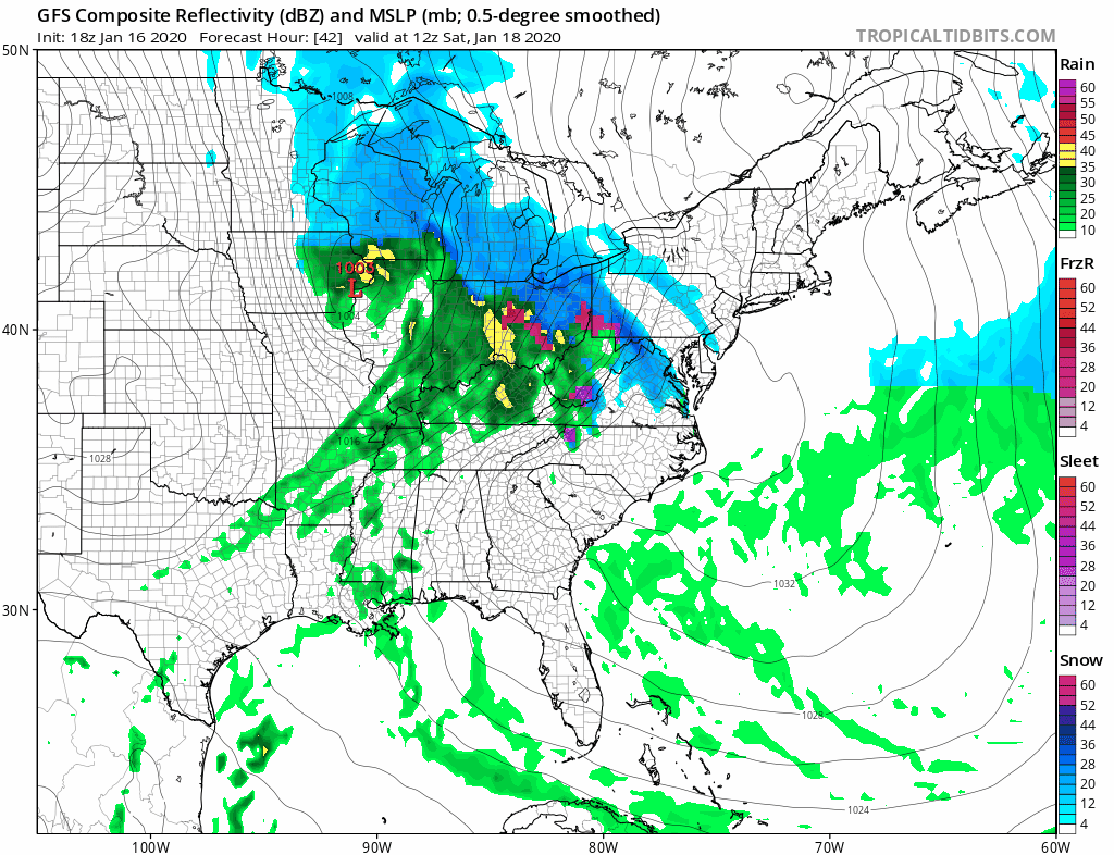
There hasn’t been much change in the outlook for Saturday. The snow comes in a quick shot from midday to mid to late afternoon before a change to sleet or rain is likely. Then it all comes to an end during the evening ours from west to east. Weather models have been just sort of nip and tucking back and forth. I don’t think there is enough here to make a big difference in accumulations unless the radar were to become much more active than what is being indicated at the moment.
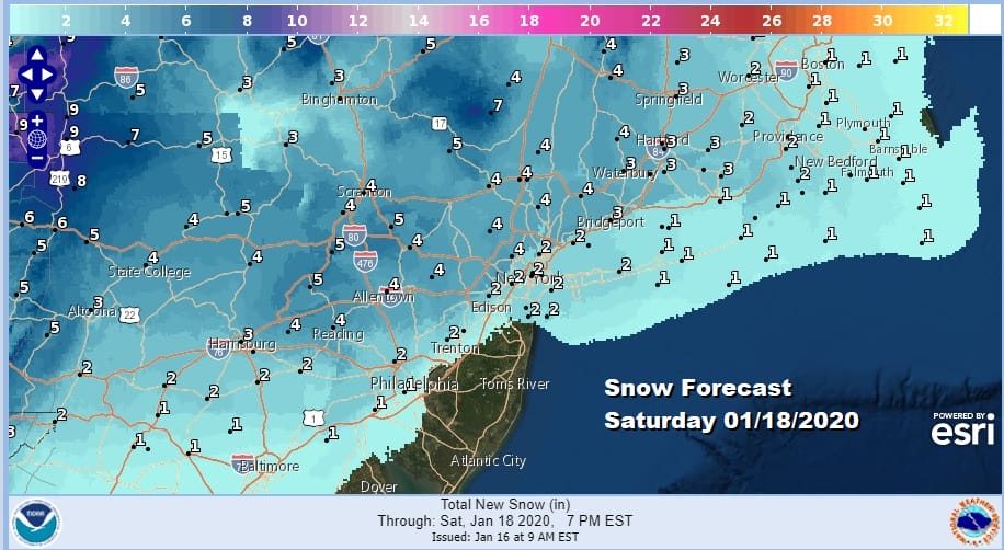
We didn’t see any major changes in weather service snow forecast amounts in their evening package nor have i changed my ideas from the last two days. Sunday sees some improvement as we head into a cold stretch of weather next week with below average temperatures though it appears that it will be dry all week long. Some sun and clouds for Sunday with a gusty wind is the outlook and temperatures will just be in the 30s.
My snow forecast map is up for Patreon members as well as users of the free app so download them today if you haven’t already.
BE SURE TO DOWNLOAD THE FREE METEOROLOGIST JOE CIOFFI WEATHER APP &
ANGRY BEN’S FREE WEATHER APP “THE ANGRY WEATHERMAN!
MANY THANKS TO TROPICAL TIDBITS FOR THE USE OF MAPS
Please note that with regards to any severe weather, tropical storms, or hurricanes, should a storm be threatening, please consult your local National Weather Service office or your local government officials about what action you should be taking to protect life and property.


