
DOWNLOAD MY NEW FREE JOESTRADAMUS WEATHER APP FOR ALL DEVICES
THE APP IS ABSOLUTELY FREE TO ALL BUT CONSIDERING SUBSCRIBING TO PATREON FOR A WEATHER EXPERIENCE FREE OF ADS, EXCLUSIVE VIDEOS FOR MEMBERS ONLY AND MUCH MORE…STARTS AT $2 A MONTH..MESSAGE ME AT ANY TIME
Winds Still Blowing But Easing Later Today Stormy Weather Late Week Weekend
We cleared out nicely overnight and we begin the day with lots of sunshine however the winds were still rather gusty this morning especially along the coast but they will ease as the day wears on. We have lots of sunshine around but there is a weak disturbance that is moving across the Great Lakes and high clouds from this will be moving in this afternoon to being to fade the sunshine away. Temperatures should be able to make it into the 60s which is something that we do almost on reflex this time of year.
SATELLITE

REGIONAL RADAR

Nothing much is happening on the radar at the moment but th weak Great Lakes system will produce a weak area of light rain showers later today in Pennsylvania and Southwest NY and that area should move overhead this evening and tonight. We will see some light rain. it won’t amount to much and it should be gone long before daybreak. Temperatures over night will hold in the 40s. 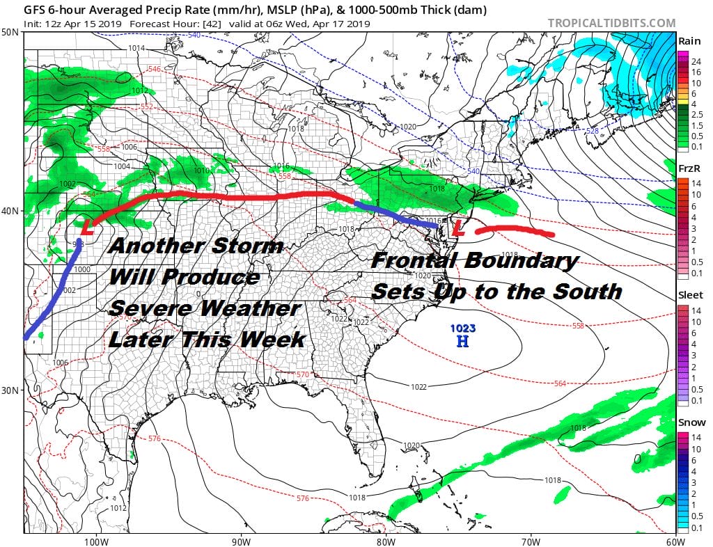
Wednesday we are expecting clouds to give way to sunshine as high pressure builds in just enough to give us a reasonably nice day with highs in the upper 50s to lower 60s. The issue however is the frontal boundary that lies to the south and the next developing storm and severe weather producer in the Southern Plains.
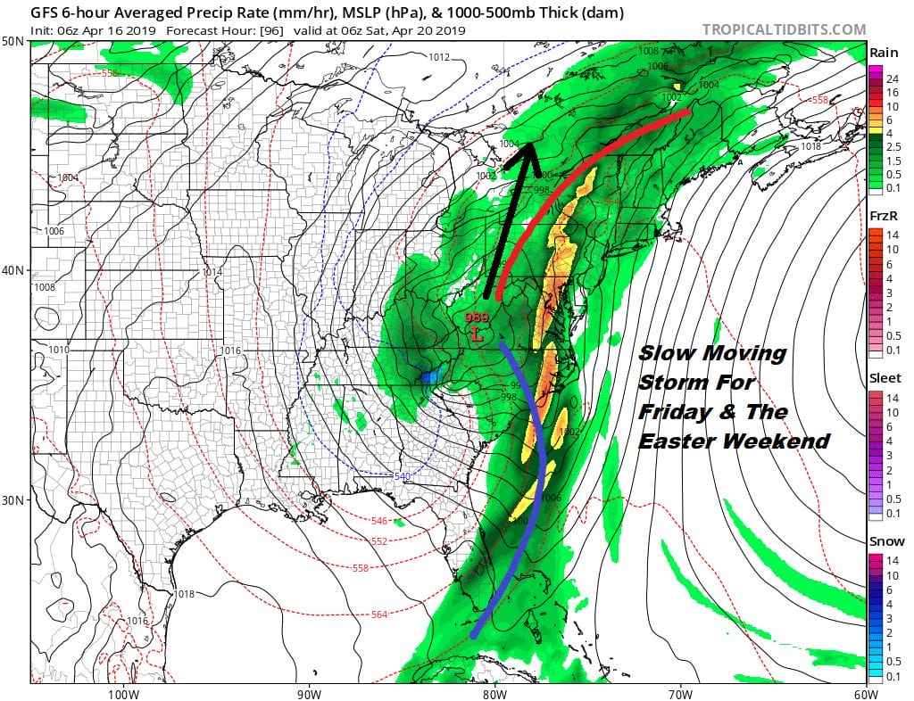
We will start the process of weather conditions deteriorating somewhat Wednesday night with the chance for some showers early Thursday. The onshore flow develops and so does a strengthening southerly flow. Thursday look for lots of clouds with highs in the 50s to near 60. Then we transition to Friday as low pressure and a cold front move east and stall out in the Ohio Valley. Then a second low develops in the Gulf states and moves northward Friday night and Saturday.
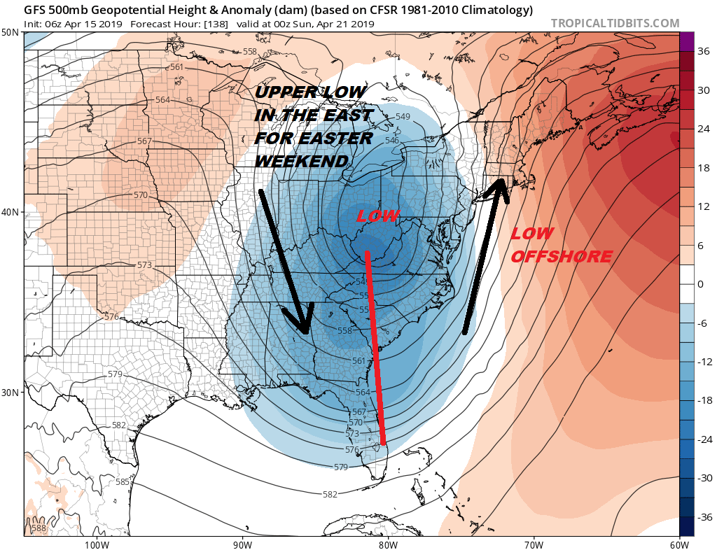
You have a very deep trough and cut off low that forms and strengthens as it reaches the Appalachians which opens up the spigots of a strong southerly flow and a ton of moisture. The position of the jet stream suggests the heaviest rain could be inland over Eastern Pennsylvania & Western New Jersey westward where a couple of inches or more of rain is possible. There will be less to the east but showery rains will move in Friday night and continue on and off through Saturday and possibly into Easter Sunday. This upper trough will be very slow to get out of the way. There could be some lingering showers around through Eastern Sunday.
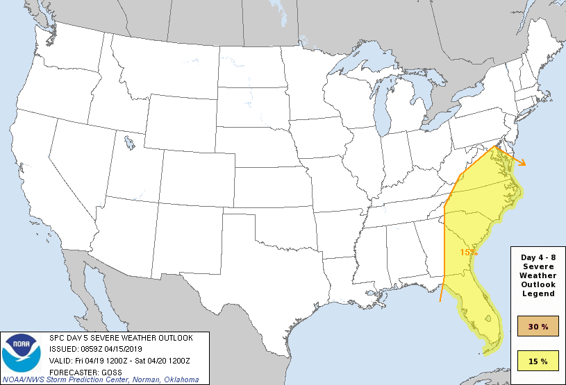
One thing the strong southerly flow might do is keep the warm tropical air further south this time and severe weather would be confined to the Middle Atlantic states southward this time around vs what happened over the weekend so that could be a positive take away. Take advantage of the sunshine while we have it since we really don’t see us stringing two nice days in a row anytime soon.
MANY THANKS TO TROPICAL TIDBITS FOR THE USE OF MAPS
Please note that with regards to any tropical storms or hurricanes, should a storm be threatening, please consult your local National Weather Service office or your local government officials about what action you should be taking to protect life and property.


