
Wind Machine Is Back On Tuesday & Wednesday
Late Week Less Wind Warmer Temperatures

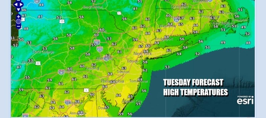
Get ready for the wind machine to start cranking again later today not just in Eastern Pennsylvania to Southern New England but up and down the East Coast. A cold front lies just to the east and we are waiting for an upper trough to pass through later today. Ahead of this we will have clouds. There are some leftover showers around with the old front and there could be a scattered shower or thunderstorm with the upper trough though I think most folks in Eastern Pennsylvania to Southern New England may not see much of anything. Highs will be in the 60s this afternoon.
SATELLITE WITH LIGHTNING STRIKES

WEATHER RADAR

Once that upper trough passes winds will pick up from the northwest and we will see winds of 20 to 30 mph with some gusts near 40 mph beginning late today and likely lasting right through Wednesday night. Skies should partially clear tonight with lows in the upper 30s to mid 40s. Wednesday we will see a mix of sun and clouds along with strong winds and highs will just be in the low to middle 50s.

Once we get into Thursday we will see the gradient relax somewhat but not completely. We will also see high pressure move offshore and that is going to set us up for a significant warm up going into the Easter Weekend. It will be dry much of the time Thursday through Sunday however we will have a cold front that will drop southeastward across the Northeast and Middle Atlantic states late in the day Saturday.

That front will produce showers and thunderstorms and there is the chance we could see some isolated severe thunderstorms with this weather front. Behind the front we have another high that will build in meaning Easter Sunday itself will be dry and on the cool side.
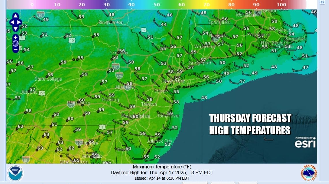
Thursday should be no worse than partly sunny and temperatures will reach the upper 50s to some lower 60s. Friday will be nice and sunny though some high clouds could move in ahead of warmer air on west southwest winds. Highs will be in the 60s. Saturday will be very warm with most highs in the mid 70s to lower 80s along with some sunshine, but again we could see some late day thunderstorms. Easter Sunday should be no worse than partly sunny with highs in the cooler but manageable 60s.
BE SURE TO DOWNLOAD THE FREE METEOROLOGIST JOE CIOFFI WEATHER APP &
ANGRY BEN’S FREE WEATHER APP “THE ANGRY WEATHERMAN!
MANY THANKS TO TROPICAL TIDBITS FOR THE USE OF MAPS
Please note that with regards to any severe weather, tropical storms, or hurricanes, should a storm be threatening, please consult your local National Weather Service office or your local government officials about what action you should be taking to protect life and property.


