
Warming Up Ahead of Showers Thunderstorms Tonight
Windy Chilly Weather Into Midweek
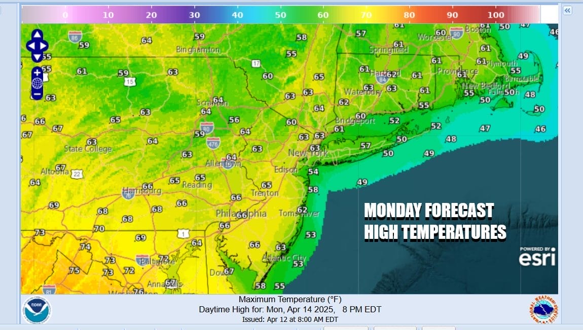
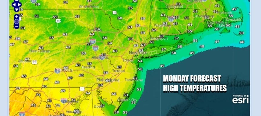
The weekend storm system is now well off to the northeast but the atmosphere is not wasting anytime bringing the next storm system along in the flow. Clouds are already moving in from a warm front heading northeastward. There is a band of showers with that warm front. Then we have to deal with an approaching cold front tonight but in between there will be some breaks of sun this afternoon after the warm front passes. Temperatures will be in the 60s. Any showers with the warm front look to be on the light side.
SATELLITE WITH LIGHTNING STRIKES

WEATHER RADAR

This evening and tonight we will be watching low pressure moving across from the Great Lakes to Southern Quebec. This low will strengthen along the way and the trailing cold front will trigger off some showers and thunderstorms. We will see a band of showers and storms move through tonight. Severe weather will be an issue from Kentucky and Southern Ohio east to Virginia and Maryland but we do not see severe weather risk reaching Eastern Pennsylvania to Southern New England.

Once the showers and thunderstorms pass through between 8pm and 2am, we will see some improvement into Tuesday morning. However the storm system in Eastern Canada and a deep upper trough along the East Coast will create a large area of strong gusty winds stretching from Maine to Georgia Tuesday into Tuesday night. You can expect the wind machine to go on again during the day Tuesday and continue probably through Wednesday. Winds will be gusting 30 to 40 mph at times.

Tuesday likely sees self destruct sunshine to some degree thanks to the cold unstable air aloft. There could be a few widely scattered instability showers inland but even if they happen they shouldn’t amount to much and they will be few and far between Tuesday we will have some leftover warm air around in the morning but temperatures will likely be easing through the 50s as the day wears on and highs will be reached early in the day.

Skies should clear Tuesday night and Wednesday will be a windy chilly day. Gusty winds to 30 to 40 mph will continue but there should be more in the way of sunshine. Highs will be mostly in the low to middle 50s. We will start to see temperatures move a littler higher at the end of the week and it will be dry at least into the first part of Saturday. There is a cold front that could come through later Saturday but at the moment the front looks to be on the weak side and not a big shower producer. Nice weather could be in the cards for Eastern Sunday.
BE SURE TO DOWNLOAD THE FREE METEOROLOGIST JOE CIOFFI WEATHER APP &
ANGRY BEN’S FREE WEATHER APP “THE ANGRY WEATHERMAN!
MANY THANKS TO TROPICAL TIDBITS FOR THE USE OF MAPS
Please note that with regards to any severe weather, tropical storms, or hurricanes, should a storm be threatening, please consult your local National Weather Service office or your local government officials about what action you should be taking to protect life and property.


