Wind Advisory Snow Showers Snow Squalls Big Warm Up Friday Weekend
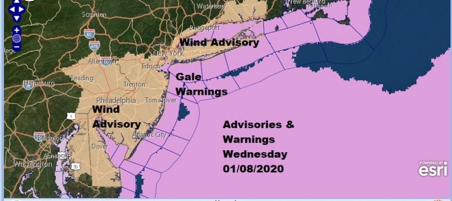
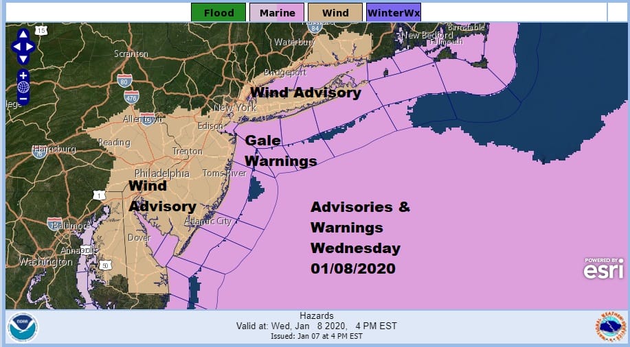
Yesterday’s storm is offshore east of New England and strengthening while an upper air trough moves across New England and high pressure sits in the southern states. This combination is one that will produce strong winds this afternoon and tonight once the upper trough passes. Wind advisories are posted for much of the coastal areas from Delaware to Southern New England. Gusts of 40 to 50 mph are possible this afternoon into tonight.
The issue of snow squalls are on the table for today. We actually have already seen some snow squalls and various snow squall warnings go up for a few places. The satellite picture actually looks a lot like one you might see on a warm spring day with pop up showers and thunderstorms developing. The strong upper trough creates instability and you get these heavy snow showers and squalls that last for about 10 minutes or so in most cases, they make you think a blizzard is underway, only to move out as fast as it moves in. In between you will see a mix of sun and clouds with temperatures in the 30s.
SATELLITE

REGIONAL RADAR

Regional and local radars are picking up on the snow showers and the heavier snow squalls. Don’t be shocked if some of these build up to a point where you see some lightning or hear some thunder from them as they go by. The radar also shows the scattered nature of these squalls so some of you will not see them and some of you will.
LOCAL RADAR NEW YORK CITY

LOCAL RADAR PHILADELPHIA


On to tonight which will be a cold and windy night as skies eventually clear. Lows by morning will be in the teens to near 20 with wind chills overnight about 10 degrees lower from the actual air temperature. Thursday will be sunny but cold with highs just in the 30s but with much less wind. Temperatures Thursday night won’t go far as a big warm up begins for Friday into the weekend.
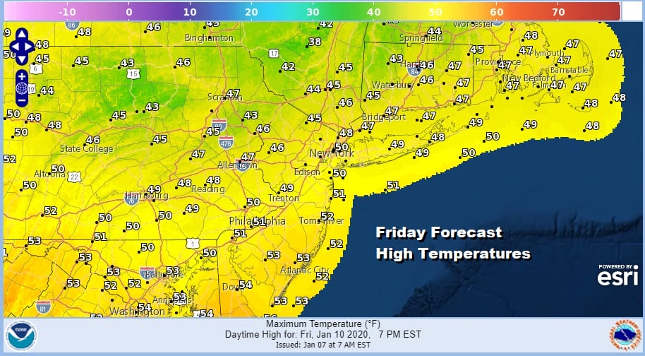
Friday will bring some sunshine and highs will reach up into the 50s. The next storm system tracks well west and north which means even warmer temperatures for Saturday. HIghs will reach the low and middle 60s and some record highs are possible.
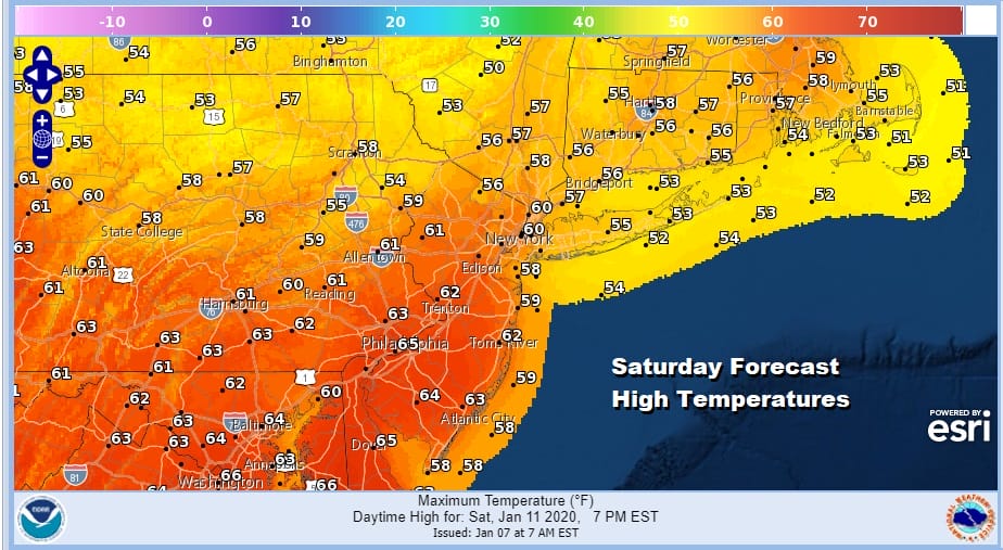
The next storm tracks so far north and west that snow and ice will be confined well to the north in Upstate NY and Northern New England. It will be warm enough for showers and thunderstorms Saturday night as a cold front comes through but at least the daytime Saturday will be mostly dry.
Weather conditions should improve Sunday with clouds and some sunshine. HIghs will still be in the 50s to near 60. It will turn a little cooler early next week but temperatures will still be well above normal for mid January.
BE SURE TO DOWNLOAD THE FREE METEOROLOGIST JOE CIOFFI WEATHER APP &
ANGRY BEN’S FREE WEATHER APP “THE ANGRY WEATHERMAN!
MANY THANKS TO TROPICAL TIDBITS FOR THE USE OF MAPS
Please note that with regards to any severe weather, tropical storms, or hurricanes, should a storm be threatening, please consult your local National Weather Service office or your local government officials about what action you should be taking to protect life and property.


