Wind Advisory Snow Showers Or A Snow Squall Week Ahead Outlook 2 Storm Systems

Wind Advisory Snow Showers Or A Snow Squall

Week Ahead Outlook 2 Storm Systems

storm free

Wind Advisory Snow Showers Or A Snow Squall

Week Ahead Outlook 2 Storm Systems

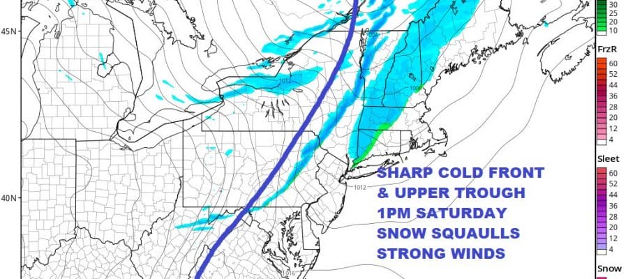
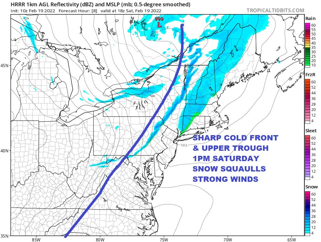
Wind Advisories are posted for today with a very sharp upper trough heading east along with a cold front. When the upper trough and cold front approach late morning to mid afternoon, get set for snow showers and even a heavier snow squall that could whiten up the ground in spots and briefly reduce visibility to under 1/2 mile. Winds will gust to 40 to 50 mph when the front and upper trough pass. This is like a line of showers and thunderstorms in the summertime except that it is winter and we are talking about a line of snow showers. Temperatures today will top in the upper 30s and lower 40s ahead of the front and then fall behind it. We can already see the set up on the satellite and radar to the west and we will watch the progress eastward as the day wears on.

SATELLITE

storm free

WEATHER RADAR

storm free

We can already see the set up on the satellite and radar to the west and we will watch the progress eastward as the day wears on. On the surface map, the isobars take on a  “V” structure. The sharper the V the stronger the features. 
 
Once the front passes a another quick shot of cold air is introduced and we will see skies clear out late today and it will be cold and clear tonight. Lows will be in the teens to low 20s in most places, mid 20s warmer urban areas. Sunday we will see sunshine and as the cold air will be already on the way out late in the day, most highs will reach the upper 30s and lower 40s.
 
Monday begins the week with a fast warm up. West winds and some sunshine will take highs into the 50s. Then we have the first of two storm systems headed our way. This is actually the second in a series of three which began with the first one Thursday night into Friday morning. This will bring rain here Tuesday into early Wednesday. as a low goes by to our west, but further east than the last one. Highs will be in the 50s. Late week we have a third storm system. The pattern this week will be changing across all of Southern Canada from west to east. Cold air will be spreading out and some of that cold air will bleed southward into the Northeast behind Tuesday’s weather system. This opens the door to the possibility of snow ice and rain late this week though the where and when’s obviously are unknown at this point.

BE SURE TO DOWNLOAD THE FREE METEOROLOGIST JOE CIOFFI WEATHER APP &

ANGRY BEN’S FREE WEATHER APP “THE ANGRY WEATHERMAN!

MANY THANKS TO TROPICAL TIDBITS & F5 WEATHER FOR THE USE OF MAPS

Please note that with regards to any severe weather,  tropical storms, or hurricanes, should a storm be threatening, please consult your local National Weather Service office or your local government officials about what action you should be taking to protect life and property.