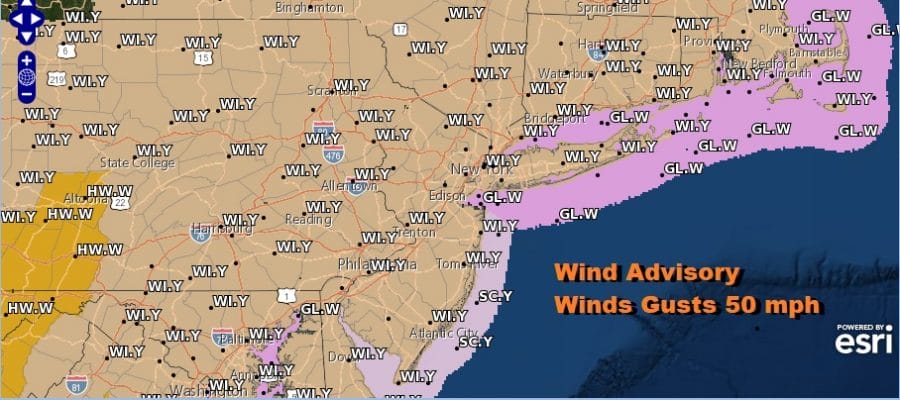
Wind Advisory Northern Mid Atlantic to Central New England Gusts to 50 MPH

Weather in 5/Joe & Joe Weather Show Latest Podcast
Wind Advisory Northern Mid Atlantic to Central New England Gusts to 50 MPH
A warm front has passed and low pressure that produced severe weather across the Deep South yesterday is now moving toward Upstate NY and strengthening. This is going to tighten the pressure gradient today and winds will start howling from the west later this morning and especially during this afternoon.
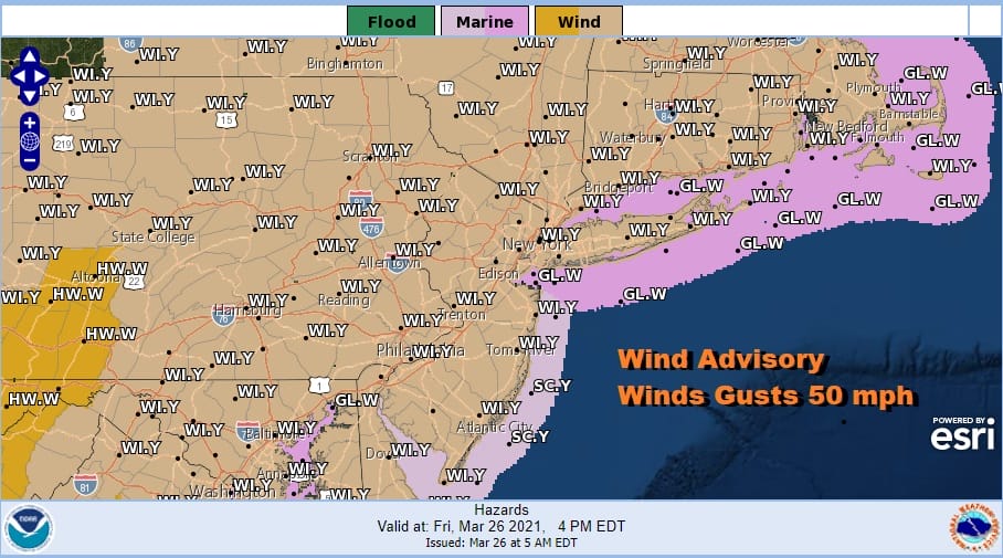
Winds will increase from the west and gust to 50 mph at times especially inland where we expect to see the strongest wind gusts from this system. Now we do have some scattered showers around on the radar this morning but they will disappear and we will break out into sunshine. That sets us up for temperatures today that will reach the 70s to around 80 degrees! Usually the wind is coupled with colder temperatures but this time around we have our own version of the California Santa Ana wind. West winds downslope from the mountains to the west and north and that warms the air and also dries it out.
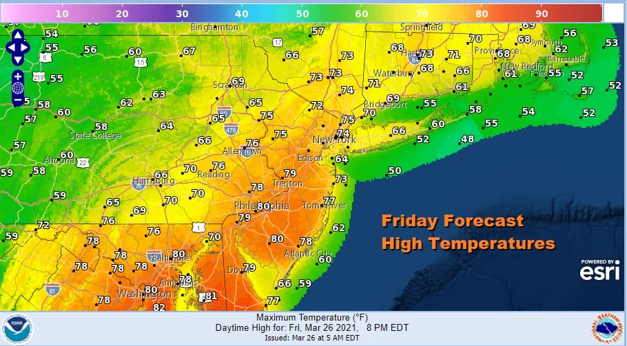
Note on the high temperature forecast map that the highest temperatures are confined in a relatively narrow band. It is cooler in Northeast Pennsylvania, Eastern Long Island and Southern New England but highs here will still hit upper 60s and lower 70s.
SATELLITE

We will clear out tonight and it does turn cooler with lows in the 40s. Winds will diminish overnight. Look for sunshine on Saturday and it will be cooler than today with highs mostly in the 60s. This will be the better of the two weekend days as the next cold front heads our way Sunday.
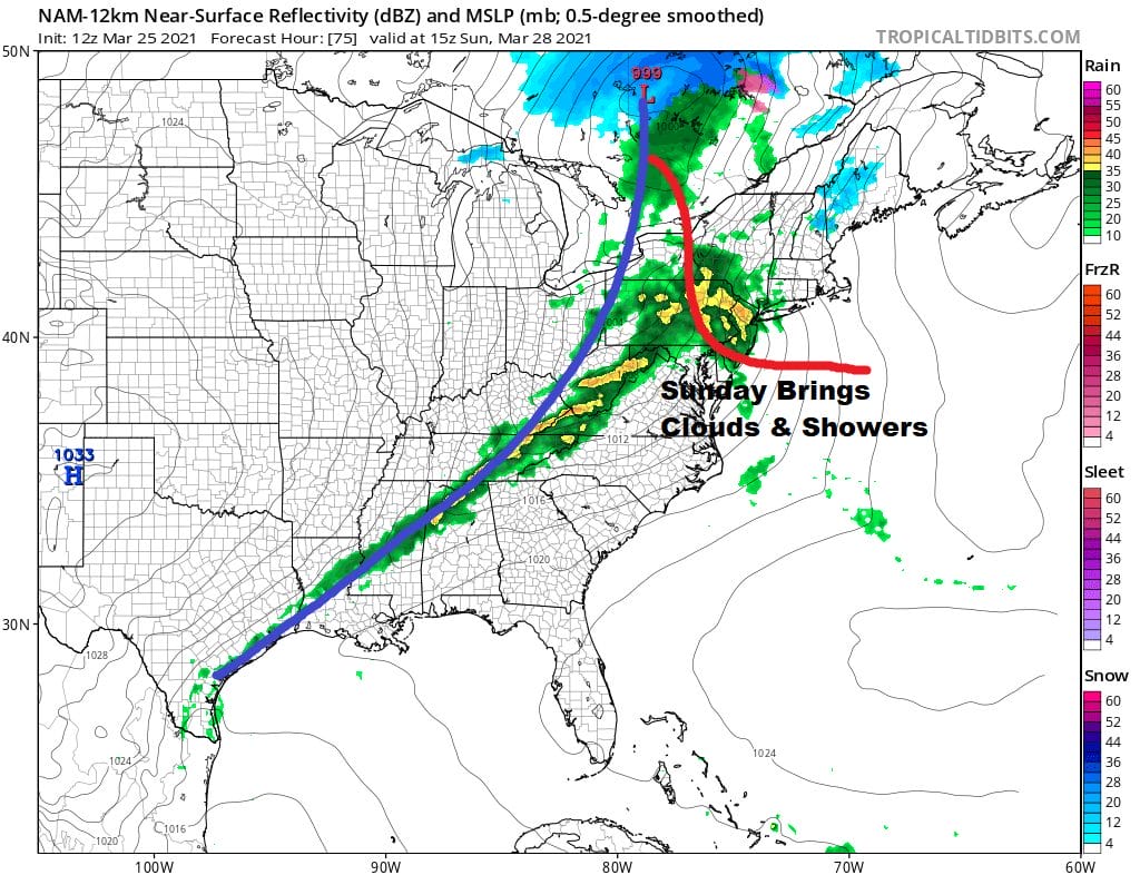
A warm front moves through Sunday morning with showers. That will be followed by a cold front with showers Sunday evening. Temperatures Sunday will be in the 60s to near 70 in some places. It also opens the door for severe weather risk.
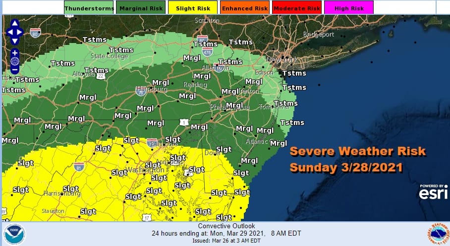
The Storm Prediction Center has marginal severe weather risk Sunday for the southern half of New Jersey and Southern Pennsylvania southward. If the warm sector is a little more aggressive we could see this risk area pushed northward. Once the front passes Sunday evening the wind machine goes back on Sunday night into Monday and wind advisories are possible again. Temperatures Monday will be chilly with highs in the upper 40s and lower 50s with some sunshine. We will deal with similar issues next week that we dealt with this week. Tuesday the high moves out and wind direction will determine temperatures each day as well as cloud cover. Another cold front arrives with showers on Thursday. There are questions about whether the front slows down and a wave develops on it. We will be dealing with those possibilities over the weekend.
BE SURE TO DOWNLOAD THE FREE METEOROLOGIST JOE CIOFFI WEATHER APP &
ANGRY BEN’S FREE WEATHER APP “THE ANGRY WEATHERMAN!

MANY THANKS TO TROPICAL TIDBITS & F5 WEATHER FOR THE USE OF MAPS
Please note that with regards to any severe weather, tropical storms, or hurricanes, should a storm be threatening, please consult your local National Weather Service office or your local government officials about what action you should be taking to protect life and property.


