Wet Snow Up To A Few Inches On Colder Surfaces
Major Storm Brings Rain Snow Wind Saturday

Wet Snow Up To A Few Inches On Colder Surfaces
Major Storm Brings Rain Snow Wind Saturday
There really isn’t much change in what to expect for today. Snow forecast maps remain essentially unchanged. Temperatures this morning are near freezing inland but coastal and urban areas are in the mid to upper 30s. The ground is warm as it has not been below freezing in days. Accumulations will be mainly on colder surfaces and most paved surfaces will be wet. The only exception to this will be elevated areas above 1000 feet which might see some accumulations on less traveled roads.
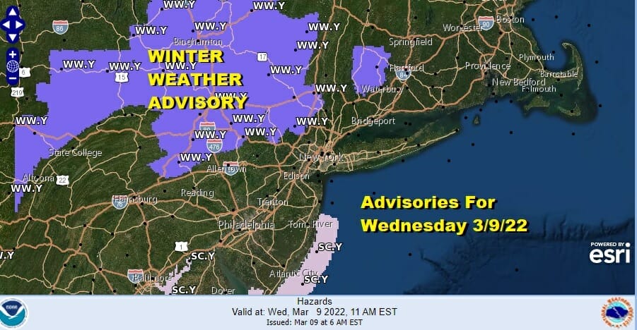
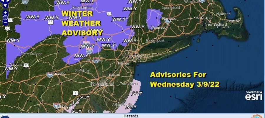
Areas under a winter weather advisory remain the same from last night. There have been no additional counties added to the mix. There doesn’t seem to be much in the way of upside as temperatures stayed mostly in the 30s. Some areas did drop below freezing but we have only marginal cold air at best. Satellite and radar shows moisture moving in and there is some heavier precipitation to the south in Delaware and Maryland. That will produce a band of steady snow that will develop around mid morning and last into early afternoon from Northeast Pennsylvania to Southern New England.
SATELLITE

WEATHER RADAR

The southern half of New Jersey and points south will see mostly rain out of this. Where it does snow to the west of Philadelphia we will see it stick to cold surfaces. Snow forecast amounts from the National Weather Service remain essentially unchanged from yesterday.

This all ends from southwest to northeast from 5pm to 9pm and then we see improving weather conditions overnight. Lows will be in the mid 20s to lower 30s. Thursday looks nice with sunshine and highs in the 40s. Friday look for sun and arriving clouds later in the day with highs in the 50s.

Attention turns to Saturday as a very deep trough drives into the Eastern US. This creates a major storm that develops in the Southeast US and moves north northeast up the coast. Showery rains will develop late Friday night and then as the low goes by much colder air comes in. I think that we could see a change to snow before ending inland north and west of NYC and it might even do that along the coast. The bigger issue remains the wind and this is going to be a big wind producer beginning Saturday afternoon and lasting into Sunday morning. Winds are likely to gust to 50s mph or higher. Temperatures will go from the 50s to the 30s Saturday. Lows Sunday morning will be in the teens to lower 20s. Sunday will be a better day with sunshine and less wind but still on the breezy side. Highs will be in the 30s. Next week brings warmer temperatures. This weekend’s storm could be the last gasp of winter as the overall pattern appears warmer in the long range.
BE SURE TO DOWNLOAD THE FREE METEOROLOGIST JOE CIOFFI WEATHER APP &
ANGRY BEN’S FREE WEATHER APP “THE ANGRY WEATHERMAN!
MANY THANKS TO TROPICAL TIDBITS & F5 WEATHER FOR THE USE OF MAPS
Please note that with regards to any severe weather, tropical storms, or hurricanes, should a storm be threatening, please consult your local National Weather Service office or your local government officials about what action you should be taking to protect life and property.


