
Next Storm Saturday Rain To Snow Strong Winds
Then Very Windy Cold Saturday Night Into Sunday

Next Storm Saturday Rain To Snow Strong Winds
Then Very Windy Cold Saturday Night Into Sunday
The next storm system is already setting itself up across the South but in the meantime we see improving weather conditions today. There isn’t much cold air around so that will allow us to warm up some today. We have some patchy clouds on the satellite so let’s call it a partly sunny type of day with highs reaching the mid 40s to around or just over 50 degrees. The radars are nice and quiet and we have no issues to deal with into Friday night so it will be a decent day Friday with some sunshine. Highs in many areas should reach back into the 50s.
SATELLITE

WEATHER RADAR

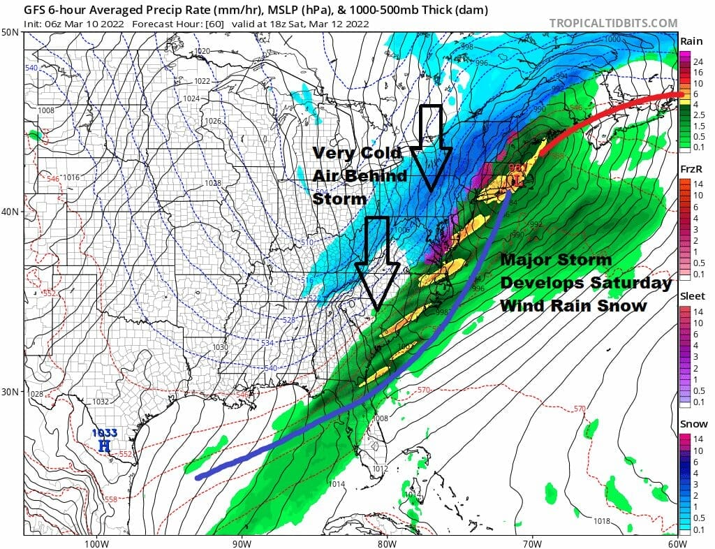
Now we move into Saturday as low pressure moves across the Southern states and turns northeast up the coast. A very strong upper trough swinging out of the Plains and Canada swings east with a very cold air mass. All the pieces are here for a major storm to develop on Saturday. Rain will will develop late Friday night and then fall into midday.
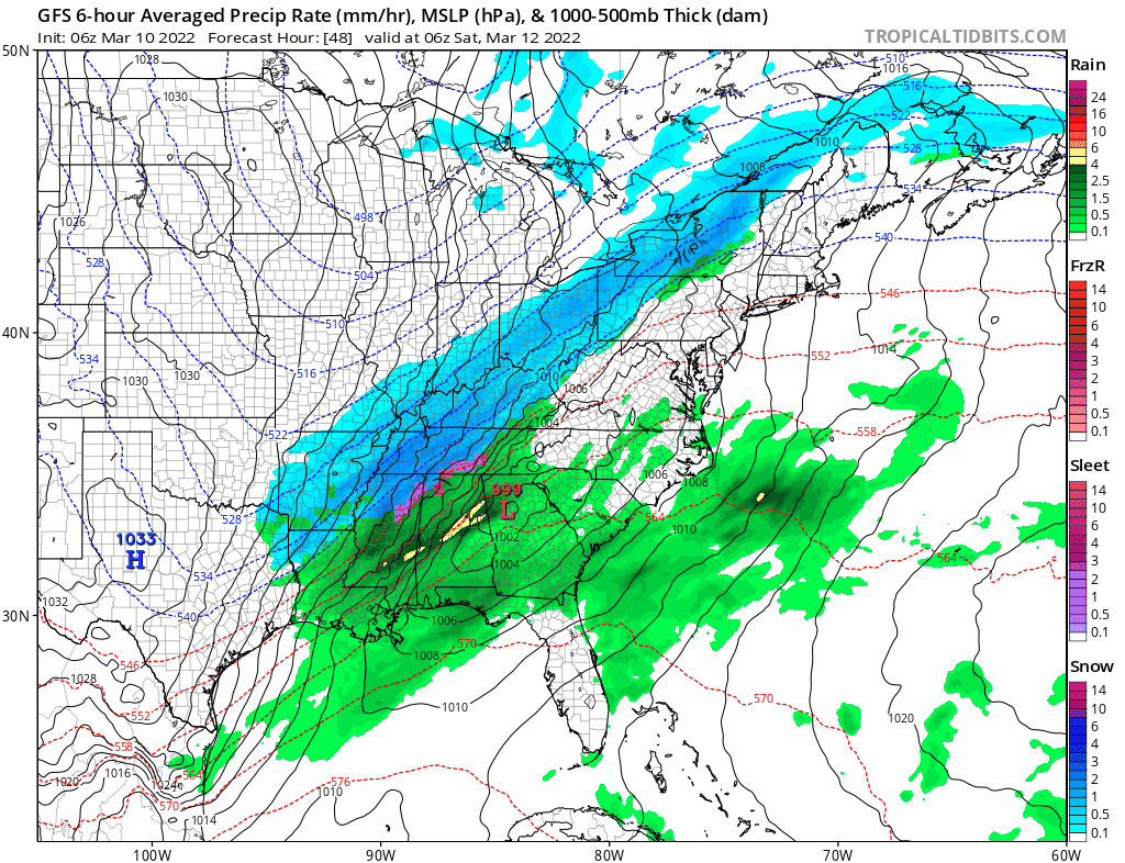
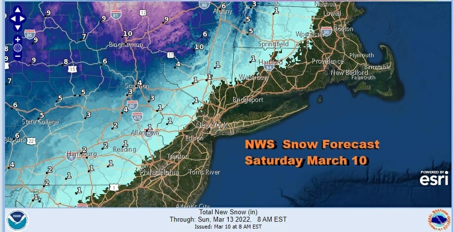
This storm is moving like a rocket shift so look for a changeover to snow midday to early afternoon. It will be mostly done by Saturday evening so this basically leaves a 4 to 6 hour wind for any snow. Temperatures will also will be falling rather rapidly from the 40s to the 20s by Saturday evening. There will be a sharp cut off to the east as the NWS snow fall forecast map shows. This is the first forecast from NWS and expect this to change and also expect the snow area to be pulled further east.
The other issue and probably the more important issue will be the wind. Saturday afternoon we will see strong northwest wind develop and then pick up to 40 to 50 mph in gusts late Saturday into Sunday morning. This will likely lead to some power outages in the usual places along with some tree damage etc. Temperatures will head south and drop into the teens Sunday morning. Sunday will be windy early but the winds may come off a bit in the afternoon. Look for sunshine on Sunday with highs just back into the 30s. After this cold shot goes by we will see somewhat warmer temperatures next week and dry conditions into Wednesday.
BE SURE TO DOWNLOAD THE FREE METEOROLOGIST JOE CIOFFI WEATHER APP &
ANGRY BEN’S FREE WEATHER APP “THE ANGRY WEATHERMAN!
MANY THANKS TO TROPICAL TIDBITS & F5 WEATHER FOR THE USE OF MAPS
Please note that with regards to any severe weather, tropical storms, or hurricanes, should a storm be threatening, please consult your local National Weather Service office or your local government officials about what action you should be taking to protect life and property.


