FROST & FREEZES TONIGHT IN SOME AREAS
WARMER FRIDAY SATURDAY BEFORE COLD ARRIVES SUNDAY
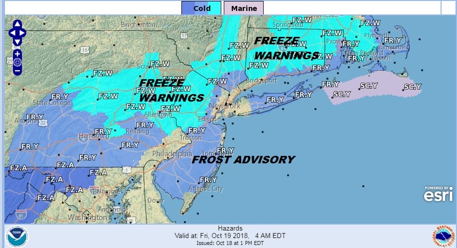
Tonight’s frosts & freezes will hinge on clear skies and wind speeds and whether winds drop off to dead calm. Where that happens we will likely see temperatures to just under or just over freezing but remember temperatures near the ground could be a few degrees cooler than the air temperature so it would be the safe thing to bring plants in just in case. We have the clear skies part of the equation on the satellite loop this afternoon and the clouds to the west dry up as they move eastward. Most lows will be in the upper 20s to mid 30s while warmer urban centers will be closer to 40.
EASTERN SATELLITE

REGIONAL RADAR

Friday begins the next warm up with sunshine and temperatures back close to 60 by afternoon. Then we set the table for the next cold front on Saturday with clouds and the chance for some passing showers. Highs will reach into the 60s. The front goes by and then cold air arrives on Sunday.

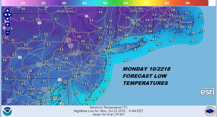
Sunday brings in the next shot of cold air and it will be a rather breezy day with sunshine and highs in the 40s. Then it is another trip down to frost and freeze leves Sunday night into Monday morning.
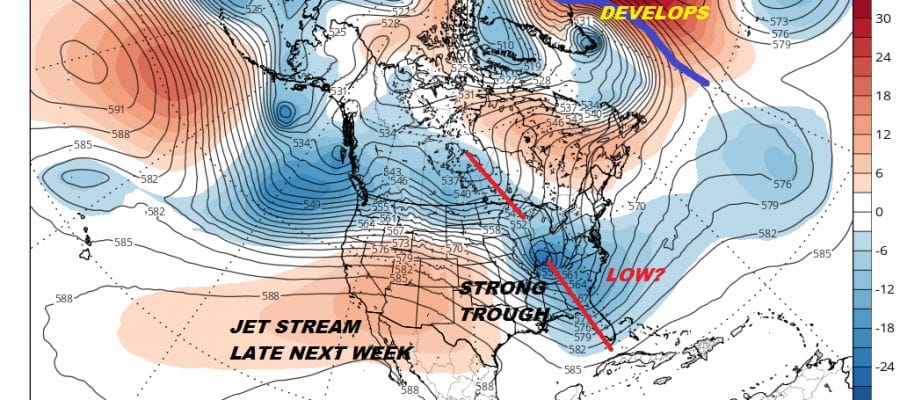
Next week looks relatively calm until the end of the week when the jet stream is forecast to buckle in a big way. This brings in the possibility of some storminess next weekend. Weather models have been pointing to a possible storm system along the East Coast though how it evolves remains a bit complex.
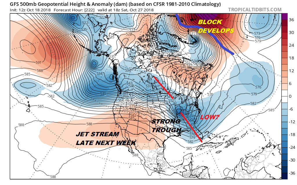
The pieces are here for a coastal low developing and moving northward but that will depend on the phasing of the two troughs shown on the map above of the upper air jet stream. We will go into this a bit deeper later this evening with a JOESTRADMUS post and also on tonight’s youtube livestream.
SUBSCRIBE TO PATREON FOR A WEATHER EXPERIENCE FREE OF ADS, EXCLUSIVE VIDEOS FOR MEMBERS ONLY AND MUCH MORE…STARTS AT $2 A MONTH..MESSAGE ME AT ANY TIME

MANY THANKS TO TROPICAL TIDBITS FOR THE USE OF MAPS
Please note that with regards to any tropical storms or hurricanes, should a storm be threatening, please consult your local National Weather Service office or your local government officials about what action you should be taking to protect life and property.
LATEST JOESTRADAMUS ON THE LONG RANGE